


WeatherTiger August 2021 Seasonal Forecast Preview
In the first look at our August numbers, a busy peak season is still in the cards.

We’re on vacation this week so in lieu of a typical Thursday column, here’s a first look at WeatherTiger’s updated seasonal outlook numbers for August, plus a brief look at the current activity in the Atlantic. We’ll be back on Monday with a full write-up of our seasonal outlook.
Overall hurricane activity forecast

Accumulated cyclone energy: 145 [50% chance of 115-185; normal over 1971-2020: 100]
Tropical storms: 19 [50% chance of 17-21]
Hurricanes: 9 [50% chance of 7-10]
Major hurricanes: 4 [50% chance of 3-5]
Forecast skill over climatology for August seasonal outlooks is approximately 40%. This means that the expected error of our forecast is 40% less than a “forecast” of the average activity levels over the past 50 years. Current ACE, tropical storm, hurricane, and major hurricane numbers as of August 5th are 12.8, 5, 1, and 0, and are counted in this forecast, which is overall very slightly more active than our early June forecast.
U.S. landfall activity forecast

Accumulated cyclone energy over the continental U.S.: 9 units [50% chance of 6-11 units; median over 1900-2020: 3.9]
As of August 5th, U.S. ACE for the season is about 3.4.
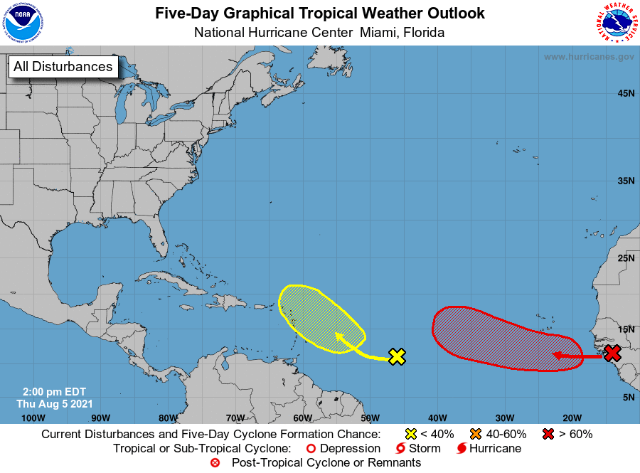
Currently in the Atlantic: Two tropical waves in the eastern Atlantic have a chance at development over the next week. A wave in the central MDR has a slight chance of getting better organized as it approaches the Lesser Antilles in 3-5 days, while a second wave just emerging from Africa (Invest 92L) is more likely than not to become a depression by early next week as it moves westward. While there is no cause for concern as yet, each of these waves bears watching as the Atlantic moves into a more active phase by mid-August.
Back early next week with a full analysis of the seasonal outlook and continuing coverage of a potential uptick in Atlantic activity.