Vague Directions: Hurricane Watch for September 18th
Another day watching a long-term potential hurricane threat to the Gulf Coast doesn't bring any less uncertainty.
Sign up for WeatherTiger’s hurricane forecast newsletter by clicking here:
Florida and continental U.S. tropical threat synopsis: A possible tropical threat to Florida or the Gulf Coast coming out of the western Caribbean remains a week or more out. This potential remains non-specific, but certainly worth watching.
Almanac: It’s Wednesday, September 18th… day 110 of the 2024 hurricane season, 73 days to go. By total storm energy, the season is 60.2%, 69.4%, and 58.7% complete for the Atlantic, continental U.S., and Florida, respectively.
Active storms: None.
Disturbances in the NHC tropical weather outlook:
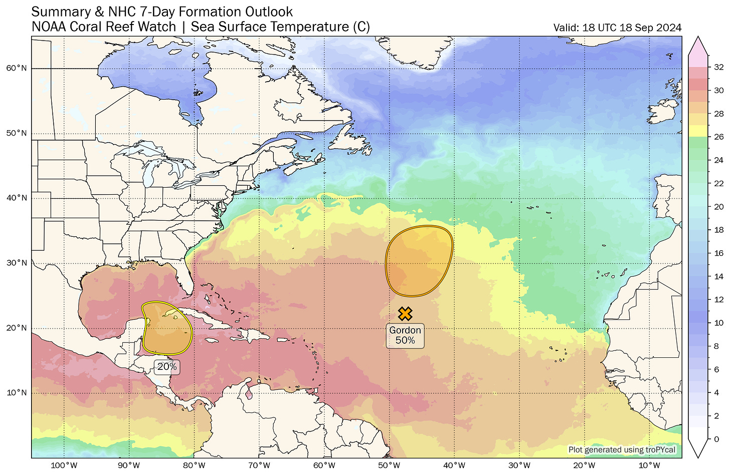
Ex-TS Gordon continues fumbling around the Central Atlantic, with the NHC giving it a 50% chance of revival into a named storm as it moves north over the next 5-7 days. Only the GFS really still shows Gordon returning, which I suppose remains possible. Even so, it wouldn’t threaten anyone.
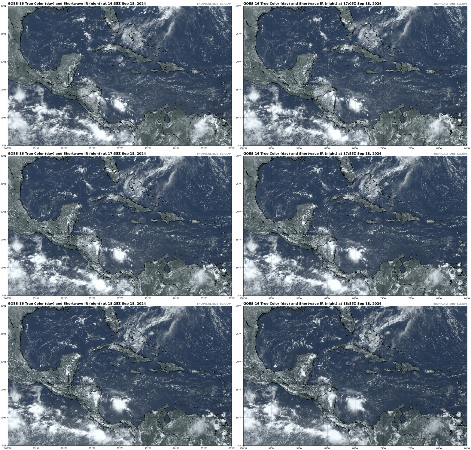
The western Caribbean continues to be where the theoretical action is in the Tropics, although like yesterday there remains nothing to look at in the real world. The NHC has added a 20% chance of development in the next 7 days to the Tropical Weather Outlook here, which may be a bit on the conservative side given the strong model consensus for a Central American Gyre (CAG) to form over the weekend. As I mentioned yesterday, a CAG is often a prelude to tropical development in late September-November, so the general sense across ensembles for some kind of eventual development in the western Caribbean or southern Gulf is reasonable. However, the window for development doesn’t open for another 5-6 days, and model solutions vary wildly in track and strength without an anchoring real world disturbance as a starting point, ranging from a broad and weak system over the western Gulf to something at hurricane strength in the eastern Gulf or crossing Florida. Of course, development itself is never a given.
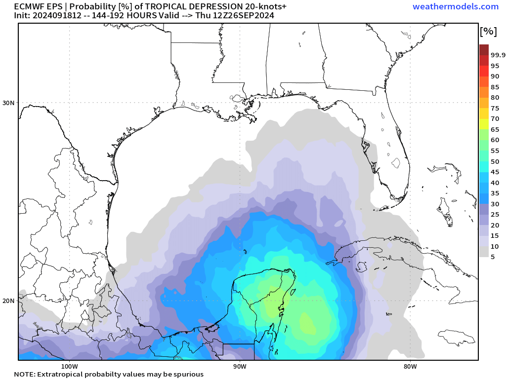
12z Euro Ensemble member tropical cyclone track density between Tuesday and Thursday morning of next week. Since there is little fact-checking to be done against model imagination at this point, let’s look at the mid-latitude steering pattern that a potential system would be navigating. Predicting the jet stream is something that models do with much more skill than predicting TC development in a CAG, with the Euro, UKMET, Canadian, and GFS the top 4 global weather models by this metric. As seen below, next Wednesday morning as a storm may be taking shape in the Caribbean, the models agree on two shortwave troughs—one in the western Atlantic, another in the Plains— imparting some north/northeast steering influence on a system. Sandwiched between the two troughs is a thin ridge of high pressure over the Southeast, which acting alone would impart a northwest or westward component to storm motion. Ensemble suites that are weaker with the ridging, like the GFS, point east towards Florida, while those with a weaker Plains trough and stronger ridge like the Euro tilt farther west into the Gulf.
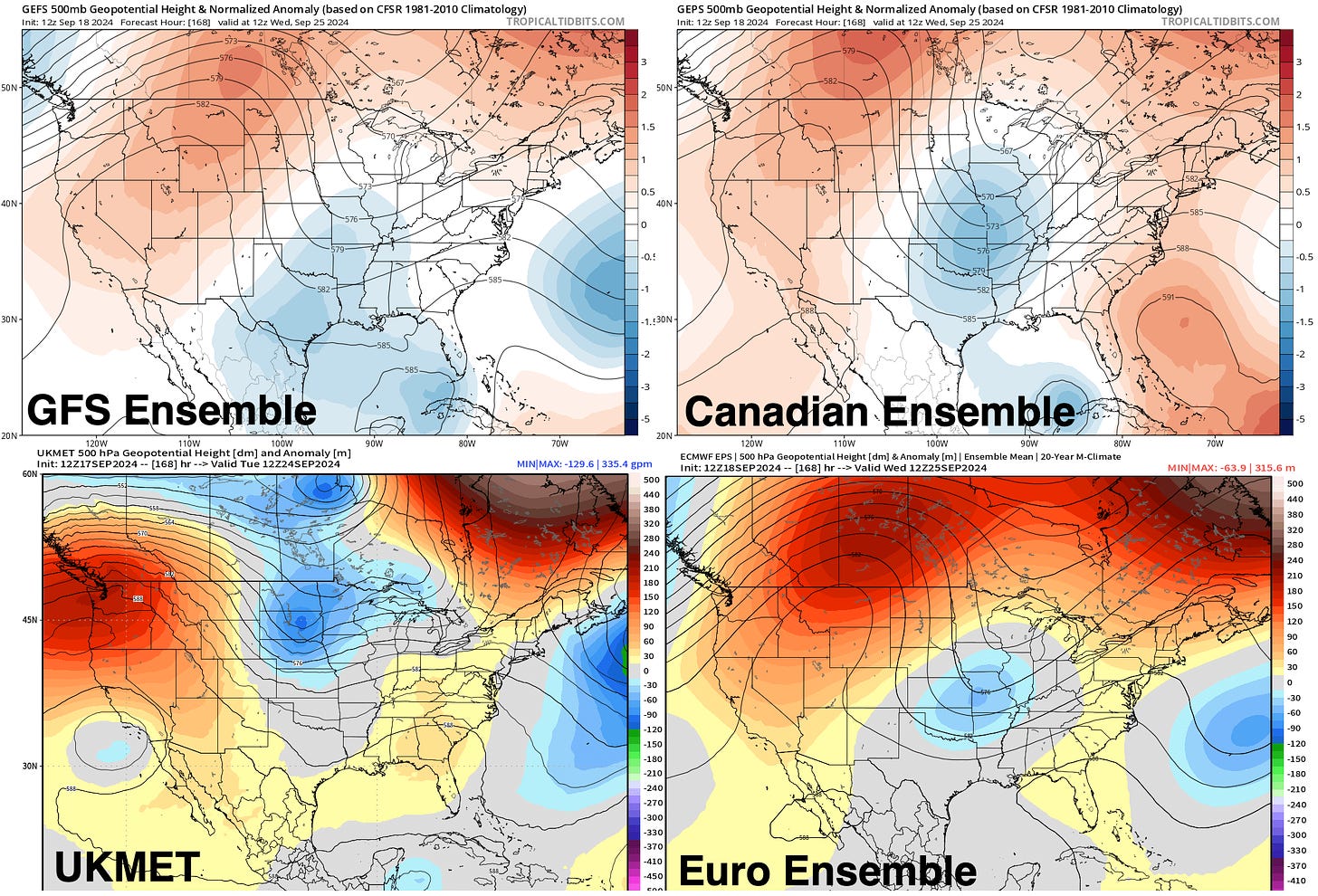
Next Wed AM 500 mb heights and anomalies from the 12z GFS, Canadian, and Euro Ensemble means, and the UKMET deterministic run. While the GFS does have a known bias towards weak ridges, the various steering options here lay out a range of possibilities ranging from a threat to Florida to a threat to the Central Gulf. The SE ridge does look too weak on all the guidance to permanently suppress a developing system into Central America, so steering indicates this is something to watch for Gulf Coast as a whole. I’ll continue to watch both trends with steering and, eventually, the disturbance itself to bring into focus who is at the most risk from this possible system.
Elsewhere: There are some model hints of Cape Verde/eastern Atlantic development chances starting next week. While CV development has been a 100% Charlie Brown football this year and I’m therefore default skeptical of the potential here, by late September the odds of an eastern Atlantic wave reaching the continental U.S. become exceedingly small. Thus, no real concerns here minus strong evidence to the contrary.
Next update: Daily bulletin tomorrow morning.



i learn so much from your reports, thank you...lb