Two Against Nature: The Hurricane Watch for September 29th
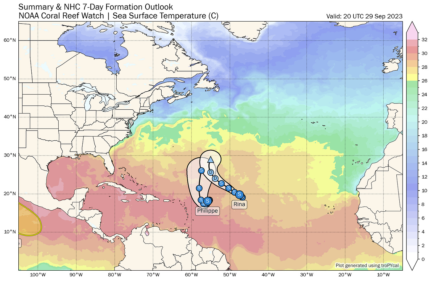
Tropical Storm Philippe and Tropical Storm Rina are slowly pinwheeling around each other east of the Lesser Antilles, but risks of any land impacts are diminishing.
Florida tropical threat synopsis: No tropical threats to Florida in the next seven days.
Mood music:
Almanac: It’s Friday, September 29th… day 119 of the 2023 hurricane season, 64 days to go. By total storm energy, the season is 74.5%, 82.1%, and 73.4% complete for the Atlantic, continental U.S., and Florida, respectively.
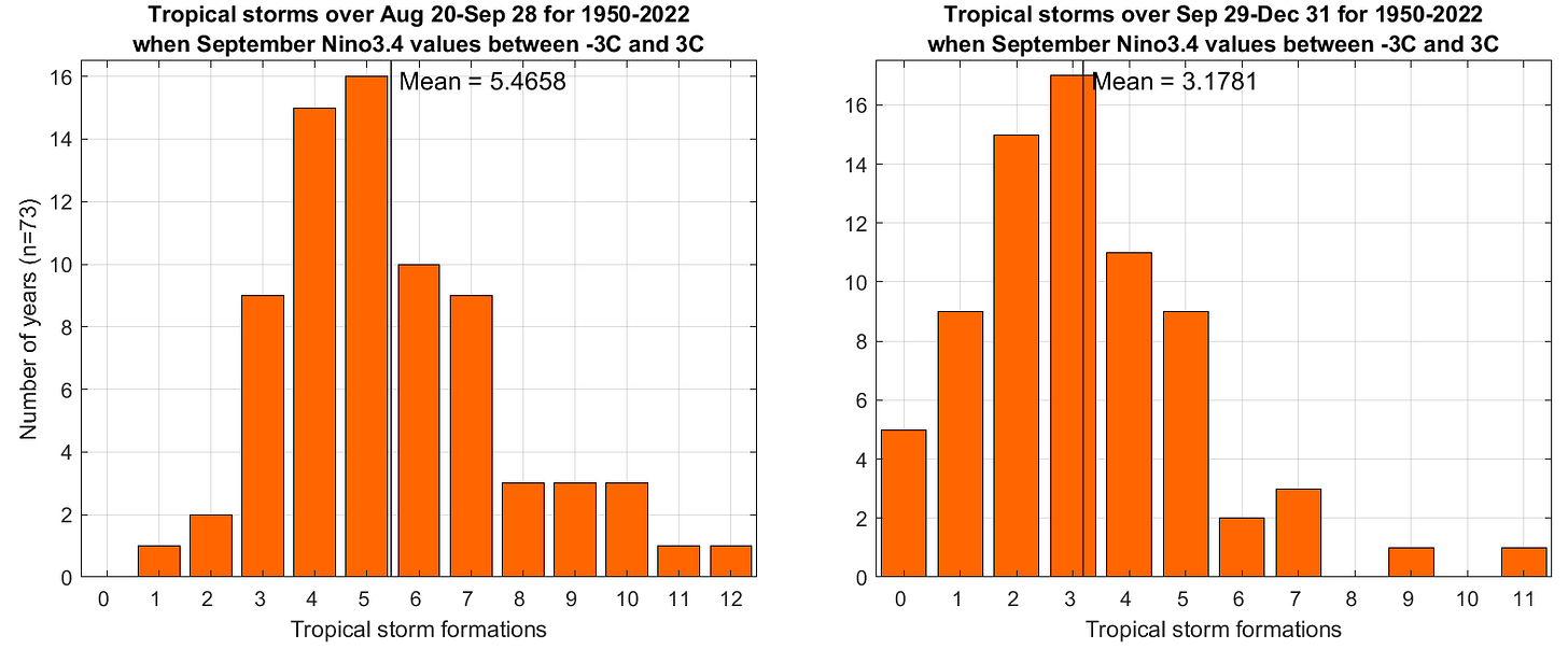
With yesterday’s development of Rina, 2023 set the record for most named storm formations in the 40 days between August 20 and September 29 with 13… truly astonishing to have set this record amidst an ongoing strong El Nino event. Moving forward from here, the average number of additional named storms forming is about 3, with anywhere from 1-5 being fairly normal. Not that normal means much in 2023.
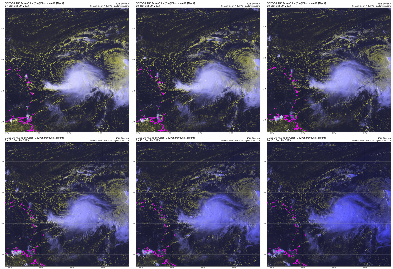
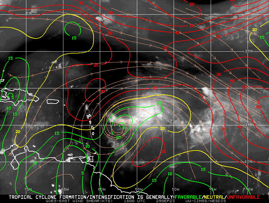
Active Storms: Tropical Storm Philippe and Tropical Storm Rina continue to interact under the influence of the Fujiwhara effect, with their respective centers now around 500 miles from each other. Their overall motion is quite slow, but with Philippe drifting slightly south and Rina angling north and west, Rina is getting pushed into a region of stronger shear. Thus, while neither storm looks healthy today, Rina is unlikely to re-strengthen as it moves northwest, and the NHC forecast now calls for it to dissipate in open waters by early next week.
Philippe, on the other hand, is likely to have a few days of slow or no motion east of the islands to attempt some kind of a comeback. Almost all the model guidance now shows some degree of reintensification over the weekend, which will allow the storm to connect with a mid-Atlantic trough and turn north. Philippe may continue strengthening to a hurricane as it pulls away from the Windward next week, but it should not affect any land areas as it does. The weaker Philippe remains, the farther west it may get before turning, but even if it were to drift into the northern Lesser Antilles, any impacts would likely be quite modest. Bottom line is that the Philippe/Rina interaction is interesting to watch, but not really a threat to anyone.
Other disturbances in NHC outlook, with 2-/7-day NHC development odds: None.
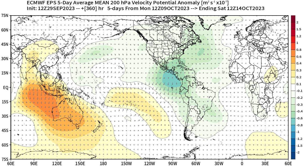
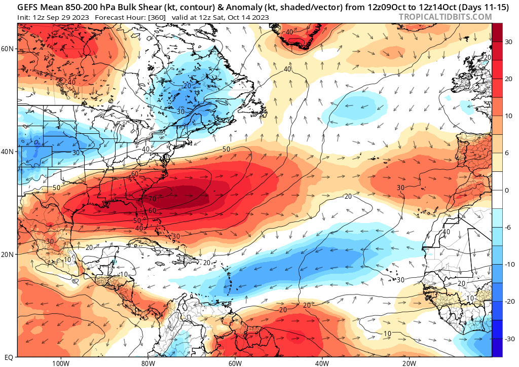
Elsewhere: Risks of any kind of hybrid development off the East Coast next week continue to diminish as there will be only a brief window of favorable conditions there before the upper-level ridge moves east and East Coast troughing develops. The next window to watch for potential development will likely start in the second week of October, when upper-level winds become more conducive for convection in the southern Gulf and Caribbean, and shear in those regions will be normal to below normal. Nothing specific in the models at this time, but given climatology, this area is always worth watching in mid-October.
Next report: Daily bulletin out Monday morning.

