


Tropical Storm Claudette Landfall Update for June 19th
Claudette is bringing the expected heavy rain to the Deep South today.

WeatherTiger’s Hurricane Watch paid subscribers receive complete landfall coverage for all tropical storms and hurricanes impacting the U.S. coastline, including today’s Tropical Storm Claudette. Enjoy this free preview as the first storm of 2021 slogs ashore the Gulf Coast.

Tropical Storm Claudette belatedly became the third named storm of 2021 overnight, obtaining a sufficiently organized low-level circulation to be upgraded from PTC 3 as it was making landfall in eastern Louisiana. This morning, Claudette continues to pack a punch for a low-end tropical storm while the center moves inland over southern Mississippi. As of the 11 a.m. ET/10 a.m. CT advisory from the NHC, sustained winds remain at 40 mph as it moves NNE at about 15 mph.

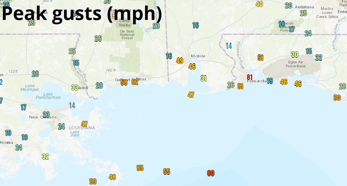
As expected, the primary impacts of Claudette are in heavy rainbands near and extending well east of the circulation center, several of which are tracking east across the Florida Panhandle and southern Alabama this morning. While excessive rainfall remains the primary threat from Claudette, some of these bands have also yielded potent wind gusts this morning; Pensacola Airport reported a gust to 81 mph (!) in a severe thunderstorm, and elsewhere brief gusts of 45-60 mph have occurred along the MS, AL, and western FL Panhandle coasts.
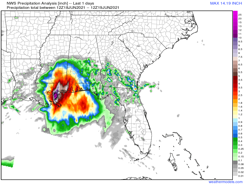
So far, rainfall totals are tracking as expected. Through 8 a.m. ET this morning, rainfall of 3-6” had already occurred in eastern LA and southern MS, with 1-3” so far in southern AL and western FL. Additional rainfall over the next 3 days of anywhere from 2-5” is likely over much of Alabama, Georgia, and the Florida Panhandle, which has nudged heavier in the Big Bend by 0.5” or so since yesterday. This rainfall will be more showery and intermittent tomorrow.

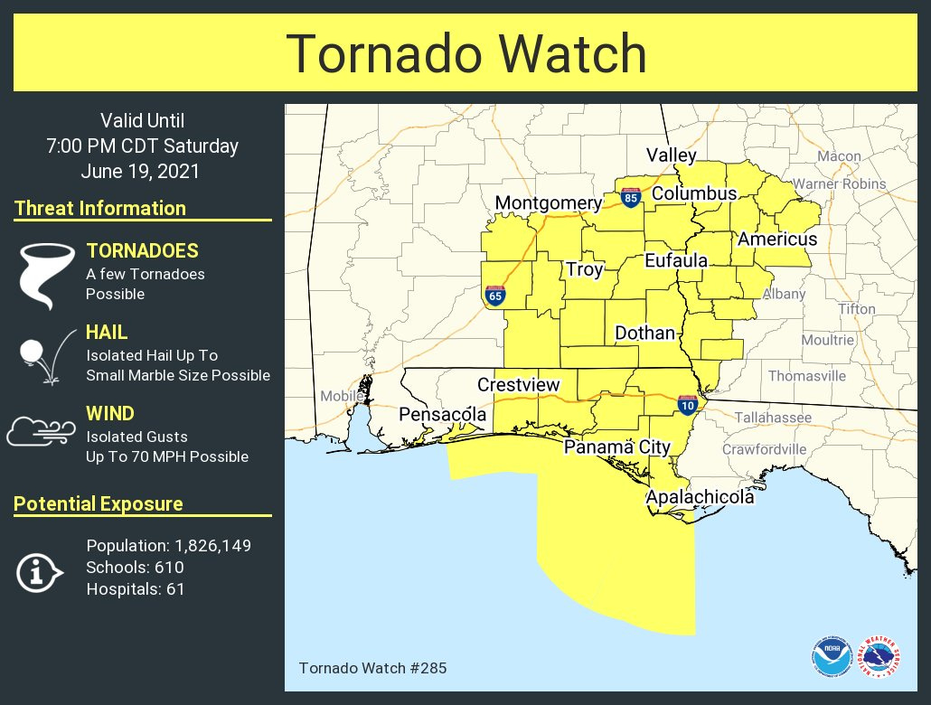
Finally, there have been several Tornado Warnings for southern Alabama and western Florida this morning with cells embedded in those powerful bands. A Tornado Watch is in effect through 7:00 p.m. CT tonight in the expectation of additional spin-ups, so have a way of receiving localized weather warnings and a plan to seek shelter if you are in the watch area.
Back on Monday with a daily briefing to wrap up Claudette’s impacts on the Deep South (and potentially to continue tracking Claudette off the East Coast as well).