Tropical Storm Rafael Impacts Forecast for November 4th
Rafael may enter the Gulf as a hurricane midweek, but U.S. impacts should be light.
WeatherTiger’s Hurricane Watch is a reader-supported publication. Paid subscribers get Florida-focused daily tropical briefings, plus coverage of every U.S. hurricane threat, our exclusive real-time seasonal forecast model, and the ability to comment and ask questions.
Florida and continental U.S. tropical threat synopsis: Tropical Storm Rafael will spread rain chances to Florida and the eastern Gulf starting Wednesday as it remains well west of Florida. Significant wind, surge, and tornado impacts are not expected.
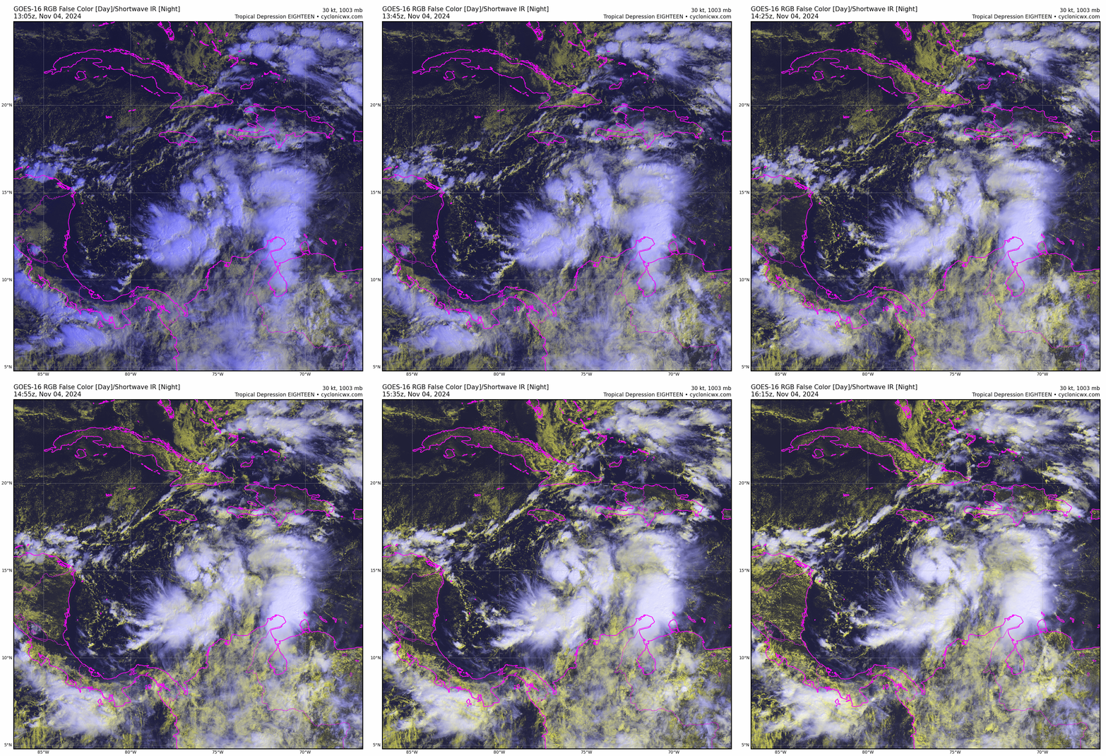
Tropical Storm Rafael has swirled to life in the central Caribbean to the south of Jamaica as expected, and is likely to enter the southern Gulf of Mexico mid-week as a hurricane. While that is an alarming opening sentence, the risks of damaging wind or surge on the U.S. Gulf Coast remain quite low due to hostile conditions near shore, and enhanced rain chances should be Rafael’s only meaningful impact on Florida and vicinity.
As of the 4 p.m. NHC advisory, Rafael has maximum sustained winds of 45 mph, and is moving north at about 10 mph. A bend to the left should get underway soon as Rafael feels the influence of a steering ridge of high pressure centered over Florida, which will keep the storm moving northwestward through Thursday.
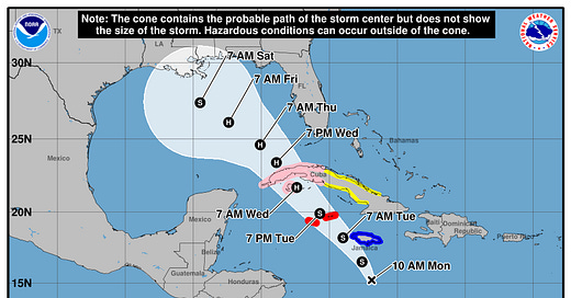
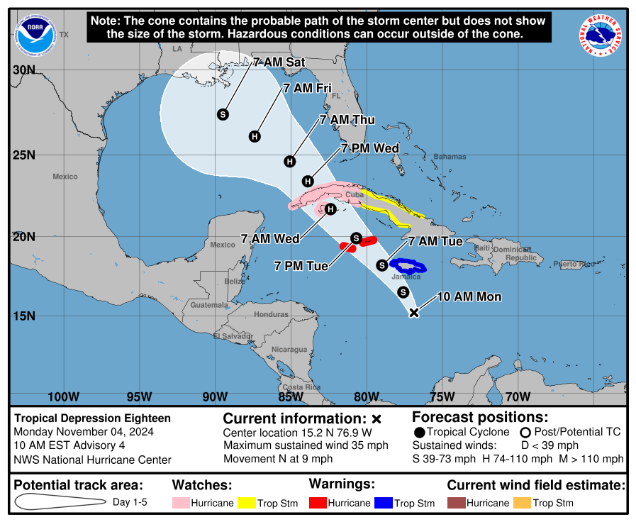
With Rafael’s low-level circulation developing in the middle of the range of possibilities, the depression’s short-term track is coming into better focus. Look for the center of Rafael to cross western Cuba or the Yucatan Channel and enter the southeastern Gulf by late Wednesday. The system is located on the eastern side of an upper-level low that will enhance its outflow and keep wind shear at favorable to manageable levels for the next several days, so strengthening is likely through mid-week as it crosses Caribbean waters still in the mid-80s. Thus, Rafael will probably peak out as a Category 1 or 2 storm by Thursday if it can avoid major land interaction.
That’s the scary part. The good news is that while Rafael may well enter the Gulf as a hurricane mid-week, there is little chance of the storm reaching land as a hurricane. As I discussed last week, a November Gulf hurricane landfall would require an amplified steering trough or cut-off low over the Mississippi Valley, such that a storm could race north or northeast across a hostile Gulf quickly without weakening much.
In this case, a front dropping into the Deep South later this week will be weak and oriented mostly east-west. That front will push the steering ridge eastward into the Atlantic, but the western flank of the high will continue to extend over Florida and the northern Gulf Coast. That means that rather than accelerating north towards Florida, Rafael will likely slow down and track west-northwest or northwest into the central or north-central Gulf on Friday and Saturday.
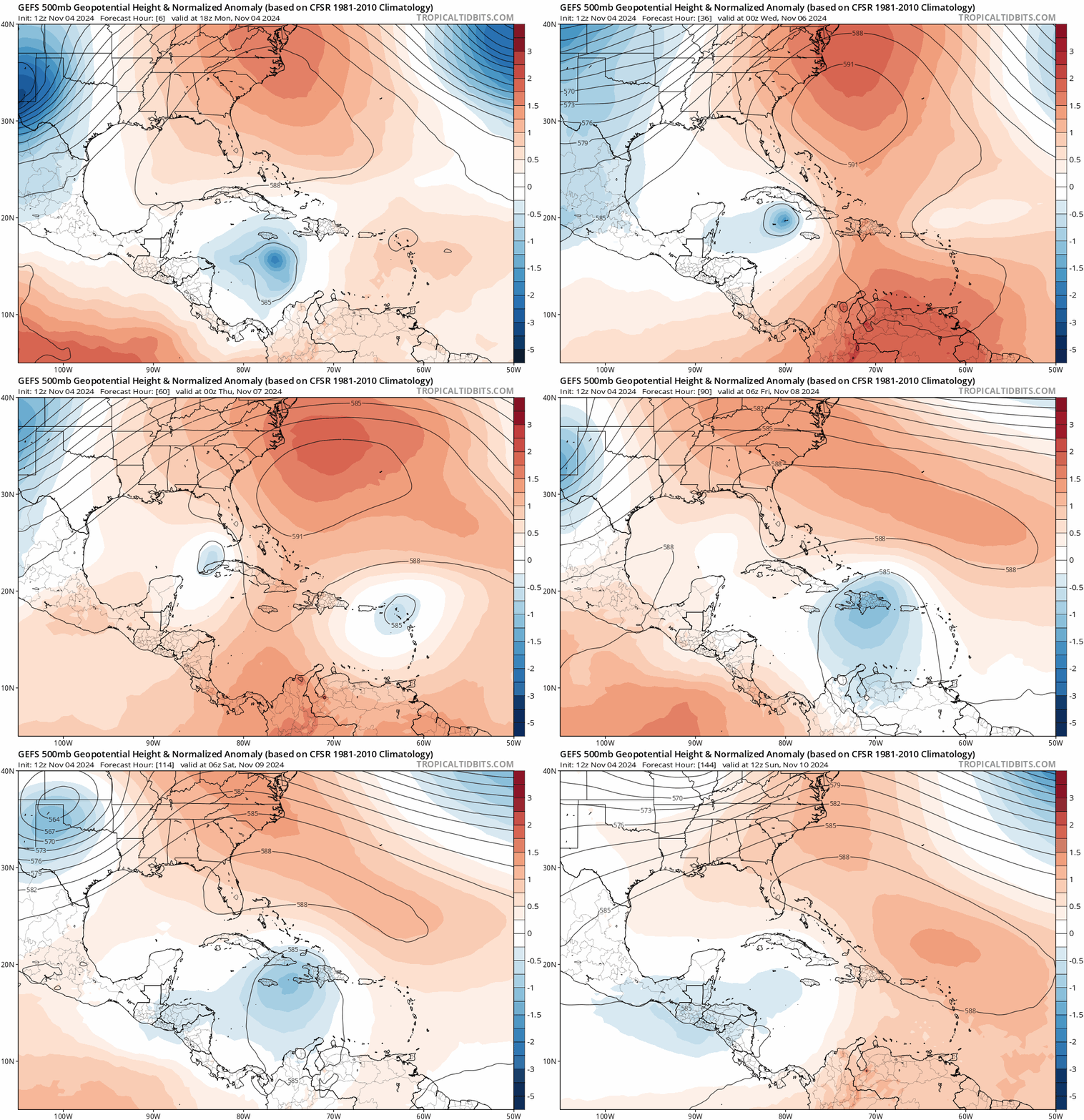
That slowdown will also be accompanied by weakening. While Gulf water temperatures away from the immediate coast are in the lower 80s and still capable of sustaining a hurricane, Rafael will be pulling a very dry continental airmass into its circulation late this week, while also being sandblasted by 30 knots or more of wind shear. The farther north and closer to land Rafael gets, the worse conditions will be for it, so weakening may be dramatic on Friday and Saturday.
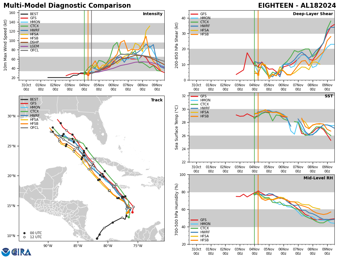
Ultimately, it is too early to say whether or not Rafael will technically make landfall on the central or east-central Gulf Coast as a tropical storm, but I don’t think it will make much of a difference in terms of weather impacts whether it does or not. For the Florida peninsula, Rafael will make its closest approach late Wednesday and Thursday. If the storm strengthens more through Wednesday, it is likely to pass a bit closer to Florida, but in all scenarios should remain well southwest of the Keys.
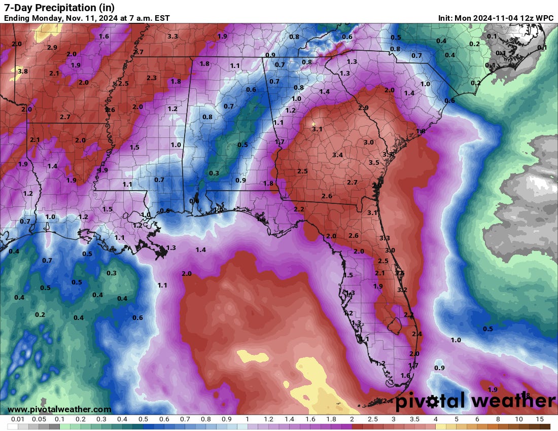
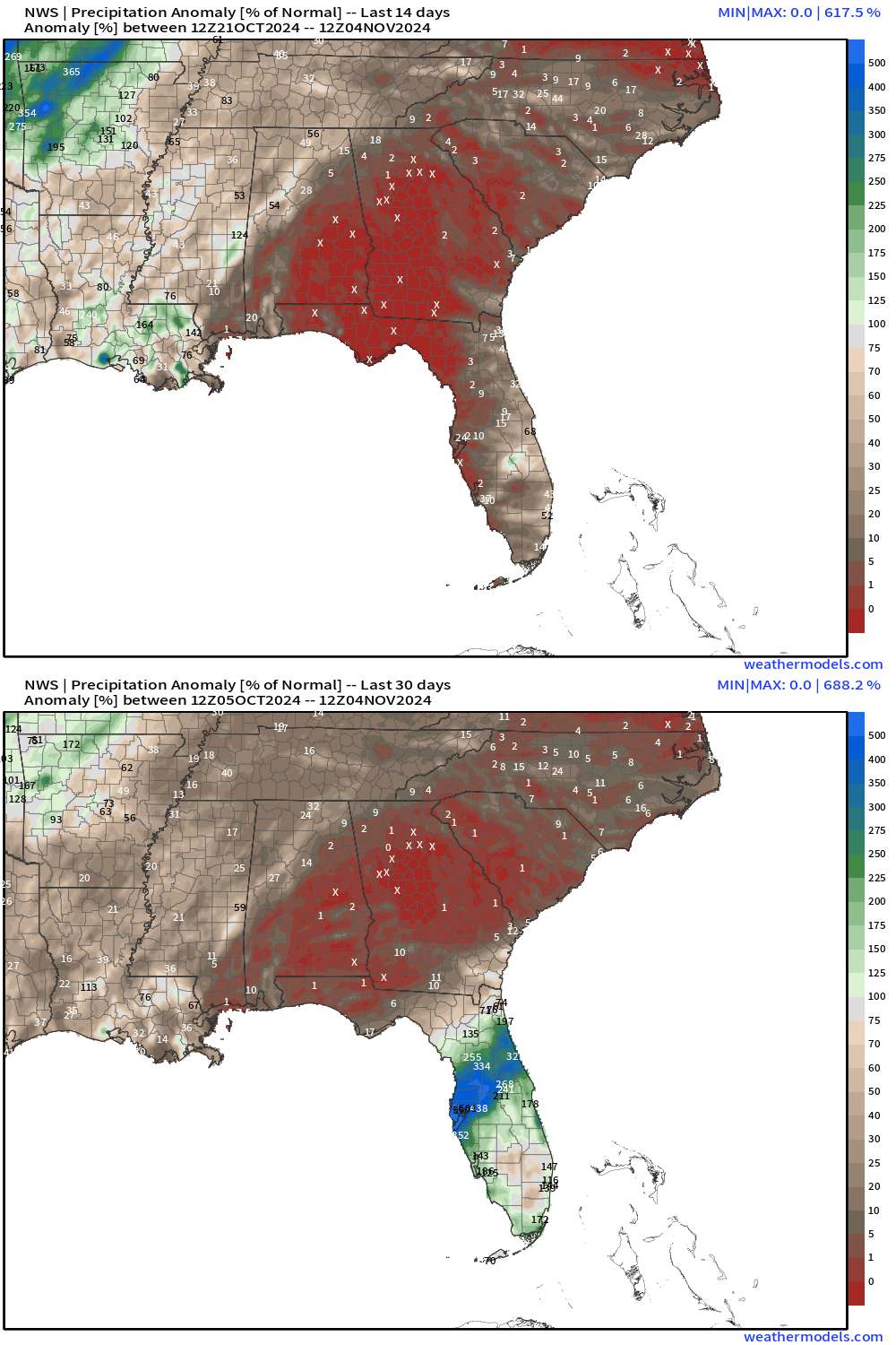
The main impact of Rafael on Florida will be an increase in rain chances between Wednesday and the weekend. While Rafael will remain well offshore the Florida Gulf Coast, it will drag tropical moisture north out of the Caribbean and over most of the state, leading to intermittent showers and thunderstorms tallying a general 1-3” through Saturday. With the peninsula seeing little rain since Milton and the panhandle notching almost none since Helene, this rainfall will be a net benefit outside the Central Florida river basins still at flood stage. Similar rain totals should extend across eastern Alabama and most of Georgia and South Carolina, where a flash drought is also developing.
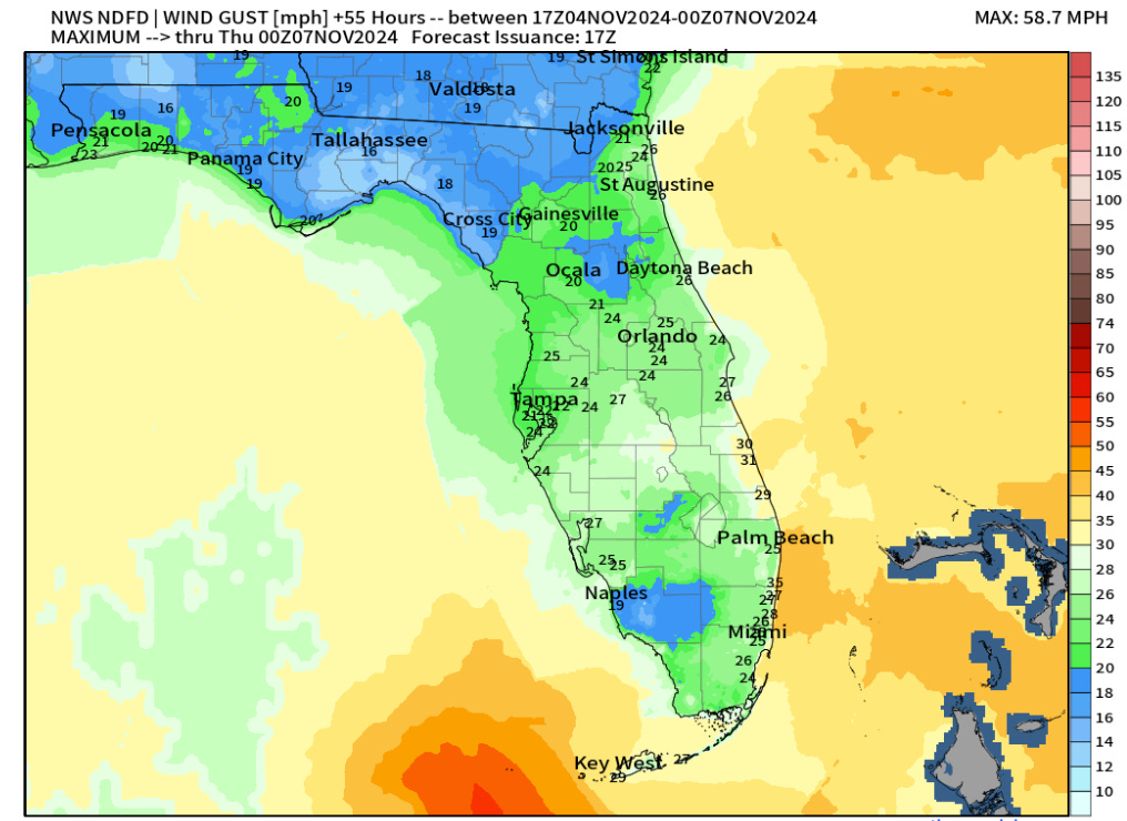
With Rafael moving west-northwest or northwest across the southeastern and central Gulf, offshore winds along the Florida Gulf Coast mean there is little to no risk of surge or coastal flooding. Conditions across Florida will be breezy inland and gusty on the coast late this week, but Rafael will initially be too far away from Florida to be a wind threat, and then too weak for much in the way of wind concerns if it does moves towards or over the central Gulf Coast by the weekend. (The Keys may see more frequent low-end tropical storm-force gusts mid-week.) Rafael should also be too far offshore to trigger any kind of a widespread tornado outbreak, though isolated spin-ups are always possible in bands well east of even modest tropical systems.
Overall, with things generally going according to plan, my concern for major impacts from Rafael remains low: the depression didn’t develop faster than expected, hasn’t rapidly intensified (yet, anyway), and the steering features haven’t budged in modeling. That means the eastern halves of the U.S. Gulf Coast and Deep South will likely see needed rains, but few other impacts.
One final note: another tropical system may develop near Hispaniola this weekend and also approach South Florida from the east by early next week. Conditions aren’t favorable for that to be a big deal either, but it could keep Florida’s rain chances up in the longer term. Here’s hoping that this late season flurry of tropical activity stays in the beneficial or at the very least, the irritant range for impacts, which so far, they appear to be doing. I’ll let you know if anything changes.Keep watching the skies.



thank you. i always feel like i get what you are saying about science akin to rocket science, really. complex but you make it understandable, for a wonk like me
I’m with Lloyd Behrendt! Thank you!