The Widening Gyre: WeatherTiger's Hurricane Watch for June 7th
The Caribbean may start to simmer this week, but it'll be a slow burn.
Welcome to WeatherTiger’s Hurricane Watch! From today through October 31st, each weekday I’ll be issuing a tropical briefing bringing you that day’s hurricane history, a quick run-down of active storms, and a look at current development threats. Paid subscribers will receive these daily briefings and be able to comment and ask questions, as well as get all of our Thursday long-form analysis columns, daily in-depth forecasts and video discussions during Florida hurricane threats, live landfall coverage, and expanded seasonal outlooks. Free subscribers subscribers will receive a weekly forecast column. Sign up below to get WeatherTiger’s Hurricane Watch newsletters all season long.
A free preview of our daily briefing will continue into June as we settle into our new Substack digs. Enjoy, and feel free to drop a line to ryan@weathertiger.com with any questions.
Almanac: Today is Monday, June 7th… day 7 of the 2021 hurricane season, 177 days to go. By total storm energy, the season is 1% complete as a whole, 1.5% complete for the continental U.S., and 2.1% complete for Florida. The two tropical storms to make landfall on this date since 1851 are Tropical Storm Colin in 2016 and last year’s Tropical Storm Cristobal, both of which were primarily rain-makers for the central and eastern Gulf with sustained winds topping out at 50 mph.
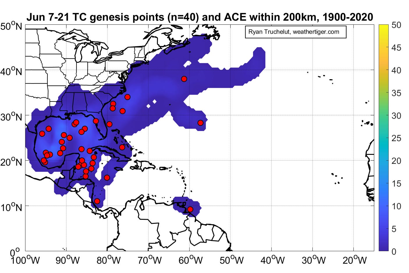
Historically, as shown above, tropical development in the second two weeks of June is most common in the northwestern Caribbean and Gulf of Mexico, with about 1 out of every 3 seasons since 1900 seeing some action. These systems often move north or northeast towards the Gulf Coast.
Active Storms: None.
Current disturbances in NHC outlook:
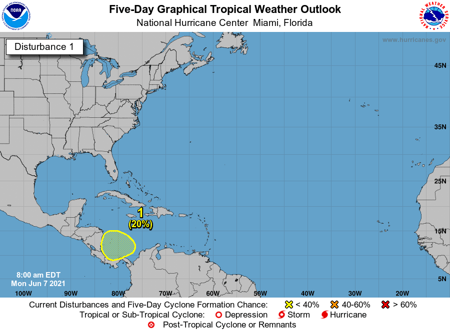
Southwestern Caribbean (2-/5-day odds: 0/20%). There is nothing to look at today in the Gulf, Caribbean, or Atlantic, but the southern Caribbean is on the board with a slight chance of development in the 3- to 5-day range per NHC. This is because a very large area of turning called a Central American Gyre is likely to set up in the upcoming several days, as shown below on the mid-day GFS for this upcoming Saturday.
These gyres are a common mechanism of storm development in June, giving rise last year to the aforementioned Cristobal. It is not possible to nail down at long range where we will see tropical development (if anywhere), as that is driven by unpredictable storm clusters popping up within the broader rotation of the gyre. That means a storm could form in the Eastern Pacific, or the Caribbean, or nowhere. There’s a long time to watch this gyre cook, but the pattern overall is supportive for eventual development somewhere in the next 10 days. Worth keeping an eye on, as steering currents in week 2 could pull anything that develops on the Atlantic side of Central America north.
Elsewhere: All quiet. The Caribbean and Gulf are the only game in town in June. A low pushing east from the Carolinas next weekend is unlikely to be tropical in nature.
Next report: Tomorrow’s daily briefing will be issued by 2 p.m., as usual.


