The Steinhatchening: WeatherTiger's Weekly Column for July 8th
Tropical Storm Elsa was a storm out of season for the Florida Gulf Coast.
This wrap-up of Hurricane Elsa as WeatherTiger’s usual free Thursday column concludes our coast-to-coast coverage of Elsa. If you enjoyed our work, please consider signing up for our paid subscription service to receive a daily threat briefing each weekday, or sharing this blog with your friends and family.
The hamlet of Steinhatchee, like many peppering the Florida Gulf Coast, is a 50/50 blend of Guy Harvey and Thomas Kinkade, ideal for seafood consumption, crab catching, and soaking in abundant salt life.
Unlike other Gulf Coast towns, however, only Steinhatchee has earned its own eponymous portion of hurricane season. This week, Tropical Storm Elsa added another notch to the long history of Steinhatchee Season, albeit with several twists making Elsa anything but a typical Steinhatchening.
As expertly forecast by the NHC, Elsa made landfall on Wednesday morning with maximum sustained winds of 65 mph between Steinhatchee and Keaton Beach in Florida’s Big Bend region. (For the uninitiated, that’s about 150 miles north-northwest of Tampa.) Elsa cycled through a couple of deep convective pulses in its 36 hours over the Gulf, with one intense but transient burst briefly lifting it back to minimal hurricane intensity on Tuesday night.
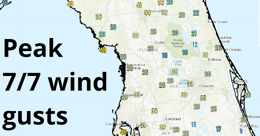
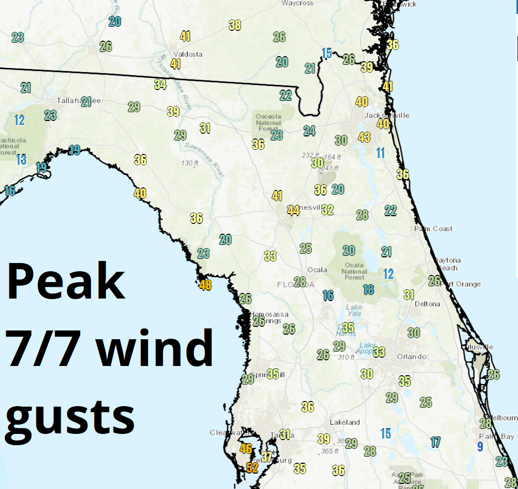
After some overnight weakening, a final uptick of convection into landfall brought some impressive tropical storm force winds to the eastern Big Bend and Nature Coast, with sustained winds of 62 mph and a gust of 72 mph reported in Horseshoe Beach. More broadly, coastal gusts of 50 to 60 mph occurred between roughly Sarasota and eastern Apalachee Bay, resulting in peak storm surge on the order of two to four feet on the Big Bend coast to the east of Elsa’s center.
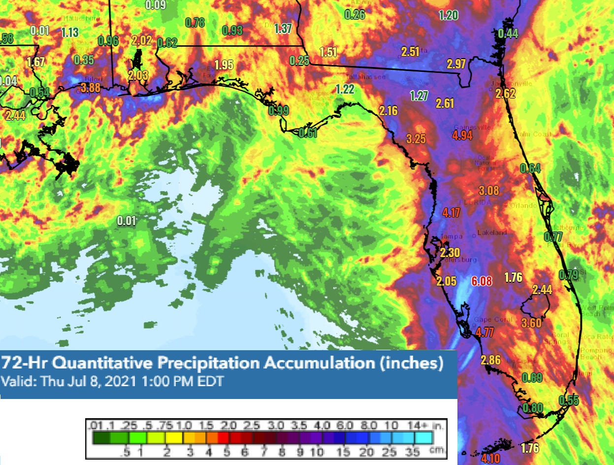
As predicted, rainfall totals of 3-5” were widespread across the western half of the Florida peninsula and across inland North Florida, with local accumulations of up to 10” in Southwest Florida. Rain totals were lower for Tallahassee and the western Panhandle on the dry side of Elsa, closer to 1-2”. Post-landfall, wind gusts mostly in the 40s and several damaging tornadoes also occurred over inland North Florida as Elsa accelerated northeast, with the Jacksonville metro area particularly hard hit by severe weather.
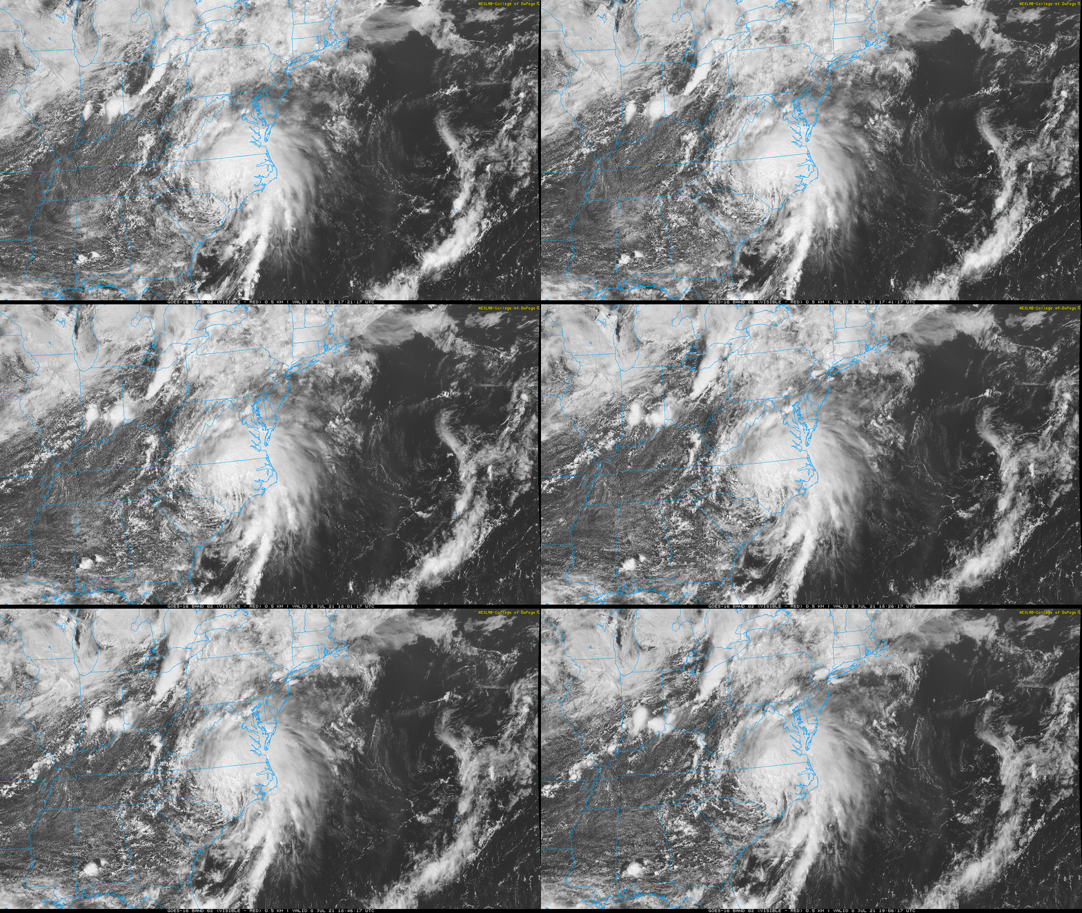
Remarkably, despite being over land for more than a day, Elsa remains a tropical storm as of Thursday afternoon. Elsa is racing northeast into the mid-Atlantic currently, and will spread continued heavy rain and coastal gales to the East Coast while becoming non-tropical over southern New England late Friday.
For early July, all of this was, to use a technical term, a lot. Elsa had many quirks, but for the sake of simplicity we’ll focus on the two most unusual aspects of the hurricane: its timing and its track.
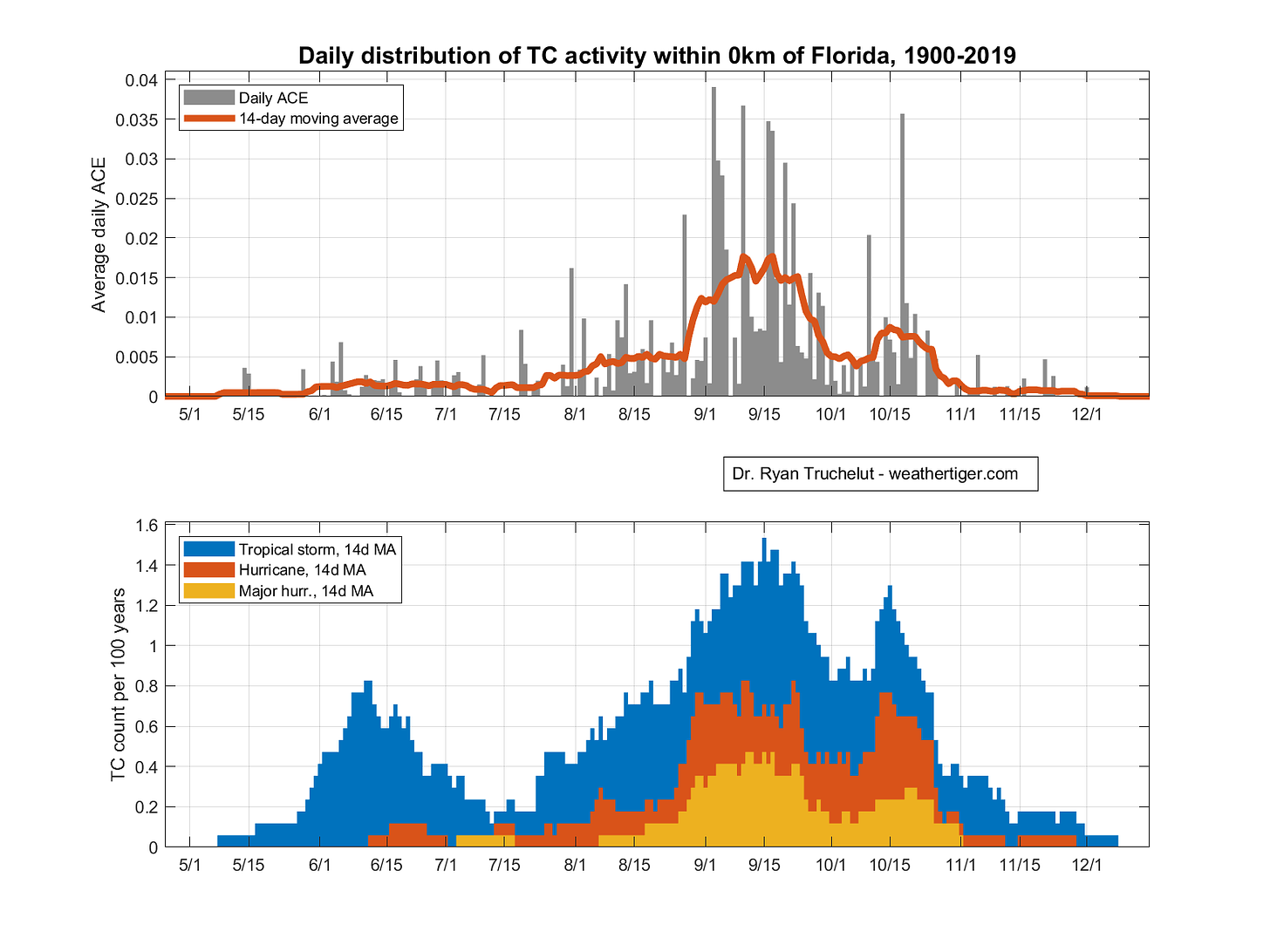
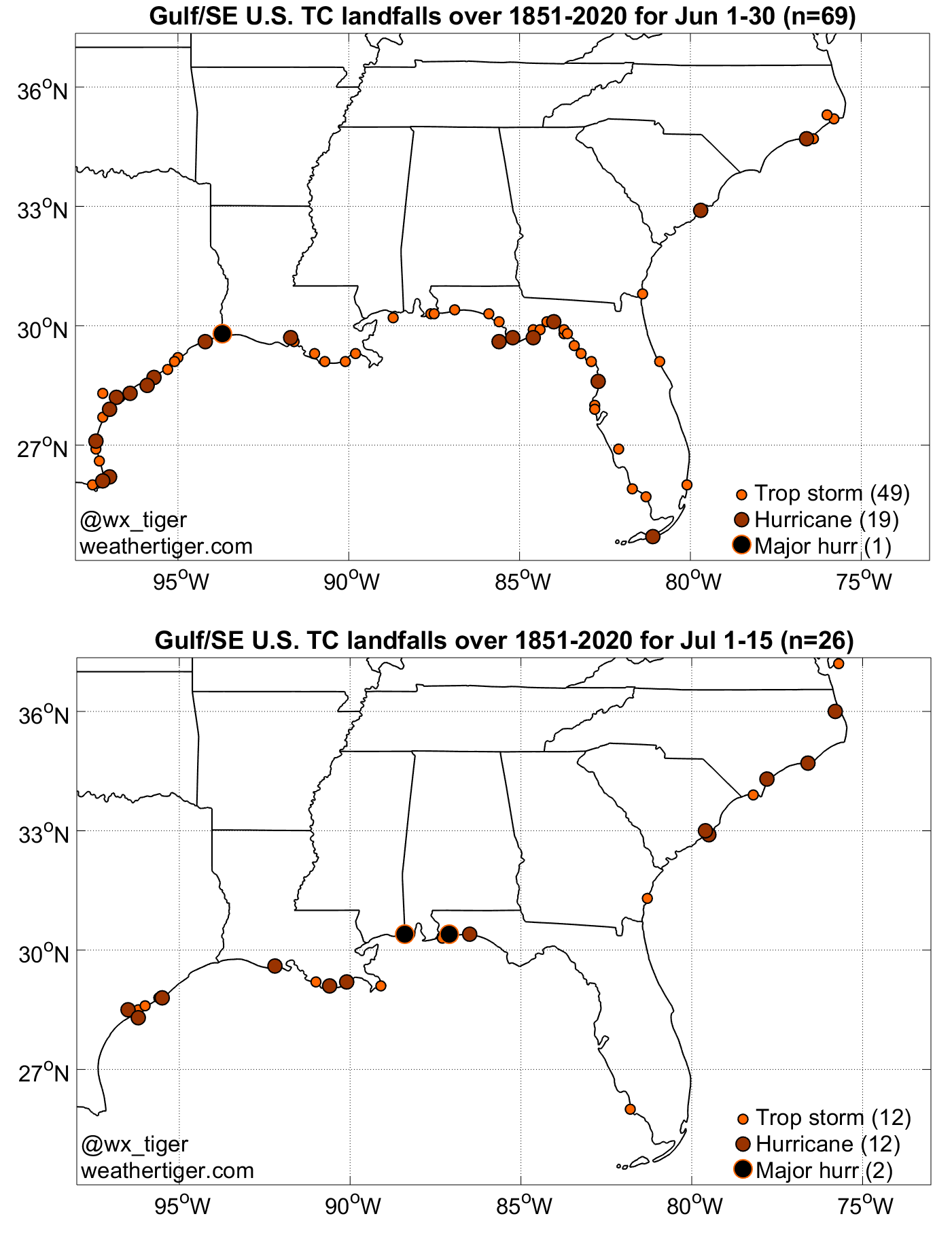
Elsa’s divergence from tropical cyclone climatology is not quite as anachronous as a summer blizzard in Arendelle, but it’s close. The Steinhatchee Season, in which early-developing tropical storms commonly angle towards the northeastern Gulf Coast (and exhibit a bizarre attraction to Steinhatchee in particular), is generally contemporaneous with June and peaks around the 10th of the month.
Typically, these June storms are an asymmetrical mess, with heavy rainfall on the eastern half of the circulation the main hazard. This was true of the Steinhatchee Specials of the 2010s, including Tropical Storms Alberto, Colin, Andrea, and Debby, some of which yielded significant flood impacts.
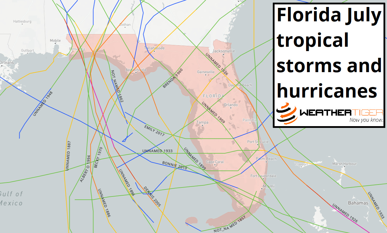
However, by the first half of July, the pipeline of early season eastern Gulf threats typically shuts down. In fact, between 1851 and 2020, only five tropical storms or hurricanes struck anywhere in Florida between July 1st and July 15th, most notably Category 3 Hurricane Dennis in 2005. During this window, there were no landfalls between the western Panhandle and Naples. Overall, the 24 storms and 9 hurricanes that scored a July landfall in Florida in the past 170 years make this month the second-least active of hurricane season, following November. So, if you share my strong belief that you shouldn’t have had to deal with Elsa for the past week, hurricane history has your back.
The other curious facet of Elsa is where it developed and moved. Rather than the more common early July development locations of the Gulf, Caribbean, or subtropical western Atlantic, Elsa formed over the Tropical Atlantic from a west-moving African easterly wave. This is a location and mode of genesis more typical of an August or September threat, and may point to an active “Cape Verde” season ahead.
Even then, storms developing from tropical waves seldom walk the tightrope of avoiding landmasses and catching mid-latitudes troughs with just the right timing to scrape the Florida Gulf Coast. While tracks like Charley do happen, most of the time Cape Verde hurricanes either continue west-northwest into the Gulf or turn north to the east of Florida. In short, Steinhatchee truly had to roll climatological snake eyes to see tropical storm impacts originating from an easterly wave in early July.
And yet, in hurricane season 2021, Steinhatchee Season went into overtime. The good news is that despite its Disney affiliation, no immediate Elsa sequels are in the cards. The Atlantic is currently quiet, as the unusually active upper-level wind pattern that aided Elsa flips into an unfavorable state for the next couple weeks. Thus, expect a well-needed break before the Atlantic throws any further truly bizarre curves at us, Steinhatchee, or elsewhere. Keep watching the skies.
Next update: Our regular daily briefing will resume tomorrow for paid subscribers.

