


The Rule of Threes: The Hurricane Watch for June 19th
TD 3 develops in the eastern Atlantic and poses a threat to the Lesser Antilles.
Florida tropical threat synopsis: No tropical threats to Florida over the next week, though locally heavy rainfall will continue for another five days or so.
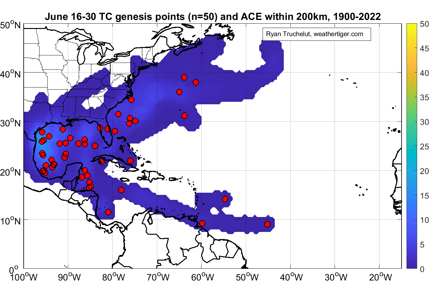
Almanac: It’s Monday, June 19th… day 19 of the 2023 hurricane season, 164 days to go. By total storm energy, the season is 1.6%, 4.6%, and 5.3% complete for the Atlantic, continental U.S., and Florida, respectively. Tropical storms generally develop in the Gulf, western Atlantic, or western Caribbean in the latter half of June, with only three genesis events east of 60W since 1900.
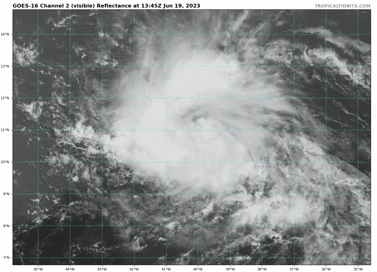
Active Storms: And #4 is soon to come. Tropical Depression Three has developed in the eastern Tropical Atlantic, with 35 mph sustained winds as of the NHC’s 11 a.m. advisory. TD 3 is located in a low-shear, high-moisture environment, and will become Tropical Storm Bret in the next day. Look for continued strengthening over the next three days, potentially to hurricane intensity by Thursday, as the storm proceeds a little north of due west at a 20 mph clip.
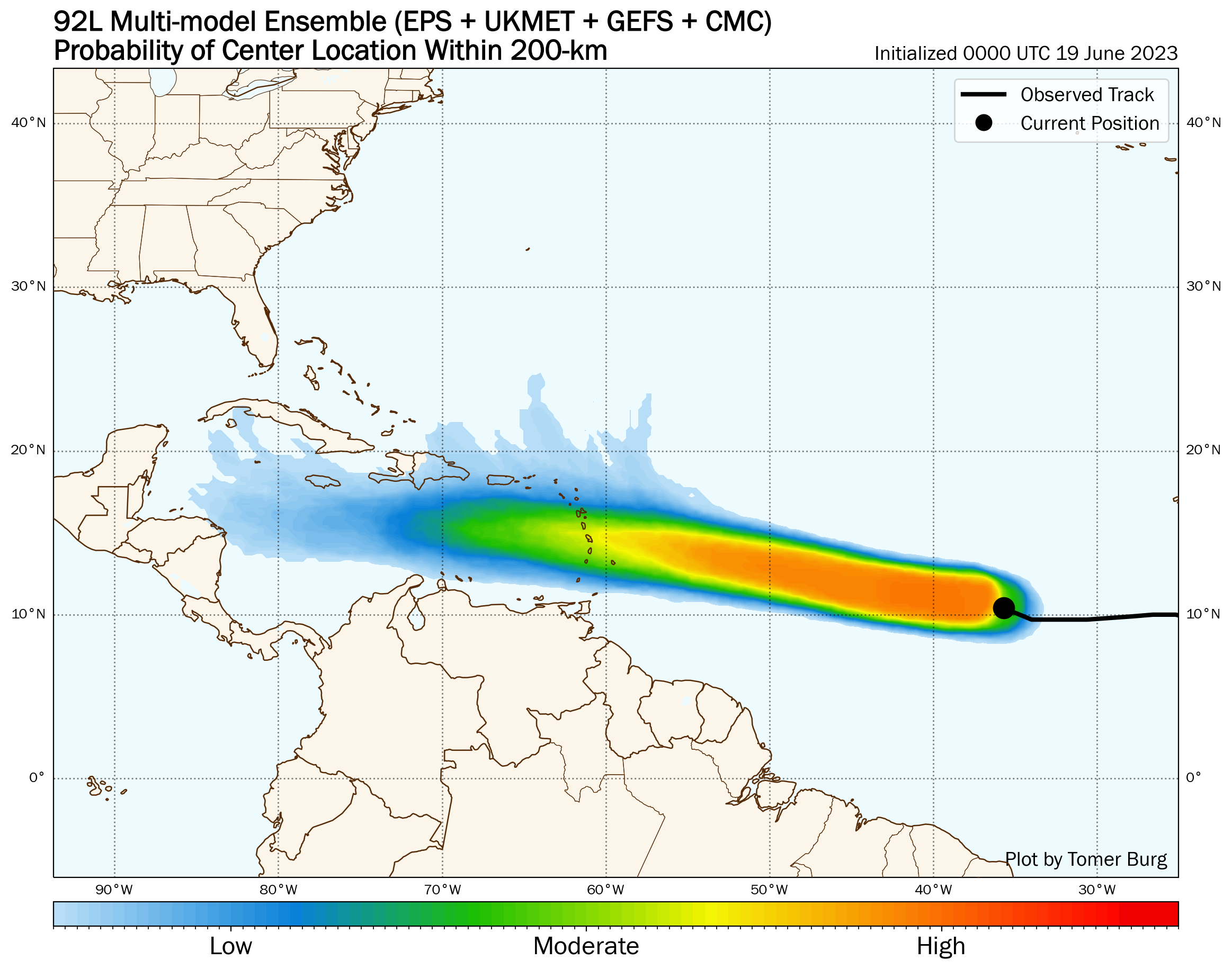
The official NHC forecast keeps the system at category 1 hurricane intensity into the weekend as it continues WNW into the eastern Caribbean. This track is a bit of a hedge between the majority of ensemble members, which keep a weaker storm moving more quickly westward, and a minority that turn a stronger storm north to the east of or over the Antilles. The trend is towards the more southward track today, so don’t be surprised to see the track adjust that direction. Nevertheless, all interests in the Lesser Antilles and Puerto Rico should be carefully monitoring the progress of TD 3. At least rain impacts are likely there Friday and Saturday, and perhaps more.
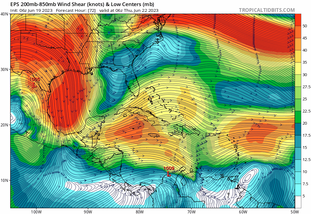
Longer term (assuming the westward track occurs), TD 3 is expected to encounter an axis of upper-level wind shear in the eastern and central Caribbean, which will likely cause intensity to plateau late this week, then decline through the weekend. Ensembles show an eastern U.S. trough keeping the region inhospitable for hurricane activity on days 6-10, and generally wash TD 3 out in the Caribbean at some point in that timeframe. Overall, while there is still quite a bit of uncertainty in the long range, there is also no indication that a continental U.S. threat is in the works.
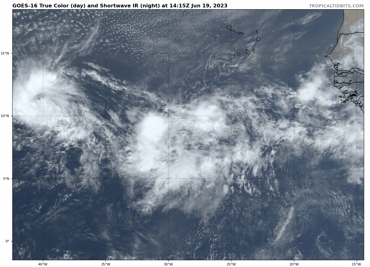
Other Disturbances in NHC outlook, with 2-/7-day NHC development odds: But wait, there’s more! Invest 93L to TD 3’s east is also a well-organized tropical wave with plenty of convection, and likewise has a 30% chance of development in the next 2 days and a 40% chance of development in the next 7 days. Should 93L develop, it is likely to peel north eventually into a gap in the Atlantic subtropical ridge starting this weekend.
Elsewhere: Nothing else in the Atlantic, Gulf, or Caribbean of note.
Next report: Weekly column out tomorrow early afternoon.