The Importance of Being Ernesto: Hurricane Watch for August 13th
Strengthening Tropical Storm Ernesto will bring rain and wind to the Virgin Islands and Puerto Rico over the next day.
Florida and continental U.S. tropical threat synopsis: No tropical threats for or impacts on Florida/the continental U.S. over the next week, other than high East Coast wave action from Ernesto.
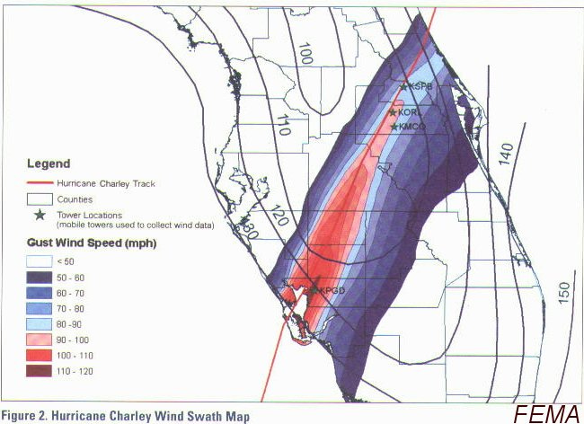
Almanac: It’s Tuesday, August 13th… day 74 of the 2024 hurricane season, 109 days to go. By total storm energy, the season is 11%, 24%, and 15.8% complete for the Atlantic, continental U.S., and Florida, respectively. Today is a significant hurricane anniversary for me, and I’m sure for many of you as well: it has been 20 years since Hurricane Charley’s surgical Category 4 strike on Friday, August 13, 2004.
Charley’s 150 mph sustained winds at landfall, small size, and swift forward speed brought a level of wind destruction not seen in almost 50 years across Southwest and Central Florida, and one that would not come close to being equalled in Southwest Florida until Ian. Sustained hurricane force winds occurred across eastern portions of the Orlando metro area, including a 105 mph wind gust at Orlando International Airport. Personally, I rode this one out in south Seminole County, recording a minimum pressure of 976 millibars shortly after 9:45 p.m. Charley’s core was so compact that there was little to no wind at my house just 90 minutes before the eye arrived, and pressure dropped so quickly in the eyewall that I could literally watch the needle fall on my grandfather’s analog barometer.
In short, Charley was the windstorm of a lifetime for many in the Florida peninsula— let’s hope.
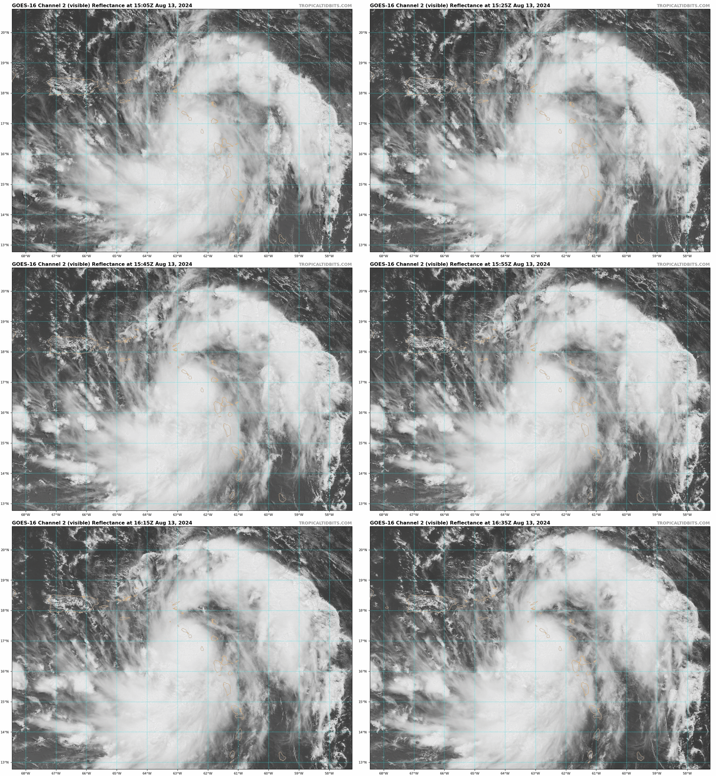
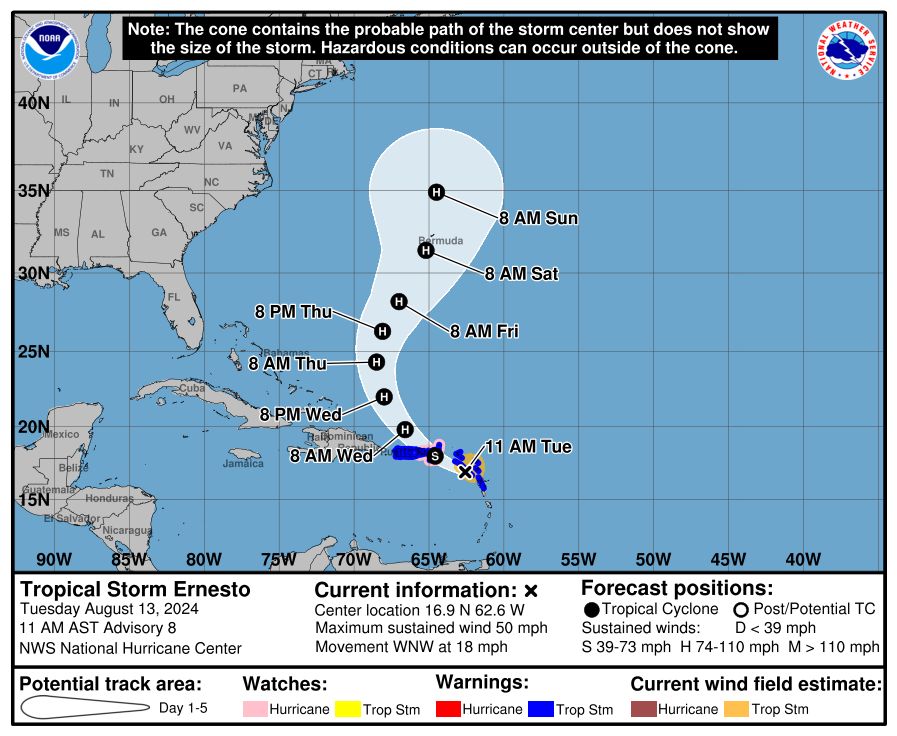
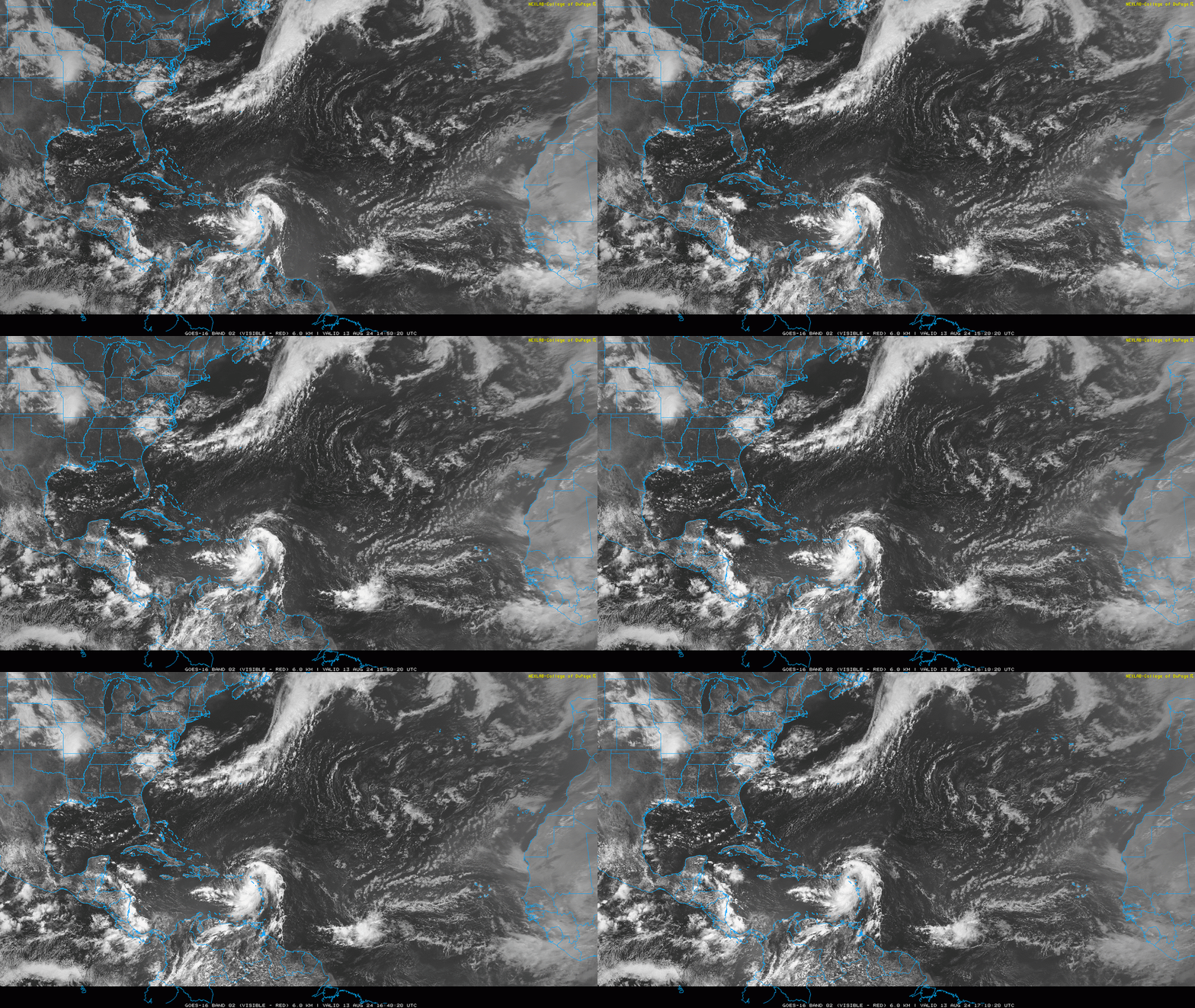
Active storms: It’s no Charley (thankfully), but Tropical Storm Ernesto is located about 250 miles east-southeast of San Juan as of Tuesday morning, with maximum sustained winds of 50 mph in bands to the northeast of the center. Ernesto is moving west-northwest through the Leeward Islands at around 20 mph. A bend northwestward and slowing of the storm’s forward speed is expected over the next 24-36 hours. On this track, Ernesto will pass just northeast of eastern Puerto Rico, with the closest approach overnight today into early Wednesday as a moderate-to-strong tropical storm.
A Tropical Storm Warning remains in effect for all of Puerto Rico, though the southwestern quadrant of the storm that will directly affect most of PR directly is its weakest. Ernesto is expected to become a hurricane by mid-day Wednesday as it moves north and away from Puerto Rico, and a Hurricane Watch is now in effect for the Virgin Islands as Ernesto gets better organized today.
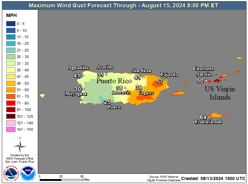
There are only slight changes to yesterday’s Ernesto impacts forecast for Puerto Rico and the Virgin Islands. With a broad windfield biased northeast, wind and surge impacts on Puerto Rico will be relatively modest, mostly 35-50 mph inland gusts within rainbands, and some 50-60 mph gusts possible on the eastern coast. The Virgin Islands may see gusts pushing hurricane force as Ernesto’s developing core rolls through tonight.
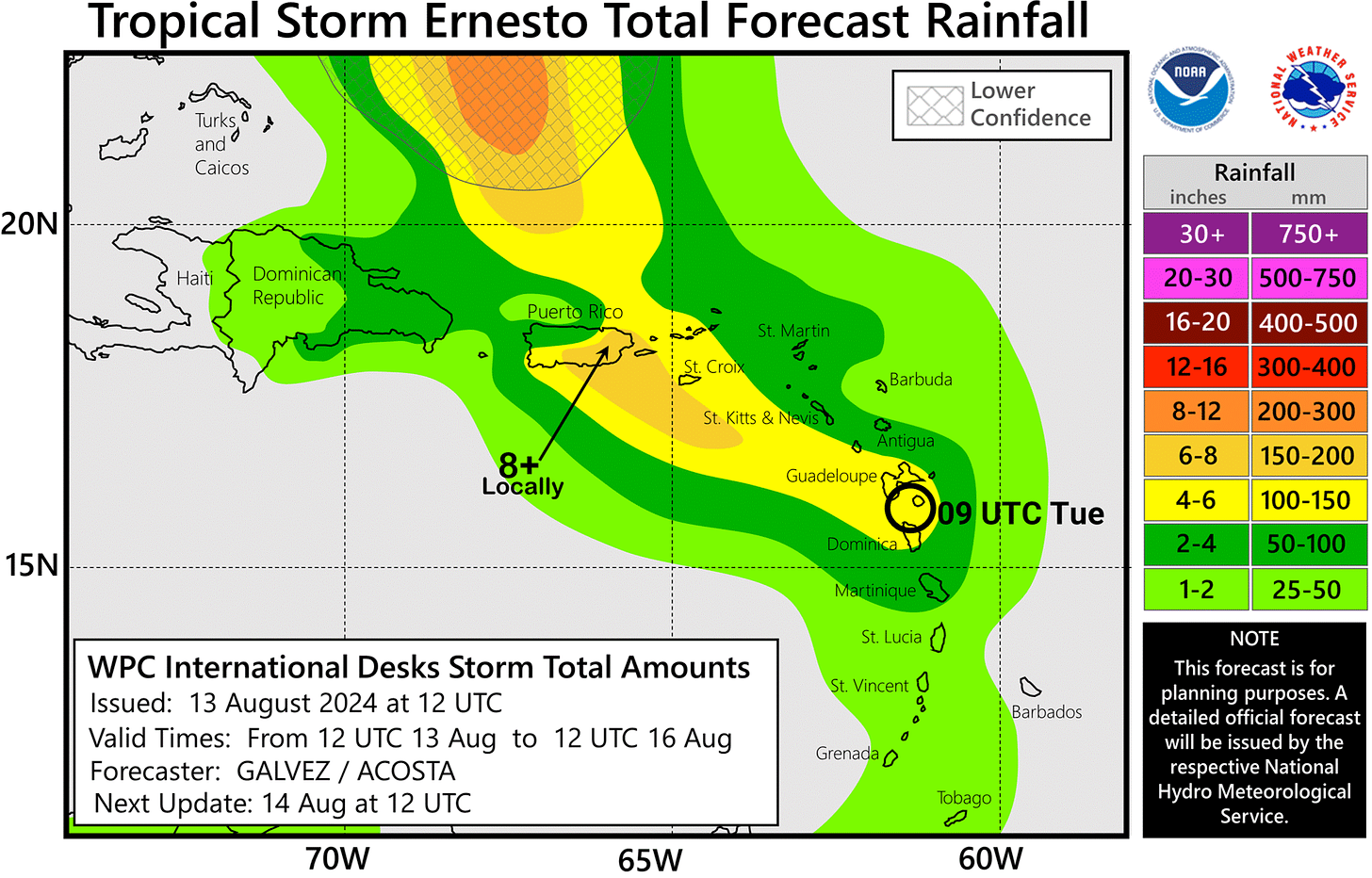
Heavy rainfall remains the greatest threat from the storm. Rainbands will overspread the island from east to west later today, and with 6-10” storm totals through Thursday still the expectation in southeastern and eastern Puerto Rico, where there is the greatest risk of flooding and mudslides. Expect 2-6” storm totals and more localized flooding impacts for north-central and western portions of the island.
Ernesto is likely to become a hurricane tomorrow as it pulls away from Puerto Rico to the north, and possibly a major hurricane in 3-4 days around when it passes near Bermuda. Expect it to reach the Canadian Maritimes Monday or Tuesday as a strong extratropical storm. Ernesto is not a direct continental U.S. threat, other than the fact that 6-10’ surf up and down the East Coast will trigger elevated rip current threats this weekend and into early next week.
Disturbances in the NHC tropical weather outlook: None.
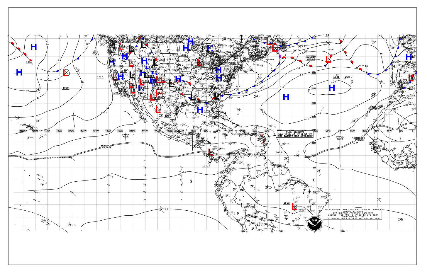
Elsewhere: A tropical wave to Ernesto’s east is generating some decent convection and rotation today, but over the next few days will be taking in a very dry airmass currently to its north. Therefore, no development is likely in 5-7 days from this wave. Another tropical wave currently over Africa will hit the water in a few days; models remain curiously unimpressed with this wave and subsequent ones over the next 10-12 days, likely due to a northwardly-displaced monsoon trough (see below) routing stable subtropical air into the wave envelopes once they roll off the coast.
Given an increasingly favorable background state and climatology, I’d be a little surprised if there isn’t another feature to watch for potential development by early next week as Ernesto washes out in the North Atlantic. However, the good news is that not only will the continental U.S. be tropical threat-free for the next week, no potential impacts are obvious in the 8-14 day range either. I’ll keep watching, as things can change quickly in late August. Life, like Charley, comes at you fast.
Next update: Tomorrow morning.


How well I remember Hurricane Charley (and Frances and Jeanne which followed close on it's heels). We lived in SW Orlando near Universal studios and Disney World. The wind damage was inconceivable. Not only a multitude of damaged roofs, but also huge stacks of tree and landscape debris piled curbside as far as the eye could see. It took weeks to get it removed.
Charlie. We were in our house a mile from the Gulf in Manatee for one year. I was GM of Siesta Key Utilities watching the track going right over us, remembering a talk by the Fire Chief of Sullivan Island. SC, about Hugo. Charlie turned, and we got almost nothing except for a few days of power outages. Bought a bigger generator and Miami rated hurricane shutters for all the openings right after that.