Starburst Sampler: WeatherTiger's Hurricane Watch for August 24th
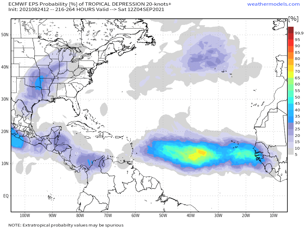
High, medium, and low probabilities for development are on the map in the Atlantic.
Two-sentence Florida tropical threat synopsis: Florida remains under no threat from tropical weather over the next five to seven days. Tropical development is likely in the southern or western Gulf by this weekend, but will pass well west of Florida; the Atlantic is likely to be very active in the first week of September and multiple systems worth monitoring for Florida may develop.
Almanac: It’s Tuesday, August 24th… day 85 of the 2021 hurricane season, 98 days to go. By total storm energy, the season is 18.6% complete as a whole, 31.3% complete for the continental U.S., and 21.2% complete for Florida. August 24 is a dark day in Florida hurricane history, as Category 5 Hurricane Andrew made landfall in Homestead with 165 mph sustained winds on this date in 1992.
Active Storms: None. But probably not for too much longer.
Current disturbances in NHC outlook, with 2-/5-day NHC development odds:
Invest 97L (20/70%): A wave in the central Atlantic passing near 25N, 50W this afternoon has a vigorous low-level circulation, but still has little associated convection. This disturbance is entering the region of no return for U.S. concerns, but development is highly likely by the end of the week once it finds a more supportive environment east of Bermuda. An intense hurricane is a good bet in the open Atlantic in five to seven days, but again, no threat here.
Invest 98L (20/30%): A wave in the eastern Atlantic along 30W is also moving westward, and has a decent circulation this afternoon. However, it is beginning to ingest unfavorably dry air from the north, so continued development is unlikely. This wave will also turn north into the open central Atlantic by the weekend, and like 97L, is not a threat to the U.S. coast.
Western Caribbean (10/60%): A wave in the central Caribbean is not much to look at currently, but development is likely by Friday or Saturday as it enters the western Caribbean or southern Gulf of Mexico. This wave remains a threat in the 6-7 day range to the western U.S. and northern Mexican Gulf Coast, as southeastern ridging steers it west-northwest or northwest across the Gulf over the weekend. Texas and Louisiana should pay close attention to this one, but there is no risk to Florida.
Elsewhere: The western Caribbean may see additional development in the 7-10 day range, which if it comes to fruition could theoretically be more of a potential threat to Florida. The eastern Atlantic is also likely to light up in early September as a convection-supporting upper-atmospheric wave reaches the Main Development Region, as shown on the Euro Ensembles above.
Next report: Next subscriber report out tomorrow afternoon.


