Seasonally Affected: The WeatherTiger Newsletter for January 2023
Winter 2023 is oscillating wildly between cold and, more often, mild extremes.
Welcome to WeatherTiger’s monthly off-season newsletter! Until hurricane season picks up again, I’ll be using this space to keep you informed on weather world developments in a fun, low-stakes kind of way. Thanks for subscribing, and feel free to drop me a line at ryan@weathertiger.com if you have thoughts on what should go in the next newsletter.
(Snow) Flake News
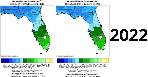
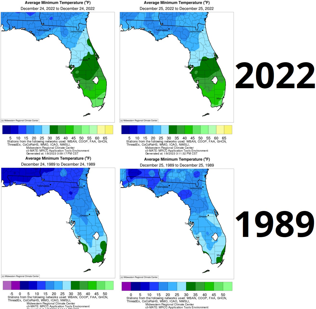
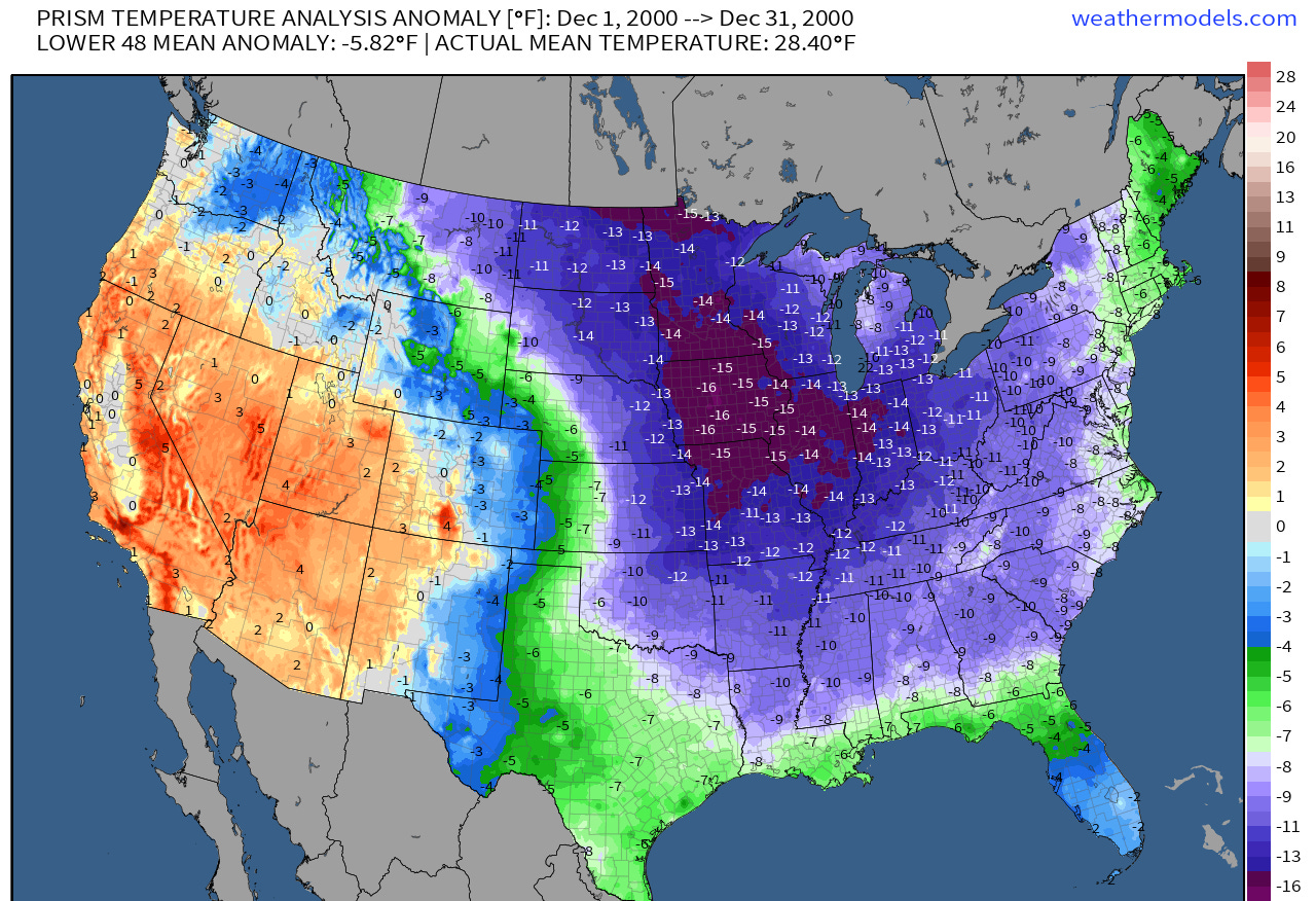
So far, winter ‘22-’23 has mostly been packed into a single week, but what a week it was. As hinted in my December newsletter, a strongly -NAO is often followed at a lag by significant cold over the eastern U.S., and Christmas Week 2022 delivered the goods. Lows on Christmas Eve and Christmas were generally in the upper teens in North Florida, 20s in Central Florida, and 30s to lower 40s in South Florida. This year didn’t quite equal the legendary Christmas freeze of 1989 (see comparison below), in which the lowest lows bottomed out generally 4-8F colder than 2022.
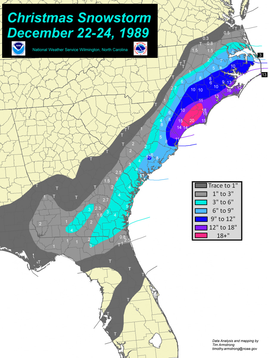
Also, this didn’t happen in 2022:
Although there were some flurries observed in the Panhandle near Marianna and ocean-effect light sleet in east Central Florida this year. Overall, advantage 1989 for winter lovers, but a memorable and respectable effort by 2022.
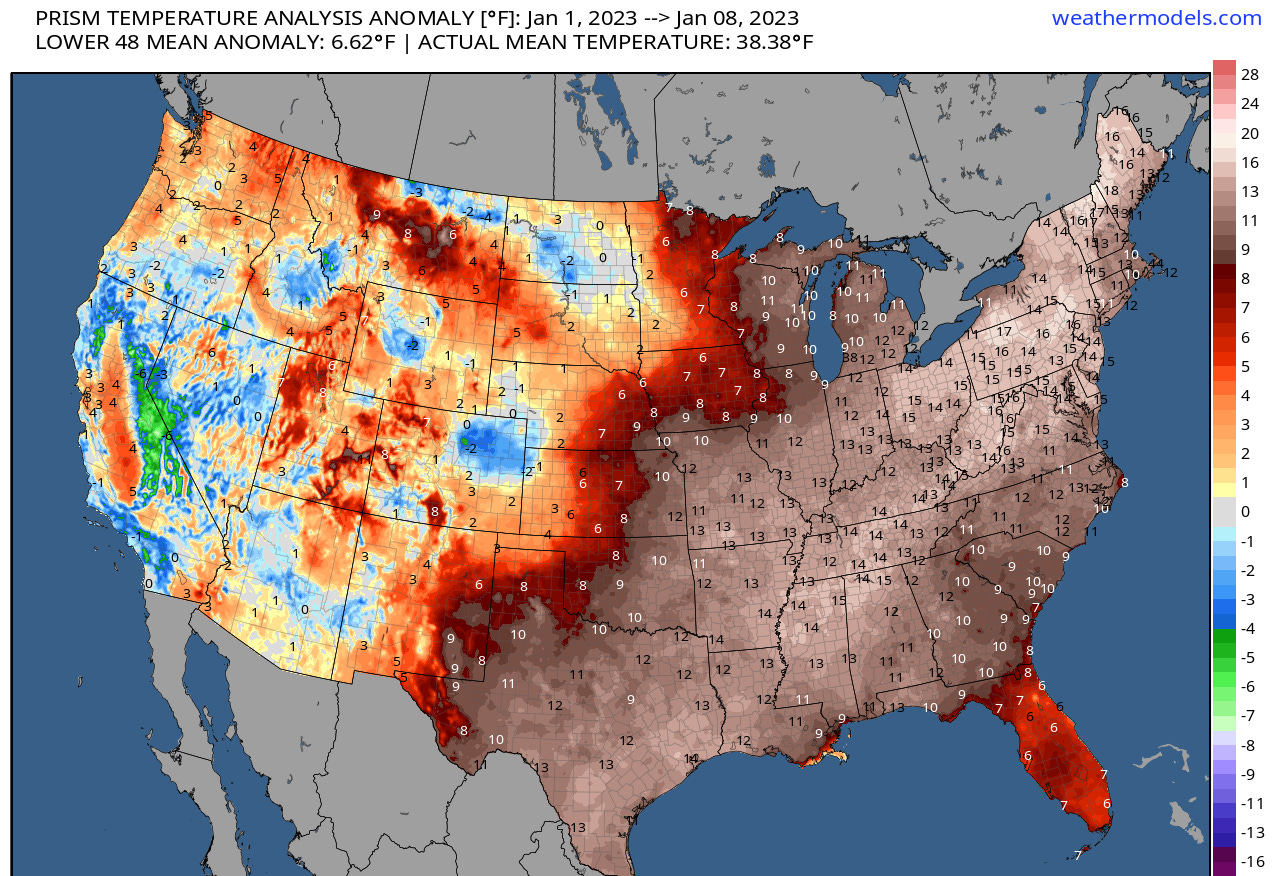
Since Christmas, that brief deep freeze has been replaced by unseasonably mild weather across most of the central and eastern U.S., including Florida, with temperatures 10F or more above normal on average. Look for warmth to persist with a few brief interruptions for the next 10-12 days, with some opportunity for cooler conditions to reassert themselves in the eastern U.S. in the last third of January.
The ENSO whisperer
While La Nina winters tend to be mild in Florida, it’s also not unusual for there to be some colder variability early in winter. In fact, the most recent triple-dip La Nina before this one, in 2000-2001, also produced a historic cold outbreak in December, albeit one that was not overly severe in Florida.
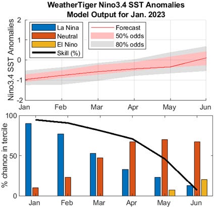
WeatherTiger’s ENSO Whisperer model run for January shows the 2020-22 La Nina generally following the trajectory of the 1999-2001 event, with about a 70% chance of a return of neutral ENSO conditions by April.
Our model is still holding serve at neutral into early summer, with as yet only a 15-20% chance of a weak El Nino developing by June. Forecast skill plummets past spring from this lead time, so while there are no clear signs of an emergence of El Nino by summer, there’s a long way to go.
January-March U.S. temperature and precipitation outlook
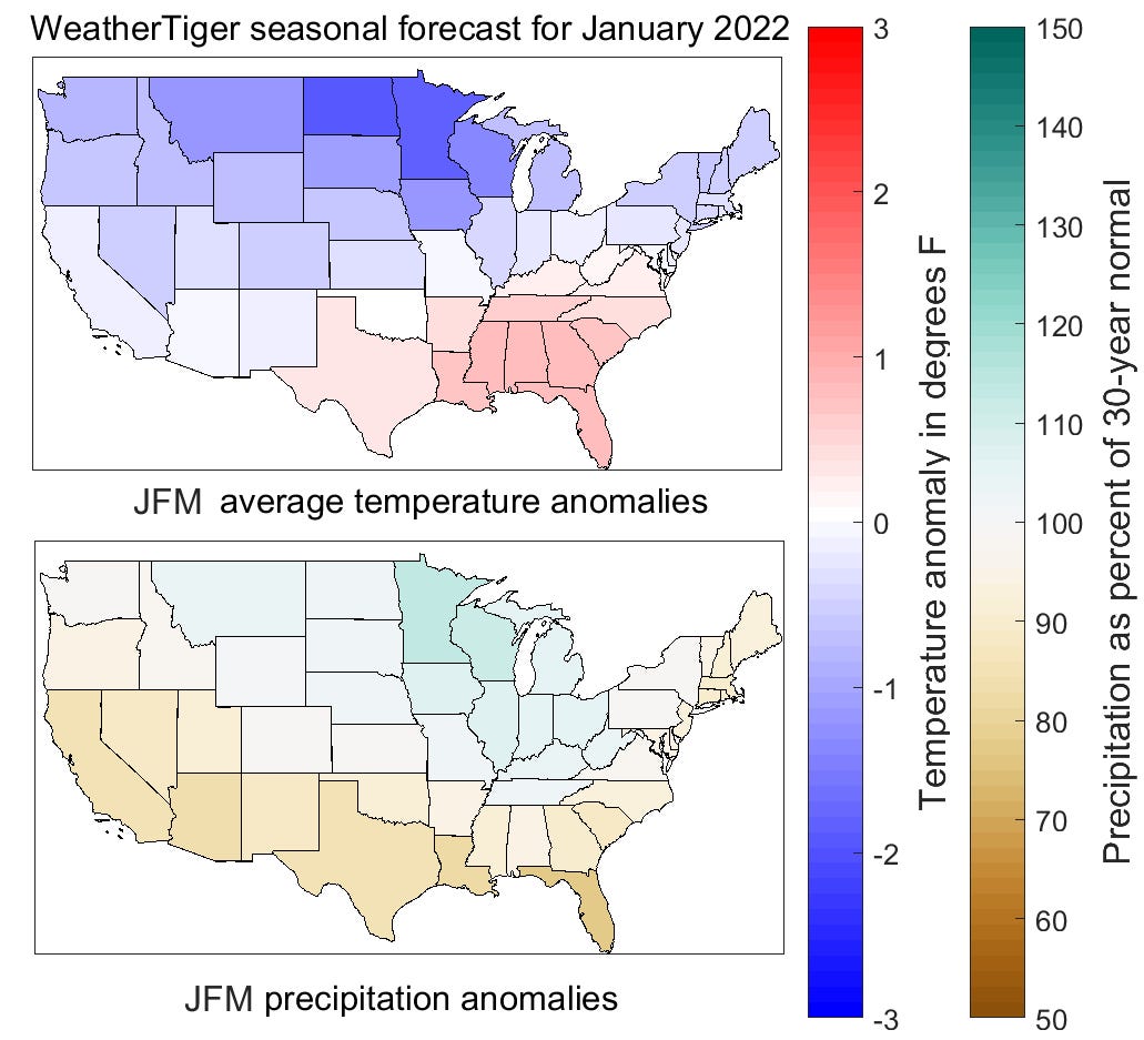
With the ENSO Whisperer basically unchanged since last month, WeatherTiger’s three-month outlook for U.S. temperatures and precipitation continues to project colder than normal temperatures in the U.S. northern tier, especially over the Northern Plains and western Great Lakes with mild conditions in the Deep South caused by persistent southeast ridging. The Gulf Coast and East Coast will likely be drier than normal through March, with the Great Lakes seeing above normal rainfall.
One region this outlook will be wrong is along the Pacific Coast, where repeated heavy rain events known as atmospheric rivers have already brought 5-10” rains in the last few weeks and an additional 4-8”+ are possible before the pattern ends in about a week and a half. This is not the typical parched La Nina winter in California, though the drought-alleviating benefits are spiked with serious flooding issues as well.
For Florida specifically…
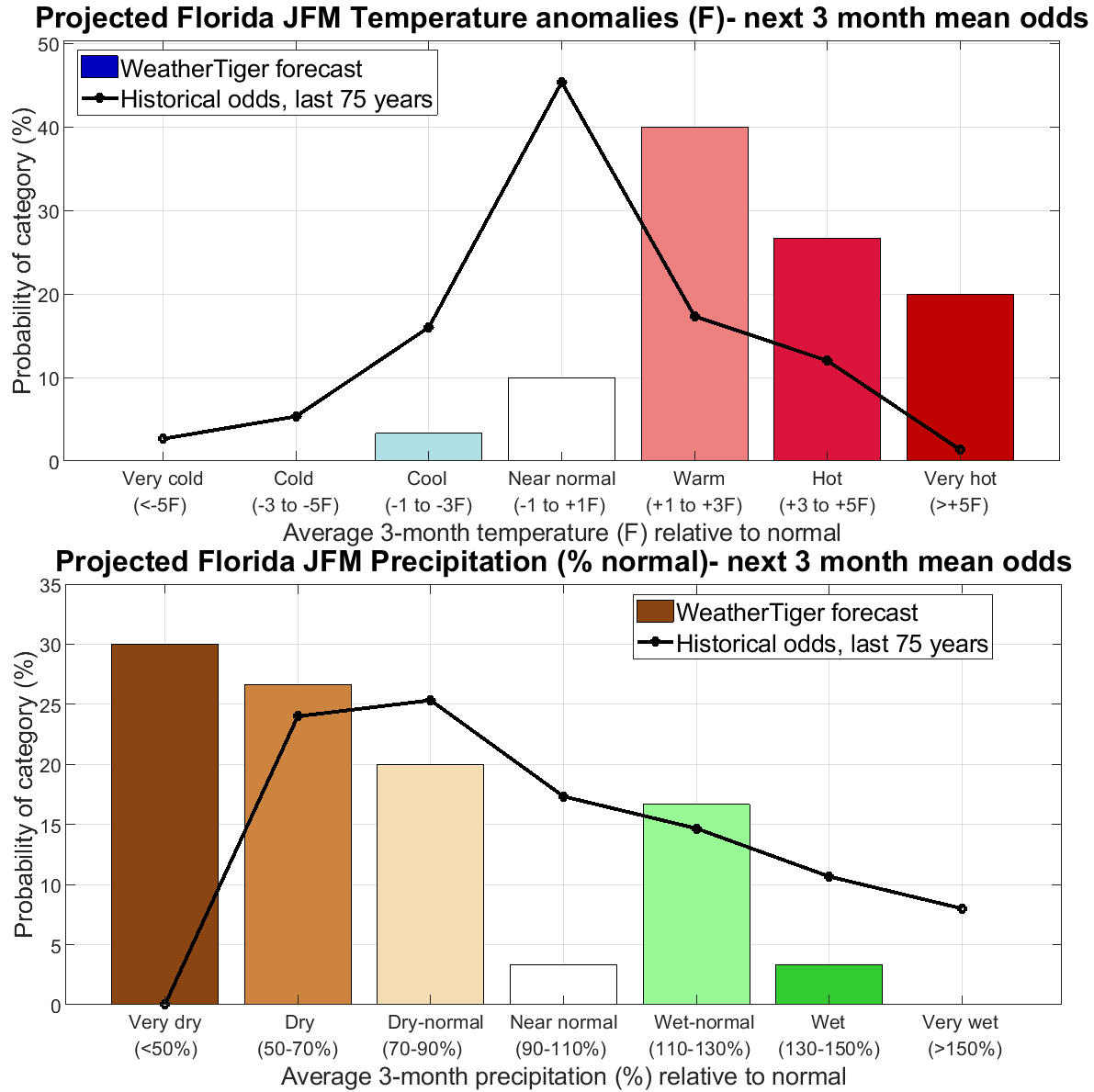
Late winter and early spring tends to be a time of relatively predictable seasonal departures from normal in Florida, as La Nina or El Nino exercise an outsized influence in that window. WeatherTiger’s model for January-February-March (JFM) average temperatures in Florida relative to normal calls for around an 85% chance of temps at least 1F warmer than normal, with a most likely anomaly around two degrees above average versus 1991-2020. Our model has shifted yet drier for Florida over the next three months, with about 50% odds of two-thirds or less of normal rainfall, and very low probabilities of significantly above average rainfall.
This month in hurricane research
With three consecutive seasons of La Nina in the immediate rear-view and two other La Nina years since 2016, it’s no surprise that Atlantic hurricane seasons have been generally busy over the last 7 years— storm-weakening shear tends to be lower in the Atlantic during active La Ninas. There are some indications that La Ninas may become more common as the climate warms, which would not be positive news for the U.S. coast. However, a new study also finds that aside from this possible effect, more storms relative to historical baselines may also form during the inactive phases of Atlantic tropical activity, when development is suppressed by cooler Atlantic temperatures or El Nino events. No rest for the weary.
You can read the full paper here.
That’s it for this month! Hope your 2023 is off to a good start, and I’ll be back with you in the first week of February.

