Tropical Storm Helene Briefing for September 24th
Newly christened TS Helene is forecast to reach major hurricane strength on approach to Florida.
WeatherTiger’s Hurricane Watch is a reader-supported publication. Paid subscribers get daily tropical bulletins, weekly columns, coverage of every hurricane threat, the ability to comment on posts and ask questions, and more. Paid supporters will also receive a subscriber-exclusive morning forecast briefing through the threat from PTC 9/Helene starting tomorrow.
This post is outdated! Click the link below for the latest.
Tropical Storm Helene has churned to life as expected in the northwestern Caribbean, with only subtle changes in its intensity, organization, or long-term forecast through the overnight hours.
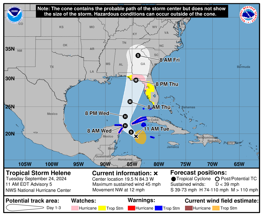
As of the NHC’s 11 a.m. advisory, Helene is located about 175 miles south-southeast of the western tip of Cuba, or about 500 miles south-southwest of Tampa. This morning, Helene’s circulation has tighten up sufficiently this morning to be classified as tropical storm by the NHC at any point as confirmed by Hurricane Hunters investigating the system this morning. These aircraft have found sustained winds of around 45 mph, and continued steady strengthening is expected today.
Helene is rolling northwest or west-northwest at about 10 mph, steered by a ridge to its north over Florida and an upper-level low over the Yucatan peninsula that is also imparting some shear on the system. Helene’s movement in the last 24 hours has been in agreement with yesterday’s NHC forecast track. As of Tuesday morning, Tropical Storm Watches are now in effect for the Keys and the Southwest Florida coast, as well as inland across central Florida. Hurricane Watches are up in the eastern Panhandle, Big Bend, and Nature Coast, including inland for Tallahassee. Storm Surge Watches are in effect for the entire Florida Gulf Coast from the Everglades to Apalachicola, reflecting the reality that future Helene will produce severe surge impacts well east of the center due to its large size.
As I mentioned yesterday, one key to the forecast was how quickly Helene’s circulation consolidated as it moves across the Caribbean and prepares to enter the Gulf on Wednesday. It was a bit of a relief to see that the consolidation took a bit on the longer side, with Helene waiting until Tuesday to become a tropical storm rather than wrapping up on Monday. This matters, as rapid increases in strength can only occur once a storm has established a tight, well-organized surface circulation and core of deep convection near it.
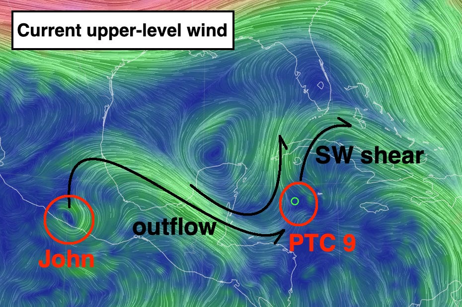
One possible reason Helene slowed its roll modestly may be the unpredicted intensification of Hurricane John in the Eastern Pacific, which hit near Acapulco overnight as a Category 3. John's outflow contributed to the southwesterly shear over Helene being a little stronger than models expected temporarily, keeping its deep convection displaced east of the center. John is now inland, so that shear is weakening today and allowing Helene to get better organized.
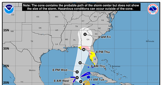
The NHC forecast track has changed only incrementally from yesterday’s advisories. The NHC still has Helene cross the Yucatan Channel and enter the southern Gulf of Mexico by early Wednesday afternoon, pass around 100 miles west of Tampa mid-day Thursday, and reach the eastern Panhandle or Big Bend late Thursday into early Friday. The most notable shift is that because Helene took a bit longer to organize than some of the models indicated yesterday, it may also take a little longer to connect with the upper-level cutoff low over the Mississippi Valley that will steer it north Wednesday and Thursday.
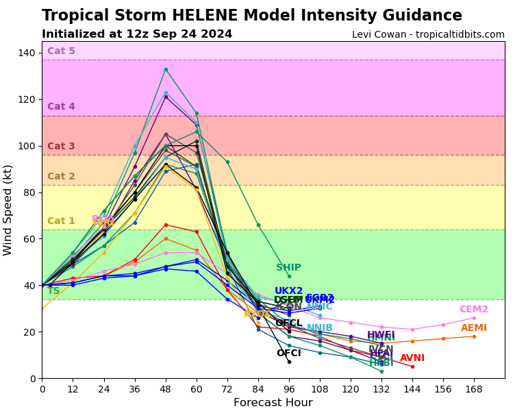
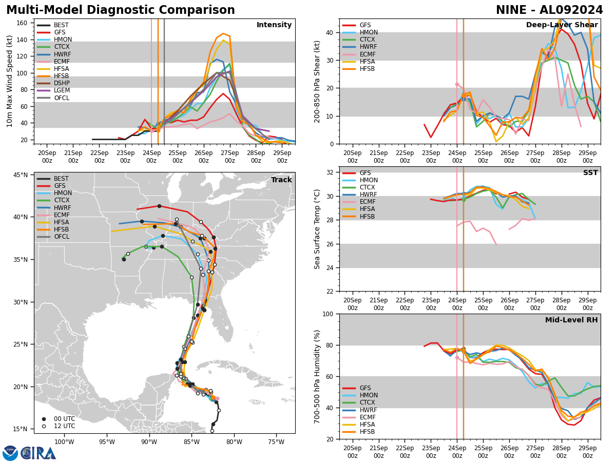
That slight delay in the bend north doesn’t much change the landfall target, but does push back the most likely landfall timing from Thursday afternoon into overnight Thursday into Friday. Forecast intensity of Helene in the Gulf has not budged, and the 11 a.m. NHC advisory continues to show rapid intensification Wednesday and a Thursday peak as a Category 3 hurricane. A weaker starting point but a little more time to work with in the Gulf on balance means that a peak intensity in the Category 2 to 4 range remains probable at this point. Some hurricane models have backed off from their most extreme predictions, but most still highlight elevated rapid intensification potential late Wednesday into Thursday, even given a slower start.
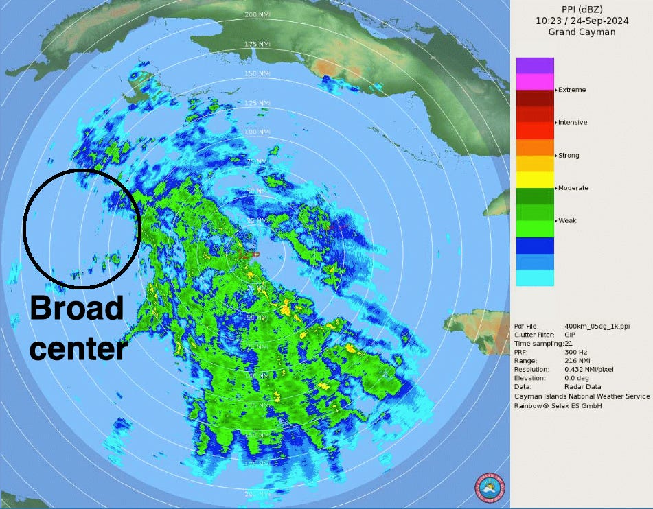
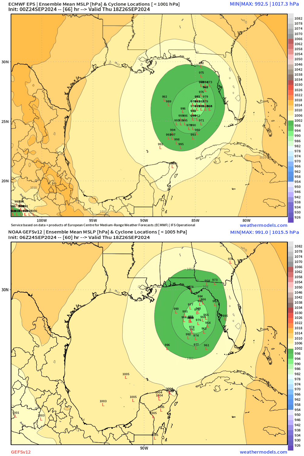
Track forecasts are clustered more tightly today on the middle of yesterday’s Destin to Tampa range, with most model ensemble members focused on a landfall in Apalachee Bay or the northern Nature Coast. Personally, I’m reluctant to shave too much off yesterday’s range since the center of circulation is still broad, though landfall west of Panama City is becoming unlikely due to the Mississippi Valley upper-level cutoff low that will grab Helene on Thursday trending east. I’ll be more comfortable narrowing the prospective landfall range and talking about regional impacts in more detail on Wednesday.
In the meantime, the fact that the most likely landfall location is relatively stable and focused on the Big Bend, despite a drift later in landfall timing since yesterday, indicates that big changes in track are probably not coming. While some track forecast adjustments are inevitable and expected, Helene looks to drop into the narrow steering “channel” I discussed in yesterday’s forecast between an upper low to its northwest and a ridge to its northeast on Wednesday, and won’t deviate from that channel. The European Ensemble members on the whole swing the storm a touch farther west and are slower to bring Helene into that channel than the GFS Ensembles, but once it does drop in, the hurricane will follow the path laid out for it between the cutoff low and the ridge. In other words, what I’m seeing suggests that Helene remains on course to potentially become a major hurricane by Thursday in the east-central Gulf, then make landfall somewhere in the eastern Panhandle, Big Bend, or Nature Coast Thursday night into early Friday.
Now, slight shifts in track within that range will make a huge difference in wind and surge outcomes for individual locations. For instance, it’s not possible to say yet whether or not Tallahassee will see the destructive gusts associated with core of the hurricane, or whether Tampa will see the severe 5-8’ surge likely on the current track, or the 10’+ surge possible if Helene’s path was to shift east. I’ll be specifically discussing the possible surge, wind, and rain impacts for Florida in a forecast video sometime later this evening. In the meantime, today and tomorrow are your days to prepare in the Panhandle, north-central Florida, and west-central Florida, so make the time count and keep watching the skies.
Next forecast: I will be out of the office this morning due to my wife’s surgery, so the time of the PM forecast video is TBD. I will send it out via email when it is up, and it can be viewed live on WeatherTiger’s Facebook page.



My family and I appreciate your in-depth and expert analysis and coverage. You are our go-to source for Hurricane updates and advice. May all go smoothly for your wife today. Bless you and your family.
Be present with your wife and know your subscribers are thinking of you both.