Persistent Gyre-ations: WeatherTiger's Hurricane Watch for June 11th
The Southern Gulf may get a little more interesting by late next week.
Welcome to WeatherTiger’s Hurricane Watch! Each weekday we’ll have a tropical briefing bringing you that day’s hurricane history, a run-down of active storms, and a look at current development threats. Paid subscribers will receive these daily briefings and be able to comment and ask questions, as well as get our Thursday long-form analysis columns, daily forecasts and video discussions during hurricane threats, live landfall coverage, and expanded seasonal outlooks. Free subscribers will receive our weekly forecast column.
A free preview of our daily briefing will continue into June as we settle into our new Substack digs. Enjoy, and feel free to drop a line to ryan@weathertiger.com with any questions.
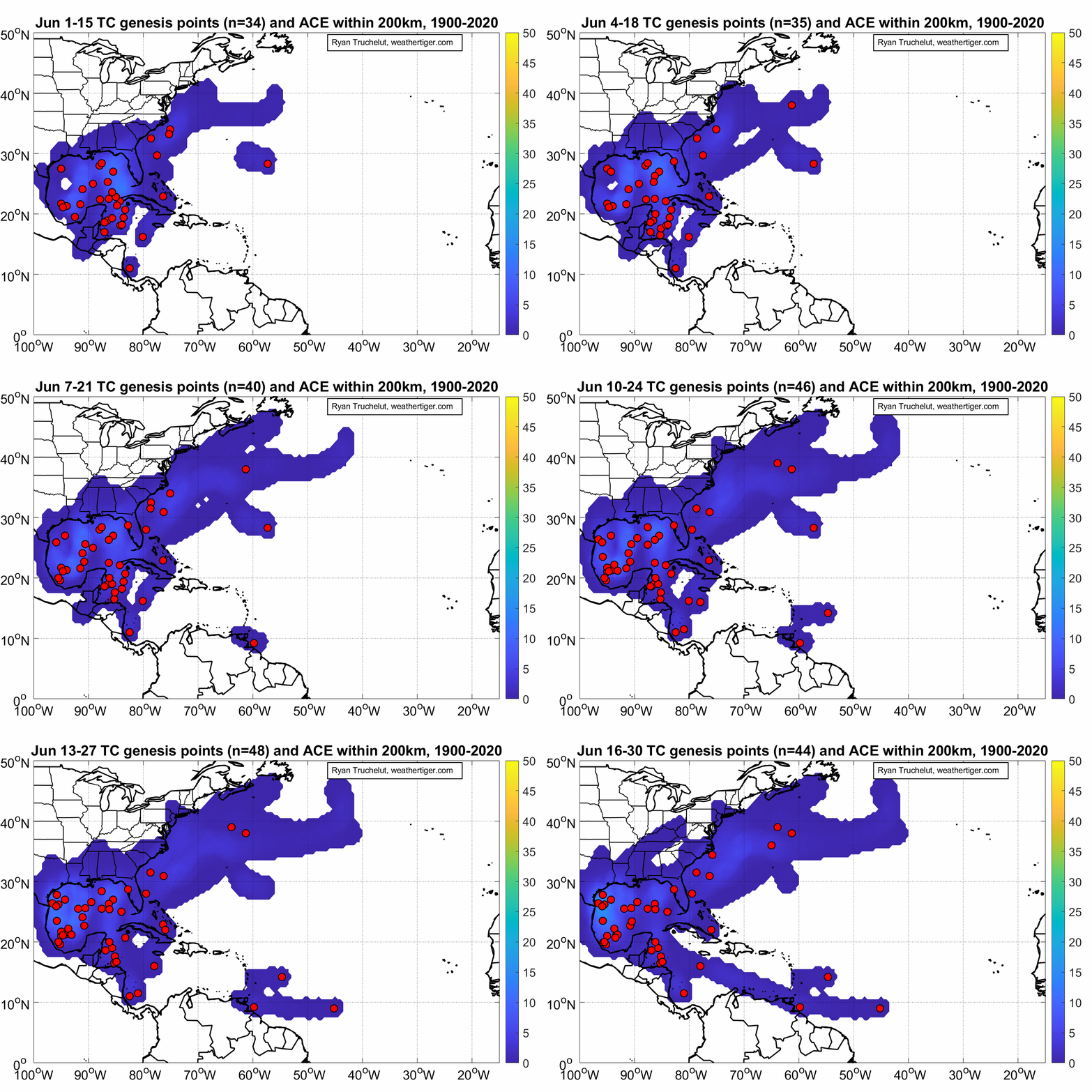
Almanac: Today is Friday, June 11th… day 11 of the 2021 hurricane season, 173 days to go. By total storm energy, the season is 1.3% complete as a whole, 2.7% complete for the continental U.S., and 4.1% complete for Florida. The only storm to make landfall on this date since 1851 is Tropical Storm Arlene, which made landfall on the Florida/Alabama border in 2005 with 60 mph winds. Arlene spread heavy rain and localized flooding north into the Tennessee Valley. I can tell you from experience that it was not a good weekend to go to Bonnaroo.
Overall, Arlene was typical mid-June storm, developing in the northwest Caribbean and impacting the central Gulf Coast with primarily rainfall hazards. June hurricane history in rolling two week chunks is shown above.
Active Storms: None.
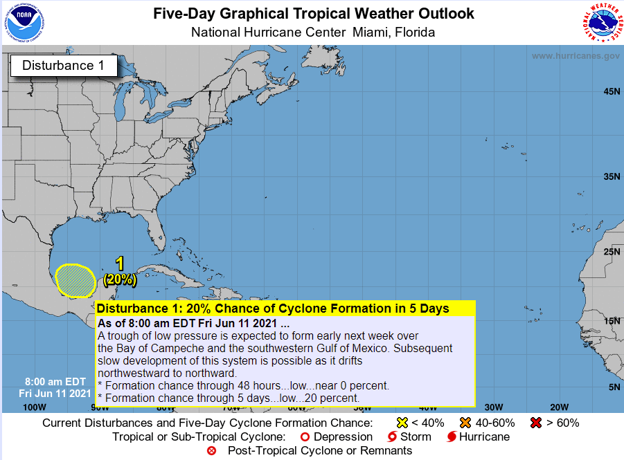
Current disturbances in NHC outlook:
Southern Gulf (2-/5-day odds: 0/20%). Disorganized convection is increasing in the southern Gulf of Mexico associated with a low-level wind shift pivoting around the broader Central American Gyre circulation. This trough of low pressure is linked to a more organized low in the eastern Pacific, which may develop by early next week; this interference should keep anything from forming in the Gulf through Tuesday.
By mid-next week, shear may decrease a bit in the southern Gulf and allow a tropical depression to slowly develop, provided the possible storm in the eastern Pacific is not too strong. Model consensus on potential Gulf development in 5-8 days has improved somewhat since yesterday, but as I’ve been saying all week, storm formation from Central American Gyres is impossible to pin down more than a few days ahead of time. Overall, there is a slight chance that the Gulf Coast will be dealing with the threat of a rainmaking tropical storm towards the end of next week or into the weekend. We’ll keep watching.
Elsewhere: Nothing worth mentioning.
Next report: A daily briefing will be issued by 3 p.m. Monday.


