Orinoco Outflow: Hurricane Watch for September 19th
Chances of a U.S. tropical threat in the Gulf next week continue to rise due to a likely favorable upper-level environment.
Sign up for WeatherTiger’s hurricane forecast newsletter by clicking here:
Florida and continental U.S. tropical threat synopsis: A possible tropical threat originating in the western Caribbean is 7-10 days (or more) from reaching the U.S. Gulf Coast. Interests from Florida to Texas should continue to monitor the situation.
Almanac: It’s Thursday, September 19th… day 111 of the 2024 hurricane season, 72 days to go. By total storm energy, the season is 61.8%, 70.9%, and 60.6% complete for the Atlantic, continental U.S., and Florida, respectively.
Active storms: None.
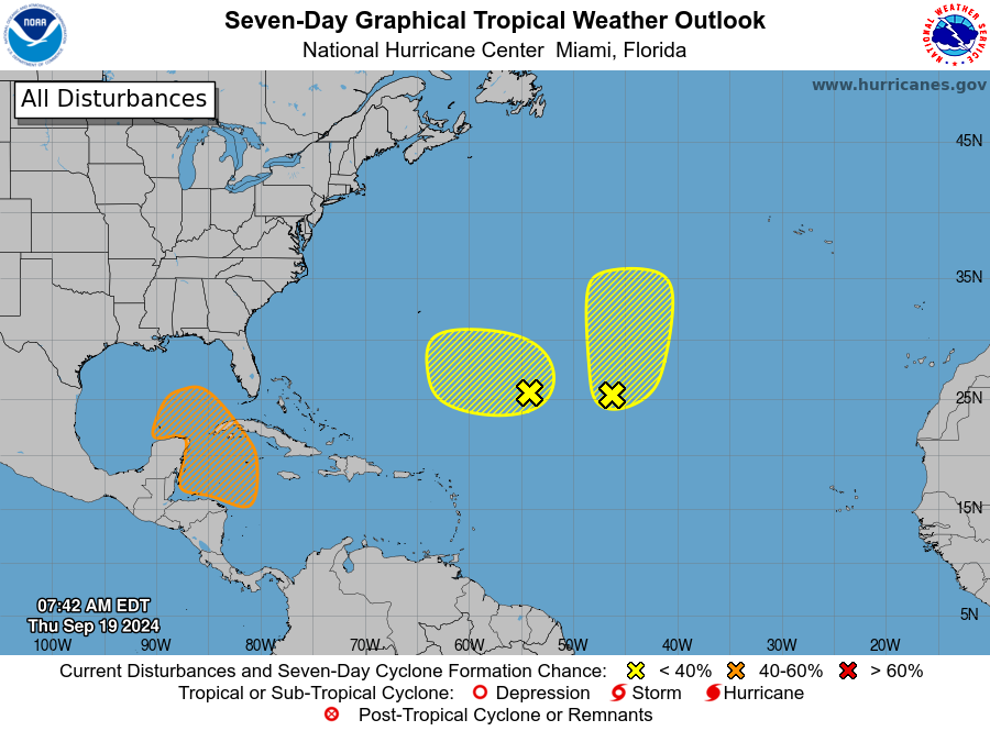
Disturbances in the NHC tropical weather outlook:
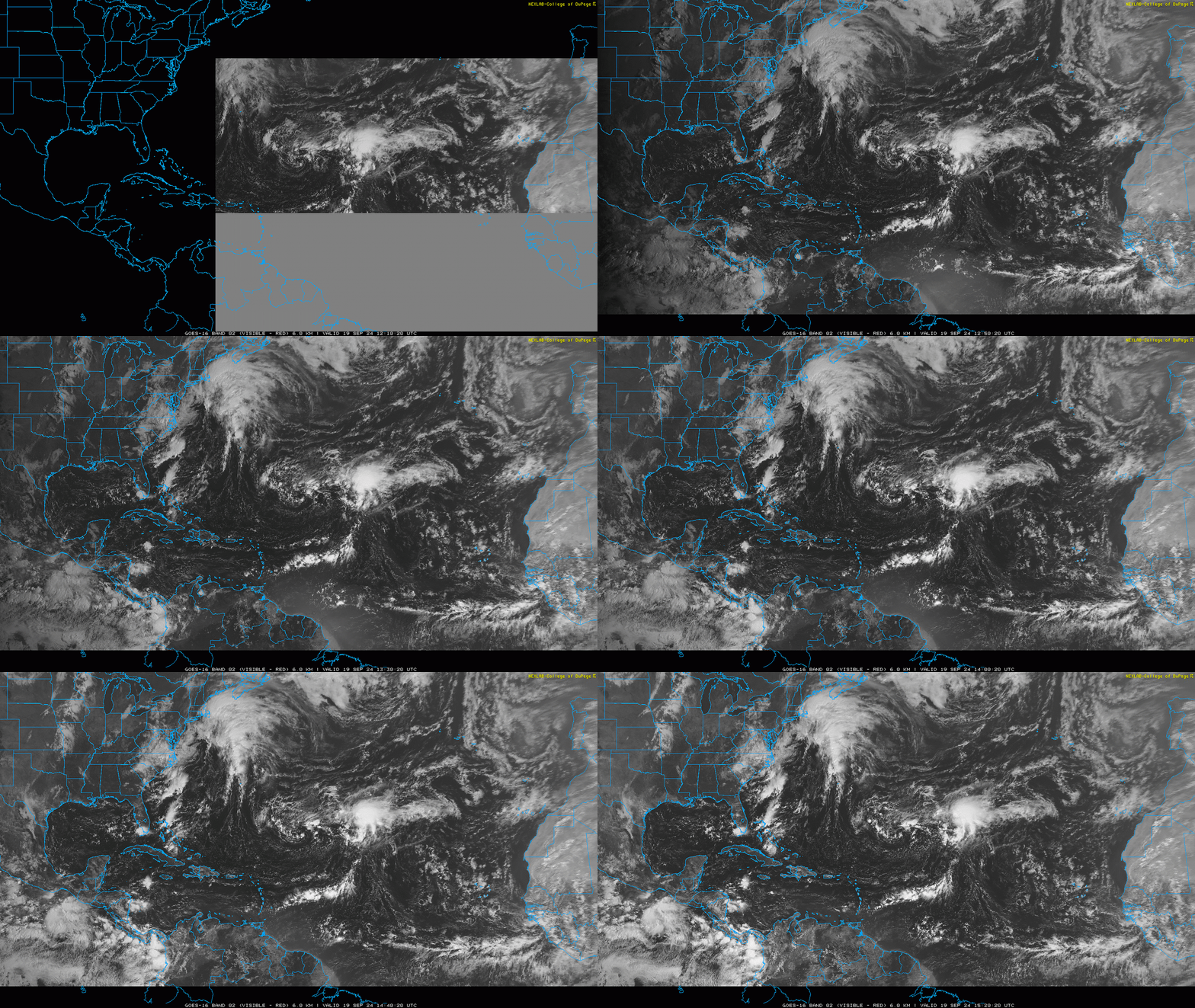
1 and 2. The former TS Gordon (Demi-gordon?) and another low in the subtropical Central Atlantic are spinning around each other in the open ocean. The NHC gives Gordon a 30% chance of development and the western low a 20% chance of development in the next 7 days. Convection with ex-Gordon has increased today, but there’s a lot of dry air around these lows, so I’m doubtful either organizes further. Also, it doesn’t matter as neither is a land threat.
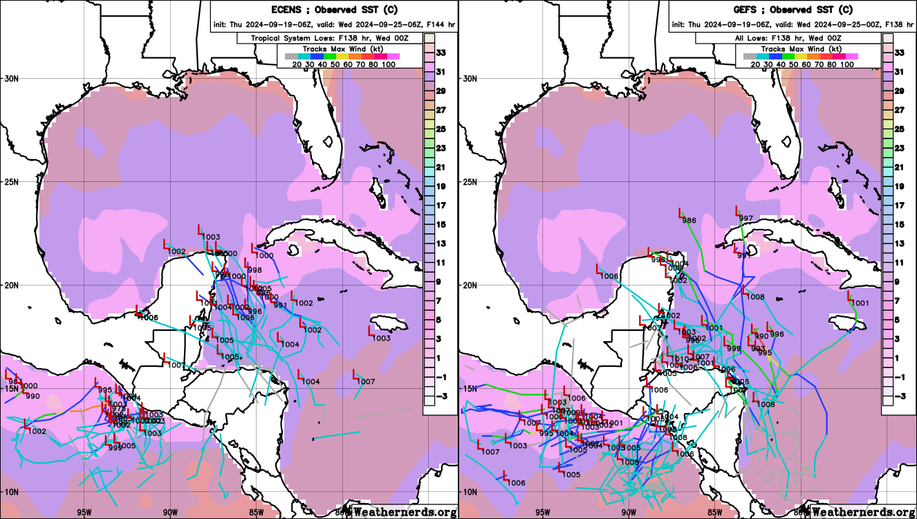
3. The NHC is now up to a 40% chance of development in the next 7 days for a tropical disturbance that will emerge from a Central American Gyre (CAG) over the weekend, and potentially develop into a tropical depression in the general vicinity of the Yucatan Channel/Peninsula next week. Model solutions for where an organized tropical system may form within the gyre are starting to become a little more focused this morning, with most suggesting development between late Monday and early Thursday near/east of the Yucatan. Of course, as seen above, there’s still nothing to track in terms of a real-world disturbance yet; the GFS suggests the initial convective cluster may develop late tomorrow near Panama, so I’ll be keeping an eye on that.
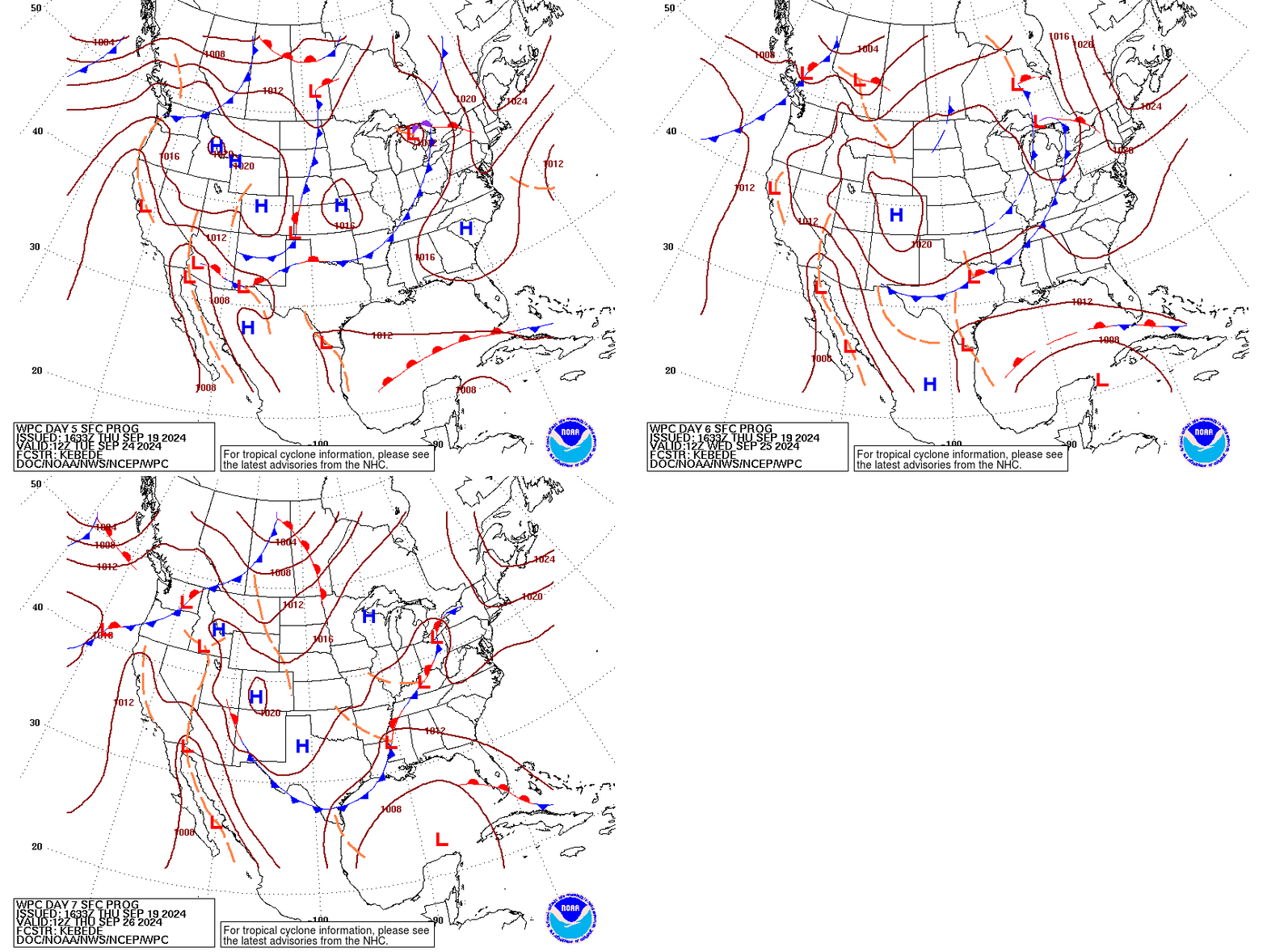
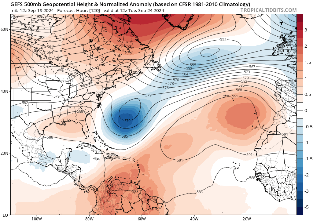
As I’ve been saying all week (and really since last Thursday when I first mentioned this potential), it still just isn’t possible to pin down where a Gulf Coast hurricane threat might track heading into late next week. In addition to the uncertainty about where a storm will consolidate within the CAG, there is also the question of interaction with a possible storm on the other side of the CAG in the Eastern Pacific, as well as the complex mid-latitude steering influence discussed yesterday. The 7-day forecast position in the south central Gulf on this afternoon’s WPC surface maps is as good a consensus guess as any at this point, and speculating further is fruitless.
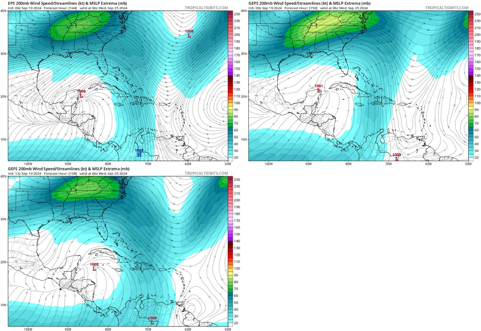
One reason why this potential is worrisome to meteorologists beyond X-treme individual model runs is because the intensity upside potential of the latent disturbance is high. Complex steering may mean slow motion, and that means time. Assessing the likely environment the disturbance will encounter next week is something that models can also provide some meaningful insight into at this range. Taking a look at upper-level winds on the three major ensembles (GFS, Euro, Canadian) below in the middle of next week, the details differ but all guidance suggests winds flowing south to the south and north to the north of the developing low in the northwest Caribbean.
That is a very favorable setup known as “dual-channel outflow” extending all the way south to Venezuela and north into a mid-latitude jet streak over the U.S. Upper South—ideal for generating the massive amounts of rising air underneath the outflow that allows hurricane to develop, organize, and intensify. Something else, like land interaction could get in the way, but right now, the upper-level wind environment looks very, very favorable in the Gulf and Caribbean in the five to ten days out range.
Finally, the ocean thermodynamics are also extremely supportive of a potentially strong system. As shown on the model maps above, sea surface temperatures are in the upper 80s in the southern Gulf and northwestern Caribbean. Those waters also run deep, which could come into play if the storm is a slow mover. Total oceanic heat content in the Gulf is near an all-time record, so there’s a lot of potential energy to tap if atmospheric circumstances conspire. Just another factor to consider as we await something to track.
Elsewhere: Finally, there does not to be some not completely absurd possibility of Cape Verde region/Main Development Region storm formation 6-10 days out in the open Atlantic, particularly with a more normal Azores ridge likely to develop over the next few days. This would be very unlikely to cause U.S. concerns down the road as latter season CV storms typically turn north, but I’ll keep an eye on it.
Next update: Weekly column out tomorrow mid-day.


