Only Shallow: The Hurricane Watch for September 25th
Tropical Storm Philippe is struggling against shear, and there are no immediate U.S. tropical threats in the forecast. Keep an eye on early October, however.
Florida tropical threat synopsis: No tropical threats to Florida in the next 7 days. Keep an eye on a convoluted pattern in the southwestern Atlantic, southern Gulf and western Caribbean in week 2, but there is no specific threat to watch yet.
Mood music:
Almanac: It’s Monday, September 25th… day 116 of the 2023 hurricane season, 67 days to go. By total storm energy, the season is 69.3%, 77.9%, and 66.7% complete for the Atlantic, continental U.S., and Florida, respectively.
Tropical Storm Ophelia made landfall on Saturday morning just under Category 1 hurricane intensity, producing a wide area of 55-75 mph wind gusts along the southern NC coast and 40-50 mph gusts inland. Ophelia and its vestigial fronts also dropped the expected 2-4” rains from eastern NC north into southern NY and over much of the mid-Atlantic. Ophelia is U.S. tropical cyclone landfall #3 for 2023, which is right around the average number of landfalls for a hurricane season since 1900.
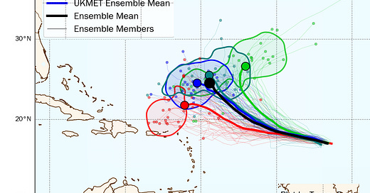
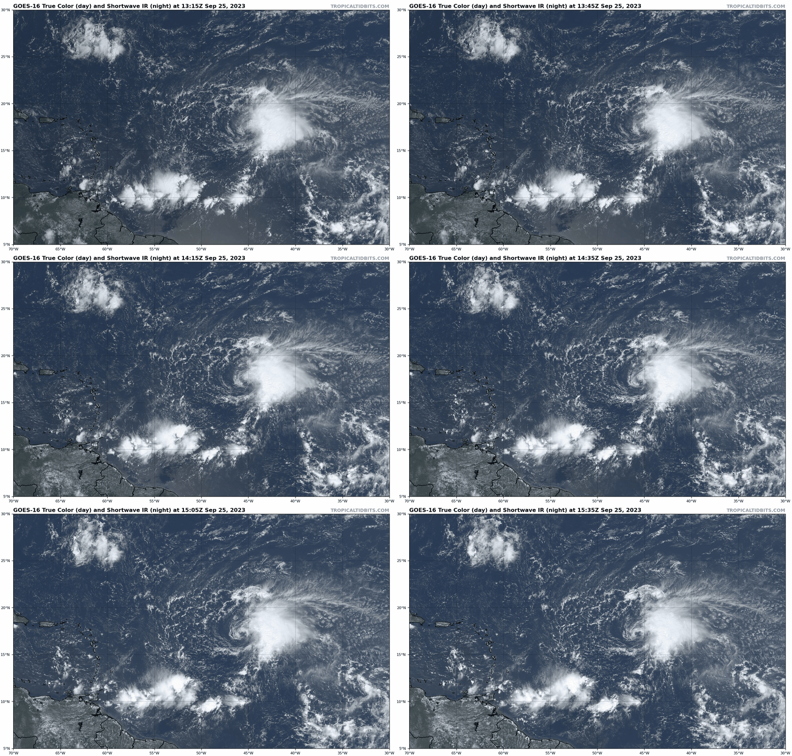
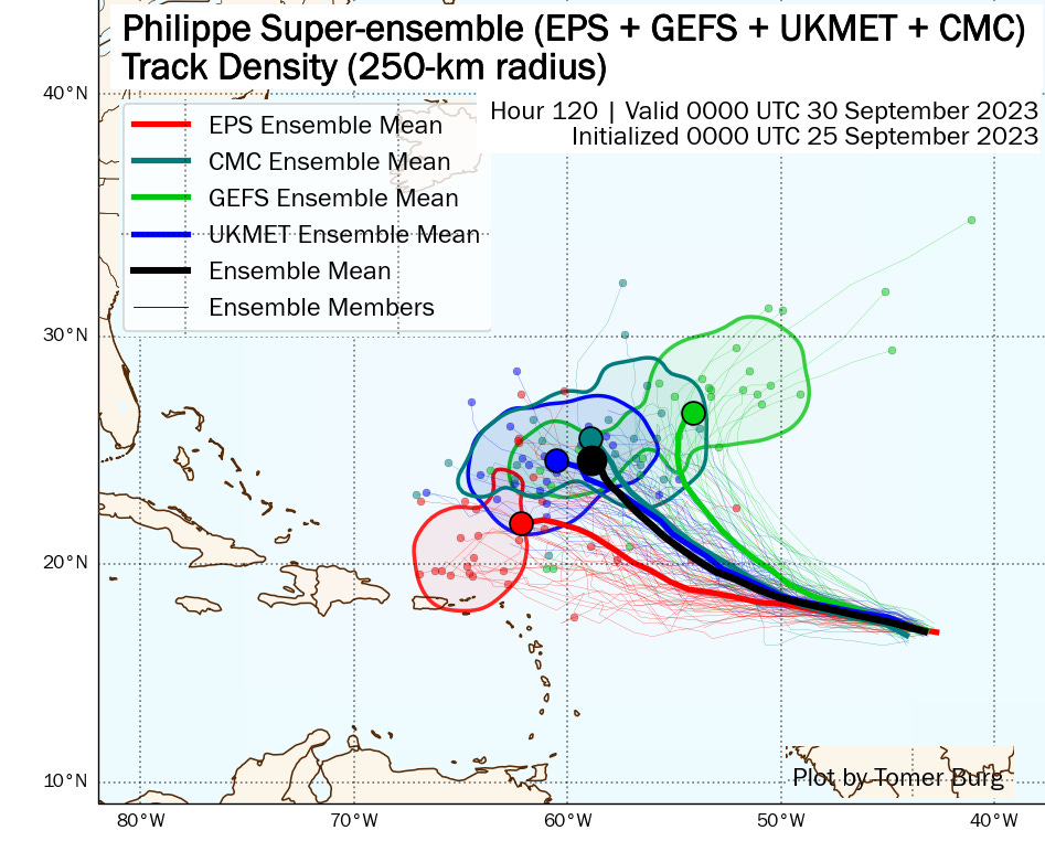
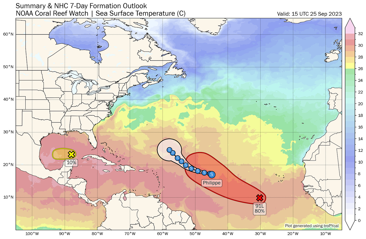
Active Storms: Tropical Storm Philippe formed over the weekend in the Central Tropical Atlantic, and today is about 900 miles west of the U.S. Virgin Islands with sustained winds of 50 mph, moving west at 10-15 mph. Phillipe is being sheared from the west and its low-level circulation and mid-level circulation are parting ways, with the surface center racing away from the deep convection today. Shear will keep Philippe weak and shallow this week, and Philippe will follow the low-level steering flow west and west-northwest to a position north of the Lesser Antilles in 5 days. (Note that the NHC forecast track as of 11 a.m. is too far north/east due to factoring in an unrealistic GFS solution, and will likely continue to adjust west into tomorrow.)
Philippe will struggle to hang on as a tropical cyclone for the next 3-5 days against this shear, and may well dissipate completely by the weekend as it passes north of Puerto Rico. Not at threat unless something changes drastically here.
Other disturbances in NHC outlook, with 2-/7-day NHC development odds:
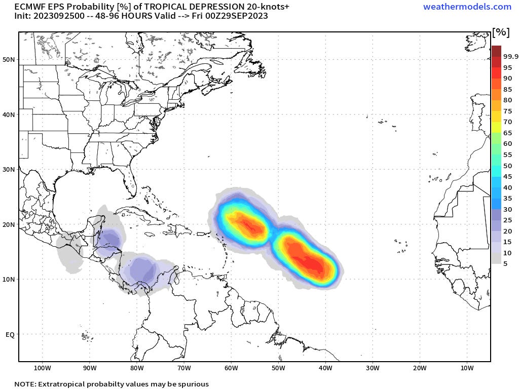
Eastern Tropical Atlantic (Invest 91L): A tropical wave along 30-35W south of 15N is producing some scattered convection near an area of low-level turning today. It’s getting a little late in the game for Cape Verde season development, but model consensus on 91L’s eventual development is decent as shear, SSTs, and moisture in Philippe’s wake appear supporting for slow organization. The NHC is going with 30% and 80% two- and seven-day development chances, respectively, and we’re likely to check another name (Rina) off the list by the weekend.
Anything developing this far east, this late in the season is a near-lock to recurve north or dissipate well east of the U.S., and 91L appears to be no exception as a weakness in the subtropical ridge should lure it north between 50 and 60W in about a week. Still, as the system may be a slow mover in weak steering currents in the 5-9 day timeframe, it is worth keeping an eye on for the northern Antilles.
Southern Gulf of Mexico: Don’t overthink this one. There are some disorganized storms in the (trigger warning) southern Gulf and northwestern Caribbean associated with a strong upper-level low, which the NHC is giving a cautionary 10% chance of development in the next 2 days. These storms should drift west and diminish over the next few days without further organization.
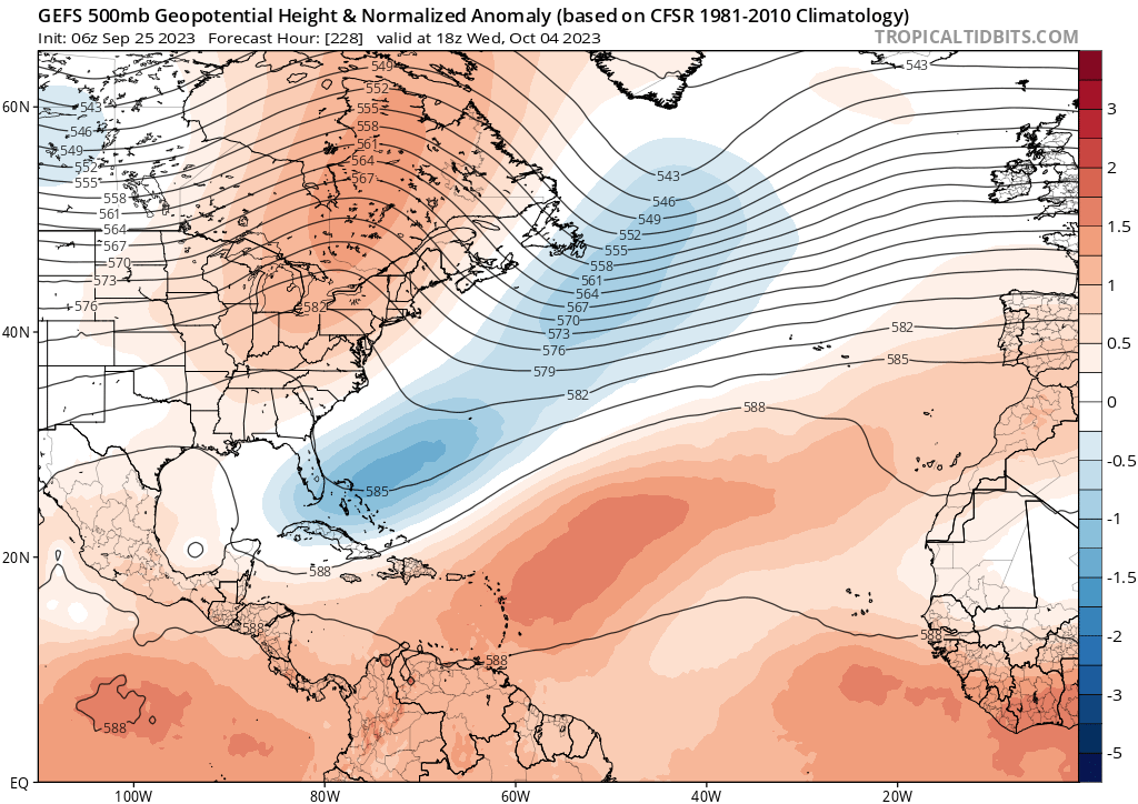
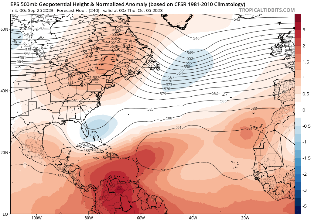
Elsewhere: No other areas of note in the Atlantic today. On days 7-10, global models suggest that upper-level ridging will develop over the eastern U.S. and northwestern Atlantic, which would potentially set up a sweet spot for potential development south of this ridge over the southwest Atlantic, southern Gulf, or northwestern Caribbean. Models (GFS ensembles above, Euro ensembles below) are not in good agreement on the details of the long-range jet stream pattern, and there’s nothing specific to latch on to at this time, just a vague, pattern-based idea of needing to watch the general vicinity of the Southeast U.S. in early October, particularly as upper-level winds may swing more favorable beyond the 5th.
Next report: Weekly column out tomorrow afternoon.



My Bloody Valentine is as welcomed as your prediction for Philippe.