Nov-gust: The Hurricane Watch for November 2nd
Two hurricanes and a potential tropical rainmaker for Florida and the Southeast: what month is it again?
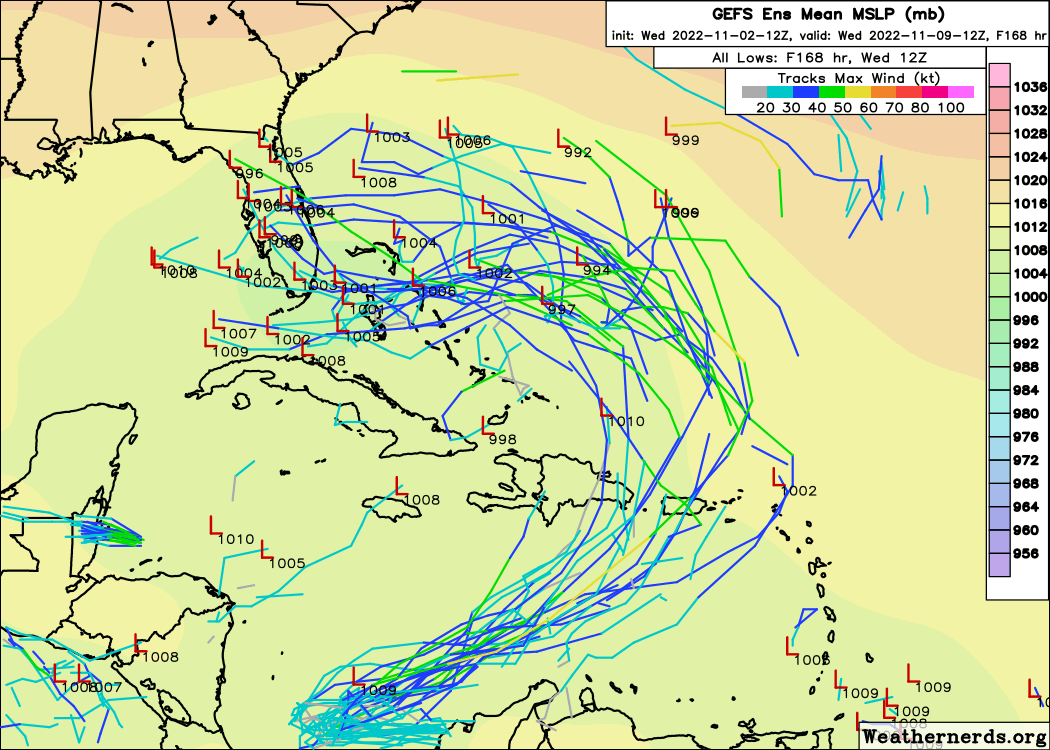
Florida tropical threat synopsis: Tropical moisture is likely to reach Florida from the east by early next week, possibly as a broad, hybrid low.
Almanac: It’s Wednesday, November 2nd… day 154 of the 2022 hurricane season, 29 days to go. By total storm energy, the season is 94.5%, 98.7%, and 97.2% complete for the Atlantic, continental U.S., and Florida, respectively.
November tropical activity tends to cluster in the western Caribbean, but also can be scattered across the subtropical western or central Atlantic. About half of Novembers have one or more named storm.
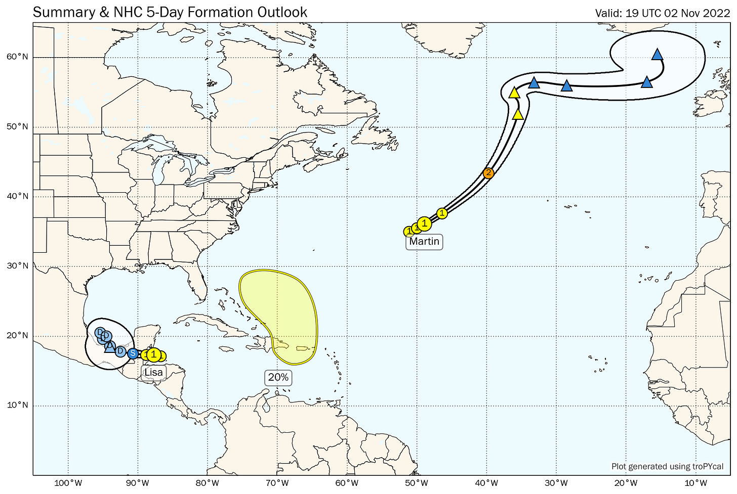
Active Storms: No shortage of named storms— in fact, today ties the most hurricanes ever active at one time in November, which is ∞% more than were observed during August 2022. Call it Nov-gust.
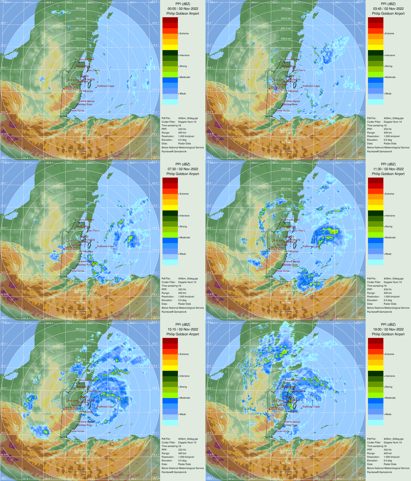
As expected, Hurricane Lisa is poised to make landfall this afternoon in Belize as a category 1 hurricane with 80 mph winds. As seen on radar above, Lisa is fairly small and plowing west at around 15 mph, which will hopefully limit the rain and wind impacts on Central America at landfall. Lisa will turn a bit more west-northwest over the next 36 hours while inland, and may pull into the Bay of Campeche by Friday and meander there for a couple of days before drifting back south into Mexico. Dry air should prevent significant re-strengthening, and Lisa is not a U.S. threat.
Farther afield, Hurricane Martin is well east of Bermuda, accelerating northeast into the open waters of the North Atlantic. Martin is quite photogenic for a hurricane over tepid waters this late in the season, and is forecast to become a Category 2 hurricane tomorrow before transitioning to an extremely powerful non-tropical low south of Greenland by Friday.
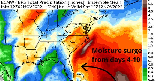
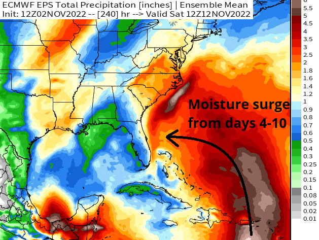
Other Disturbances in NHC outlook, with 2-/5-day NHC development odds: But wait, there’s more! An upper-level low (0/20%) pushing south from the Carolinas will slingshot a robust surge of tropical moisture through the Greater Antilles starting this weekend, with this moisture reaching eastern Florida and/or the Southeastern U.S. coast by early next week. Rain totals between Saturday and Saturday may be anywhere from 2-5” or more for these areas, including Puerto Rico, as this pattern potentially lingers into mid-November.
As to whether this system will be organized (i.e., named), the answer is that there is a chance, but that any system that forms is likely to be either a subtropical or hybrid system. With an upper-level low aloft, look for a very diffuse windfield and the lack of a tight, well-organized core; rather, more diffuse rain impacts are likely to extend over a broad area of the coastal Southeast. Models will get a better handle on this as the event approaches, but most guidance and ensembles are showing some kind of a closed low pinwheeling in the general direction of Florida or the Bahamas in about a week, with an eventual pivot north and east. I’ll keep an eye on this.
Elsewhere: Nothing else of note.
Next report: Bulletin out Friday, or earlier as conditions warrant.

