Nothing To See Here: The Hurricane Watch for November 6th
The Tropics are quiet and no U.S. threats are on the horizon, but keep an eye on the Caribbean next week.
Florida tropical threat synopsis: No tropical threats to Florida over the next 8-10 days.
Almanac: It’s Monday, November 6th… day 158 of the 2023 hurricane season, 25 days to go. By total storm energy, the season is 95.4%, 99%, and 97.8% complete for the Atlantic, continental U.S., and Florida, respectively.
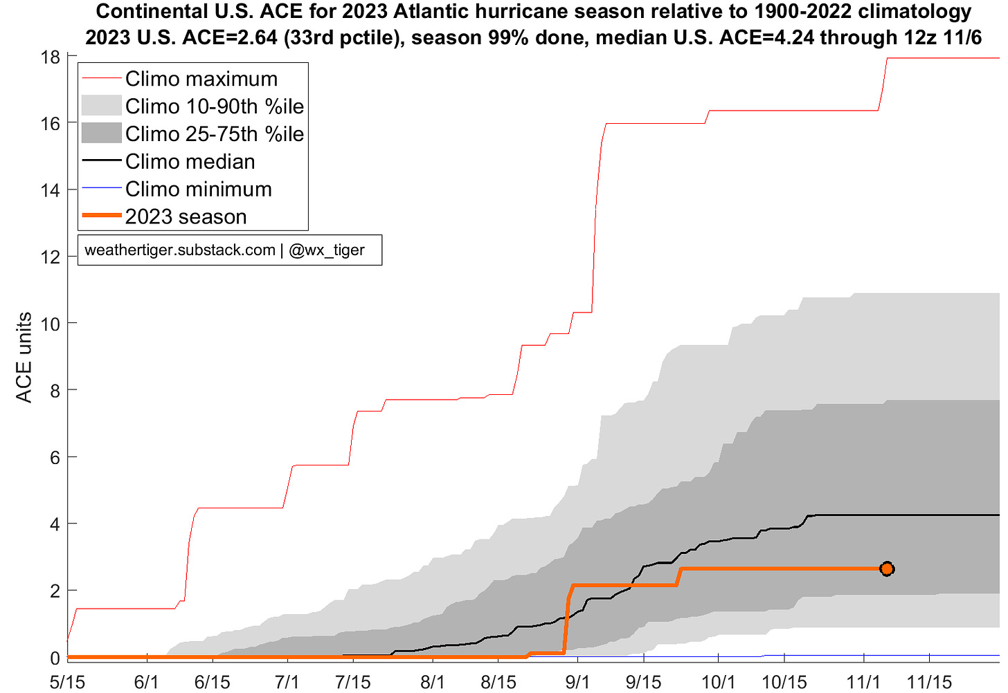
With only 1% of U.S. landfall activity occurring after today and no threats on the horizon, the 2023 hurricane season is more than likely to finish with two U.S. tropical storm landfalls (Harold and Ophelia) and one major hurricane landfall (Idalia). However, because these storms moved quickly, the total Accumulated Cyclone Energy occurring over the continental U.S. for 2023 (2.6 units) is actually below normal, with 2 out of 3 seasons since 1900 having more U.S. ACE to date.
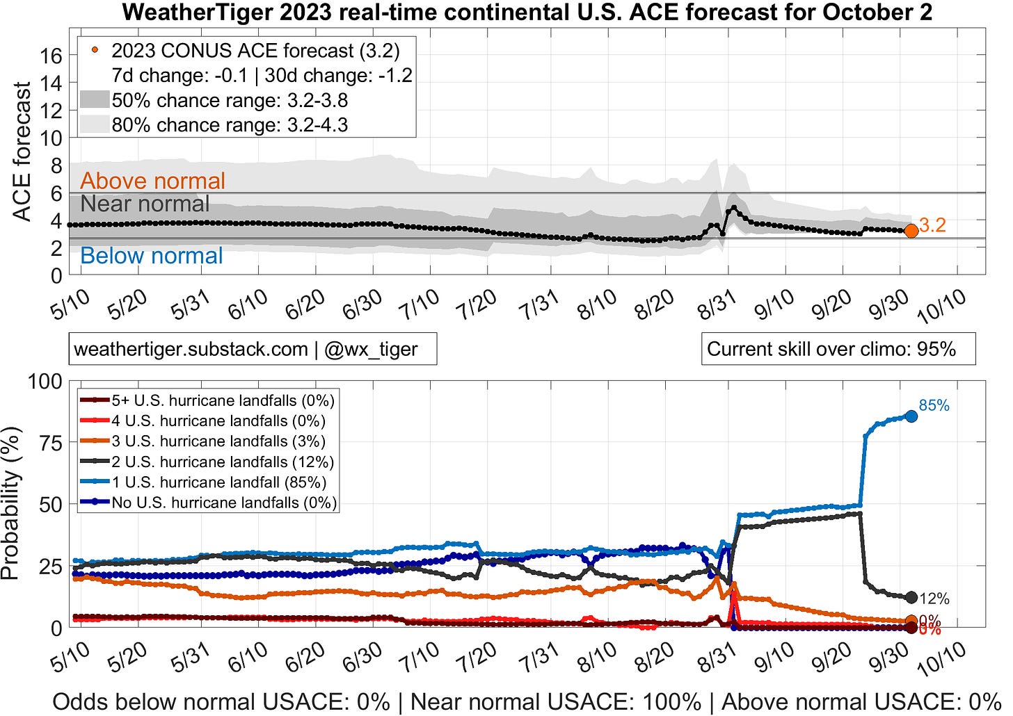
Interestingly, despite our expectation of an active hurricane season, WeatherTiger’s U.S. ACE seasonal model never budged from projecting a near- or below-median amount of U.S. landfall activity. Overall, a solid debut performance from our experimental real-time landfall model. Expect more regionally specific landfall risk models exclusively for paid supporters in WeatherTiger’s 2024 season coverage.
Active storms: None.
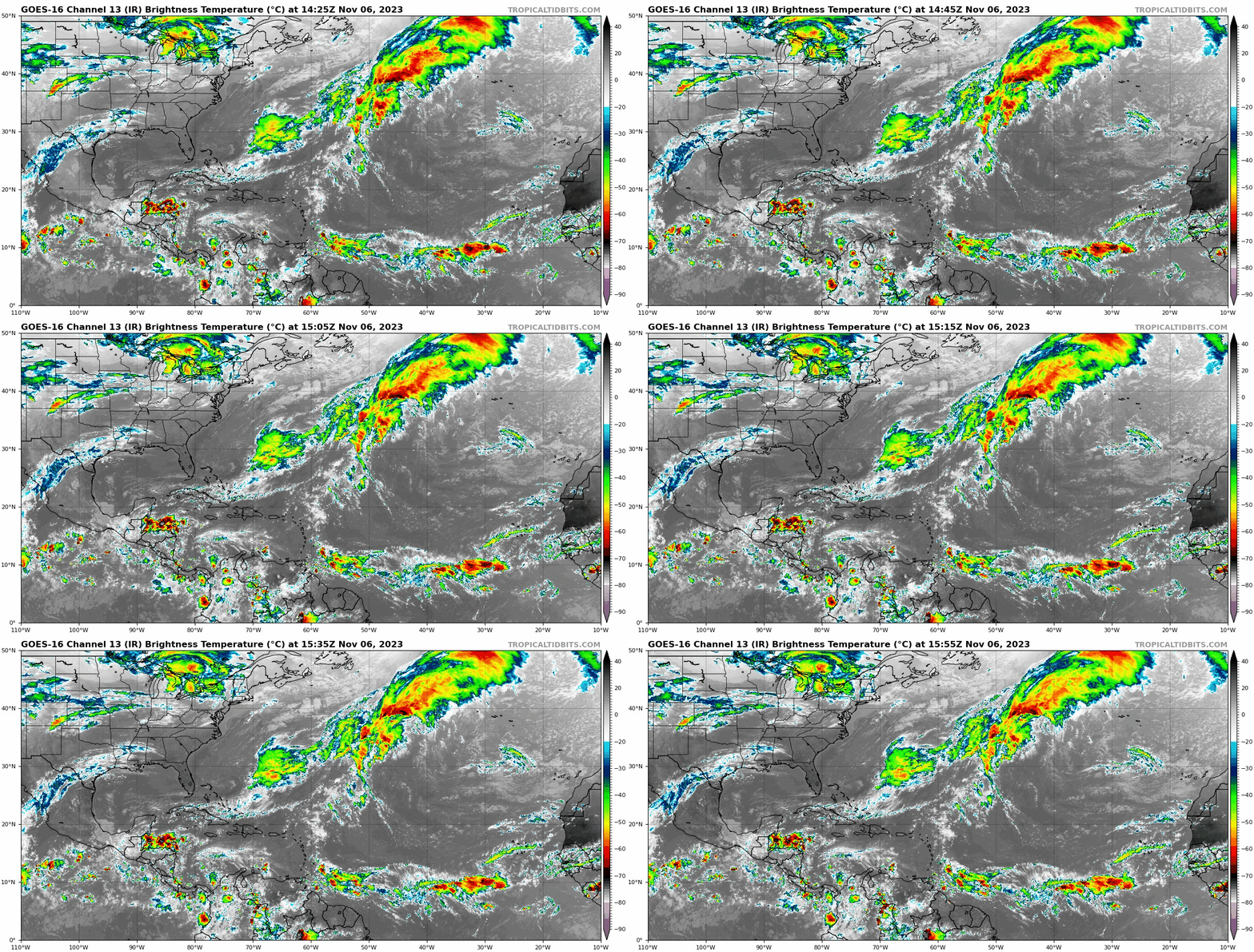
Disturbances in the NHC tropical weather outlook: None. Invest 97L crossed Central America over the weekend without developing.
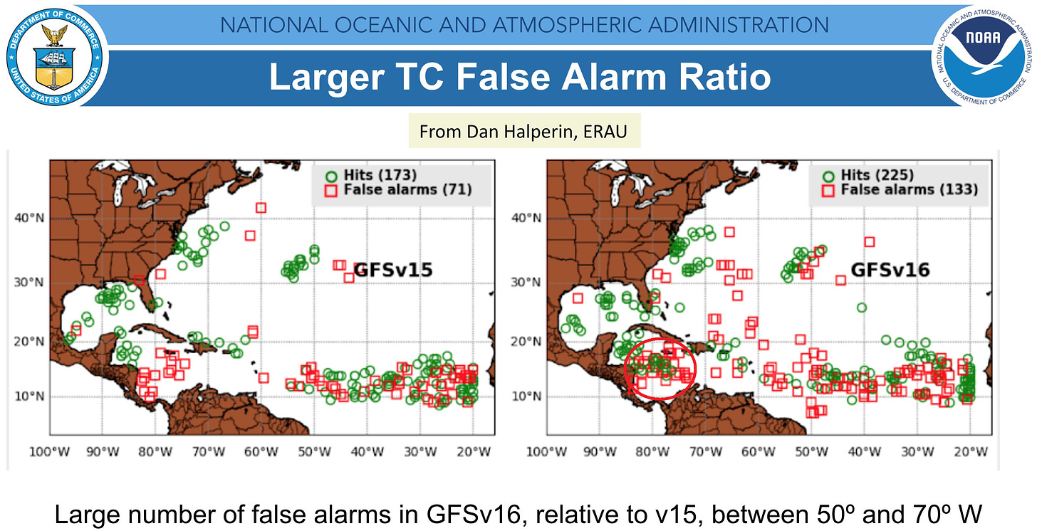
Elsewhere: No notable disturbances in the Gulf, Caribbean, or Atlantic, and none are likely to develop in the next 5 days. Fresh on the heels of taking a massive L for insisting a major hurricane would develop from Invest 97L, the GFS is back at its usual antics, once again trying to spin up a tropical storm/hurricane in 6-10 days in the western Caribbean on multiple runs. Given its recent track record and the high historical false alarm rate in this region (below), I’m default skeptical of this possibility. However, the broader pattern looks semi-favorable for tropical development next week, and the southern Caribbean remains much warmer than normal. I’ll keep an eye on things, but there is as yet no indication even if a system slowly congealed that it would be a concern for Florida or the continental U.S.
Next update: If the Caribbean system is looking more realistic later this week, I’ll have another update on Thursday or Friday this week. If it remains meteorological vaporware, I’ll be back with another overview of the Tropics next Monday.


