


Mountain Jam: WeatherTiger's Tropical Storm Fred Watch for August 11th
Tropical Storm Fred takes to the hills of Hispaniola, but may re-intensify near Florida in a couple of days.

WeatherTiger’s Hurricane Watch will be issuing daily forecasts for Tropical Storm Fred for the duration of the threat to Florida. If you enjoy our work and are not already a supporter, please consider signing up for our paid subscription service to receive a daily threat briefing each weekday, or sharing this blog with your friends and family.
Almanac: Today is Wednesday, August 11th… day 72 of the 2021 hurricane season, 111 days to go. By total storm energy, the season is 10.4% complete as a whole, 22.6% complete for the continental U.S., and 14.2% complete for Florida. On this date in 1860, a strong Category 3 hurricane made landfall in eastern Louisiana, executing a bizarre 180 degree turn over the central Gulf Coast.
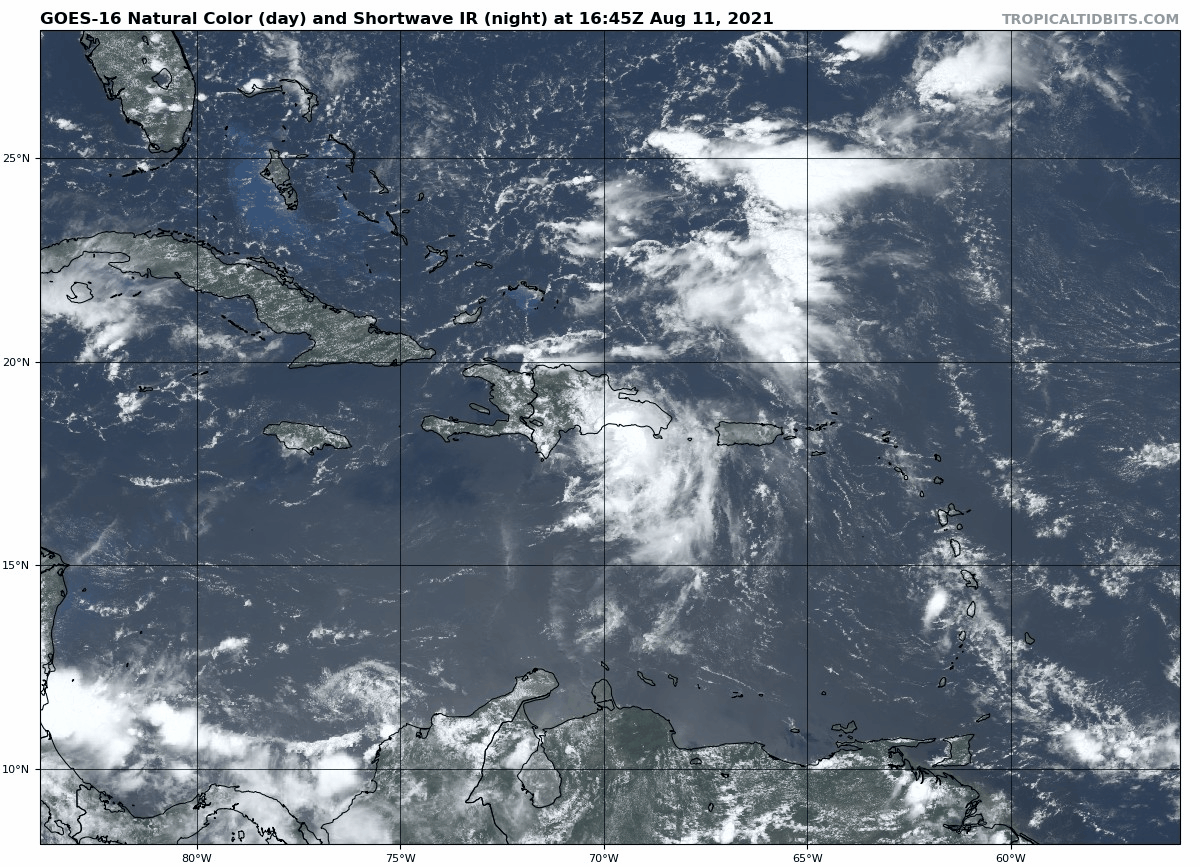
Active Storms: Tropical Storm Fred developed last night from PTC 6 as it passed just south of Puerto Rico. As of 2 p.m. Wednesday, Tropical Storm Fred has made landfall in the southern Dominican Republic with maximum sustained winds of around 45 mph. Moving west-northwest at around 15 mph, Fred will emerge from Hispaniola early tomorrow morning and is likely to traverse much of eastern and central Cuba on Thursday and Friday.
A travel itinerary over landmasses pocked with 6,000’+ mountain ranges means there is certainly a chance that Fred will weaken back to a tropical wave in the short term. Hispaniola and eastern Cuba have shredded plenty of historical storms from Debby in 2000 to Erika in 2015, though poorly organized systems like Fred (or Isaias last year) seem to often fare a little better in relative terms. At the very least, look for Fred to remain disorganized into the early weekend, at or below low-end tropical storm strength as it moves into the Florida Straits late Friday.

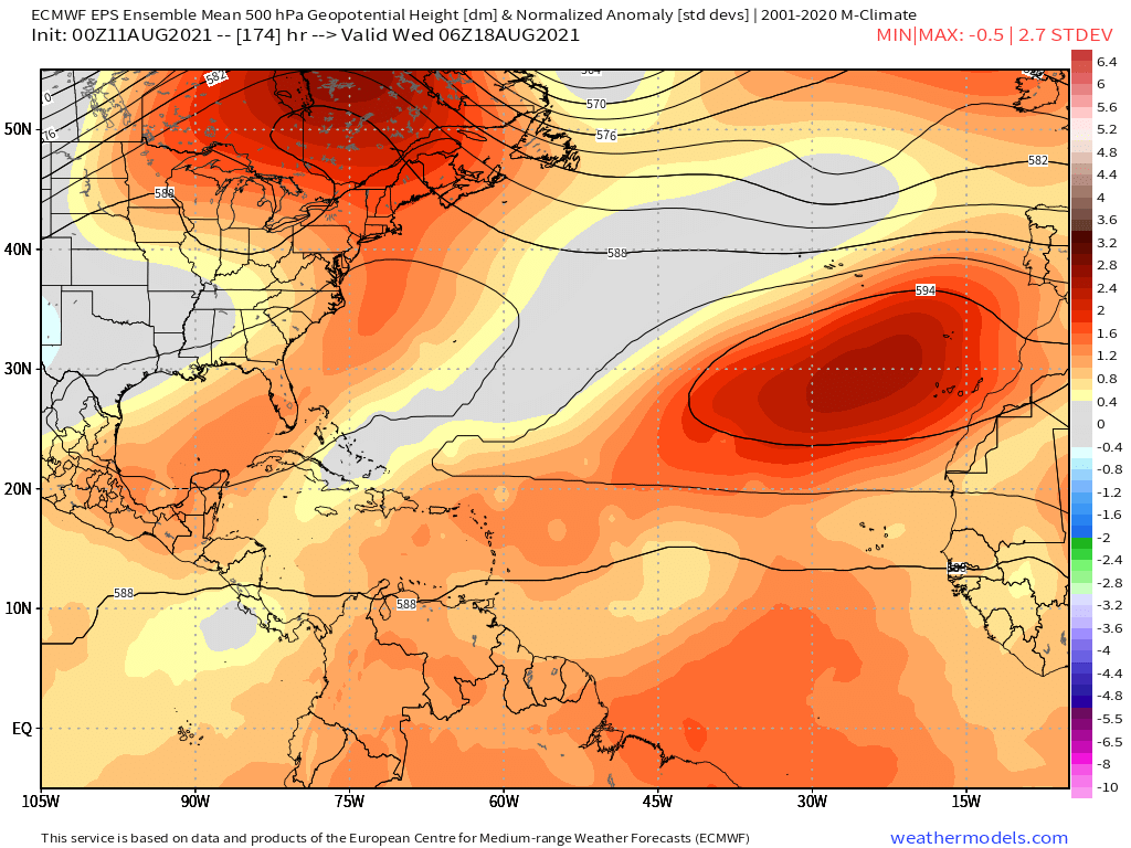
Over the weekend, Fred’s forward motion is likely to bend increasingly northwestward as it reaches the western edge of a ridge over the southwestern Atlantic and interacts with an upper-level low over the Gulf. The most likely scenario is a track near or just south of the Keys and then angling in the general direction of the Panhandle by late Sunday or Monday, as supported by most of the models. Given the potential for center reformation after crossing Hispaniola hinted at by this afternoon’s European model, however, South Florida and the entire Florida Gulf Coast should continue to monitor Fred closely as well.
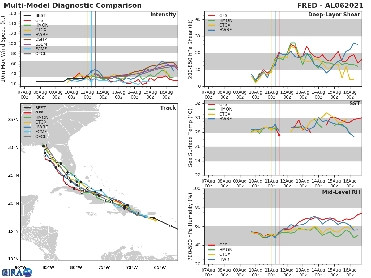
Once Fred disentangles itself from land, the environment over the eastern Gulf is likely to be relatively favorable for some strengthening. Shear is likely to be a manageable ~15 knots out of the southwest, water temperatures are in the mid and upper 80s, and no significant dry mid-level airmasses will be nearby. The intensity forecast is highly dependent how dilapidated Fred is structurally after transiting Cuba; currently, the NHC is calling for a 65 mph tropical storm with an early Monday landfall near Apalachicola. However, if Fred spends less time than expected over Cuba and still misses South Florida, attaining hurricane intensity on approach to North Florida would be a strong probability given the reasonably favorable environment of the Gulf. Conversely, there may not be much left of Fred in a few days, or it could scrape inland over the Florida peninsula and render the Gulf’s environment moot. Until Fred clears Hispaniola and Cuba, we just won’t know.
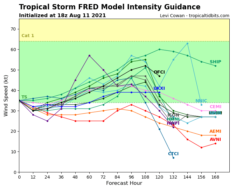
Overall, all the typical uncertainties of a weak storm crossing the landmasses of the northern Caribbean are in play with Fred. It is a hurricane threat to the Panhandle (or even South Florida/the Keys if something weird happens during the land transit), but a hurricane threat also is by no means assured for Florida either. We be able to eliminate some scenarios by tomorrow and start narrowing down our forecast focus. In the meantime, you’ll want to keep paying attention to Fred.
Current disturbances in NHC outlook, with 2-/5-day NHC development odds:
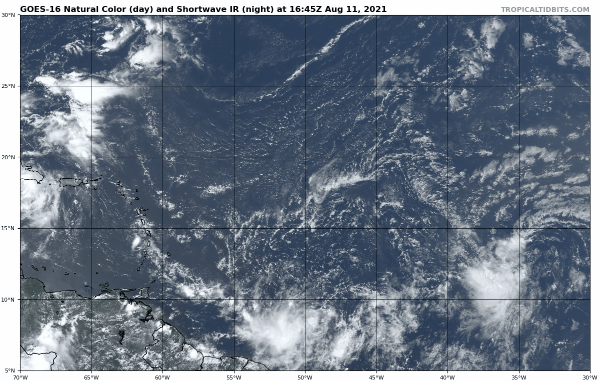
Invest 95L in the Eastern Atlantic (30/50%): A tropical wave nearing 40W has some associated convection, mostly displaced southwest of a broad area of low-level turning. Invest 95L is likely to become a tropical depression in the next three to five days as it moves west and reaches the northern Leeward Islands over the weekend. If 95L develops, the ridge between Bermuda and North Carolina steering Fred to the N/NW in the Gulf is likely to keep this system moving generally W/NW over the northern Caribbean or southwest Atlantic into the middle of next week. This one definitely has potential to be trouble down the road. Plenty of time to watch, though.
Elsewhere: No other significant areas of disturbed weather today. Another wave emerging from west Africa in a few days may also have a shot at developing in the Tropical Atlantic in 6-10 days.
Next report: A full forecast discussion for Tropical Storm Fred will be issued to all subscribers tomorrow afternoon.