


MJO Risin': WeatherTiger's Hurricane Watch for June 2nd
Nothing doing in the Atlantic today, but upper winds could turn more favorable next week.

Welcome to WeatherTiger’s Hurricane Watch! From today through October 31st, each weekday I’ll be issuing a tropical briefing bringing you that day’s hurricane history, a quick run-down of active storms, and a look at current development threats. Paid subscribers will receive these daily briefings and be able to comment and ask questions, as well as get all of our Thursday long-form analysis columns, daily in-depth forecasts and video discussions during Florida hurricane threats, live landfall coverage, and expanded seasonal outlooks. Free subscribers subscribers will receive a weekly forecast column. Sign up below to get WeatherTiger’s Hurricane Watch newsletters all season long.
A free preview of our daily briefing will continue into June as we settle into our new Substack digs. Enjoy, and feel free to drop a line to ryan@weathertiger.com with any questions.
Almanac: Today is Wednesday, June 2nd… day 2 of the 2021 hurricane season, with a mere 182 days to go. By total storm energy, the season is 0.7% complete as a whole, 0.9% complete for the continental U.S., and 0.7% complete for Florida. The sole tropical storm to make landfall on this date since 1851 is a weak tropical storm that moved ashore near the Florida/Georgia line in 1873, and produced sustained winds of a brisk 28 mph in Jacksonville. (They rebuilt.)
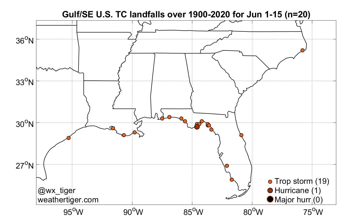
Historically, as shown above, U.S. landfalls are most common along the northeastern Gulf Coast in the first two weeks of June, with about 1 out of every 7 seasons having a storm in that timeframe. Of 20 Southeast U.S. landfalls between June 1 and 15 since 1900, 19 have been tropical storms— mostly rainmakers in the mix early in the season.
Active Storms: None.
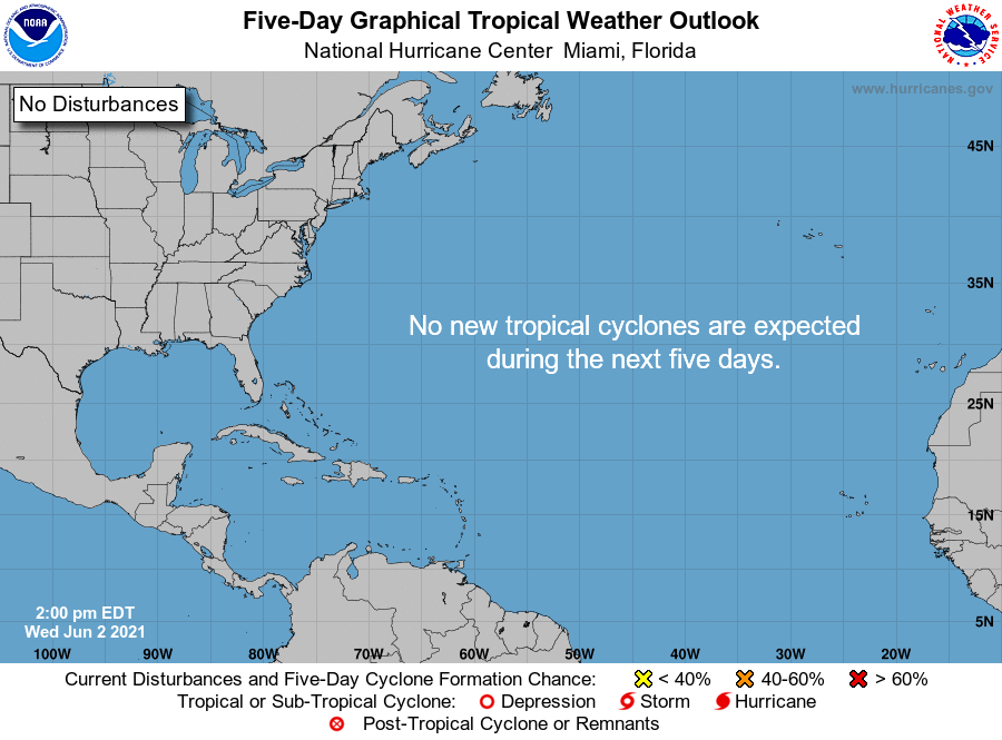
Current disturbances in NHC outlook: None. Day 2 of hurricane season is as calm as day 1, with no tropical development expected over the next 5 days.
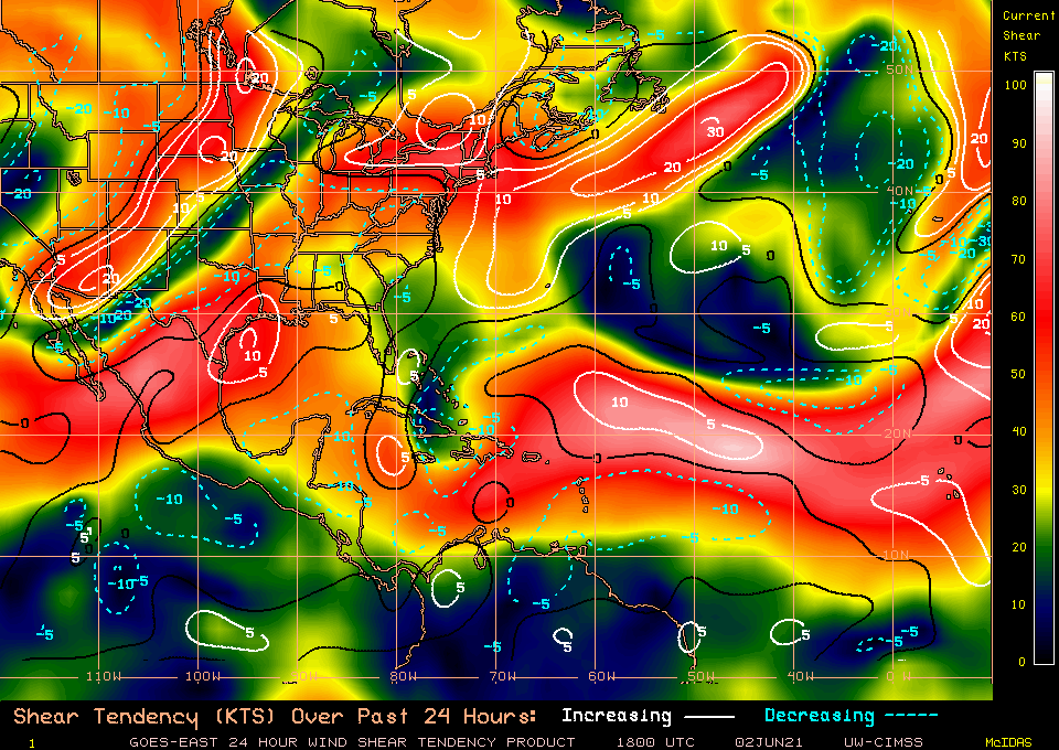
Elsewhere: Wind shear is quite strong across the Gulf, Caribbean, and western Atlantic today, as typical for phase 7 of the Madden-Julien Oscillation, which does not favor Atlantic development. However, the MJO may pivot into a more conducive phase 1 state around June 10th, when a tropical wave currently in the eastern Atlantic will likely be entering the western Caribbean. It’s worth keeping an eye on the Caribbean and southern Gulf starting late next week, as that is a climatologically favored area for development in the second week of June.
Next report: Our weekly long-form column will be released tomorrow afternoon, and will take a look at whether a dry May in Florida means anything for hurricane risks in the year ahead. WeatherTiger’s 2021 updated hurricane season outlook will be issued on Friday, June 4th.