


Low Gyre Pressure: The Hurricane Watch for November 4th
A nasty 3-5 days of weather is inbound to Florida next week in association with a broad subtropical disturbance.

Florida tropical threat synopsis: The eastern Florida peninsula is increasingly likely to see rain and gusty winds from a hybrid low between Tuesday and Friday of next week. There is also a chance that similar impacts may spread further west across Florida later in the week.
Almanac: It’s Friday, November 4th… day 156 of the 2022 hurricane season, 27 days to go. By total storm energy, the season is 95%, 98.7%, and 97.3% complete for the Atlantic, continental U.S., and Florida, respectively.
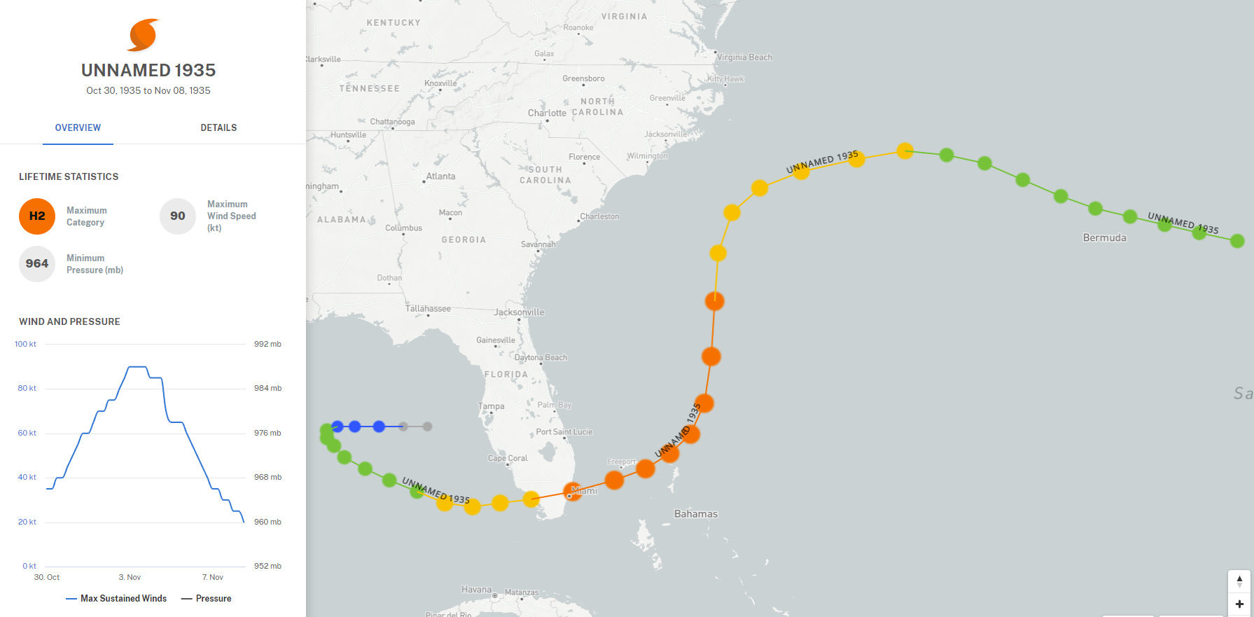
On this date in 1935, the infamous Yankee Hurricane— so named for its unusual approach from the northeast— struck Miami as a Category 2 hurricane with 100 mph sustained winds. This is the second-latest U.S. hurricane landfall on record, only exceeded by Hurricane Kate on November 21, 1985.
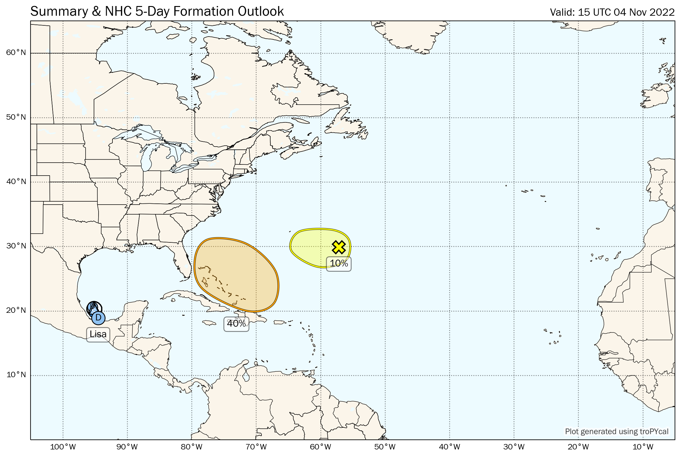
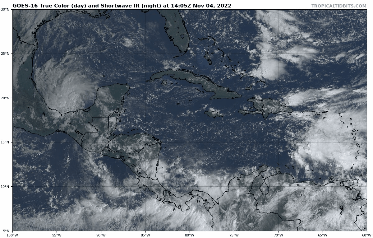
Active Storms: Tropical Depression Lisa has nipped back into the far southern Gulf of Mexico after making landfall as a hurricane in Belize on Wednesday. Lisa will meander for a couple of days, possibly making it back to minimal tropical storm status in the next 12 hours, before being sheared apart and drifting back south over the weekend. No threat to the U.S. from Lisa.
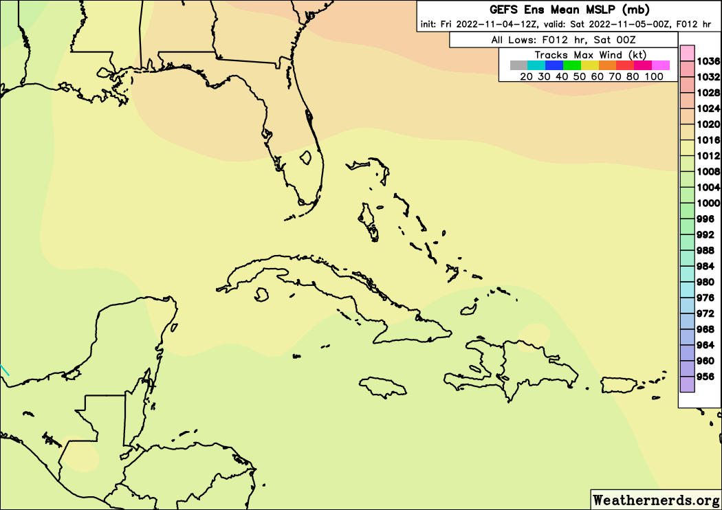
Other Disturbances in NHC outlook, with 2-/5-day NHC development odds: A large circulation will form over the Greater Antilles this weekend and drift west towards the Bahamas early next week. The NHC estimates the odds of tropical or subtropical development of this system to be 40% between late Sunday and Wednesday. Separately, this gyre will also swallow a small non-tropical low east of Bermuda that the NHC is giving a 10% chance of development in the next 2 days before it merges with the larger disturbance.
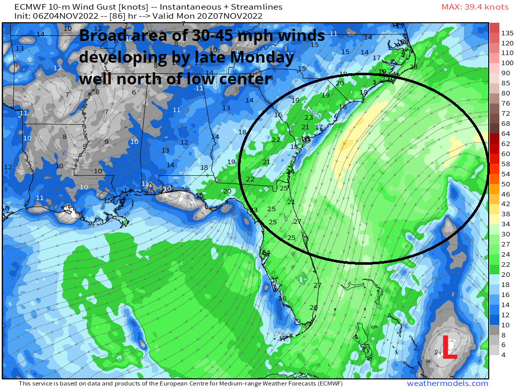
With an upper-level low aloft, whatever develops from this gyre is likely to be a subtropical or hybrid low; in practical terms, that means a decentralized structure, with showers and gusty winds extending well away from the center of circulation, particularly to the north due to a strong pressure gradient between the low and a high over the Great Lakes. As such, the Florida East Coast north into coastal South Carolina can expect rain and brisk coastal winds starting late Monday or early Tuesday, with elevated rain coverage in Florida extending through at least Friday. There is a trend in the model guidance towards a more coherent and organized system (though still broad), which may cross the Florida peninsula Wednesday or Thursday as a named system before turning north as a front approaches late in the week. There remains significant spread in the ensembles and between models on the structure and track of the low, as shown in the 12z GFS Ensembles below.
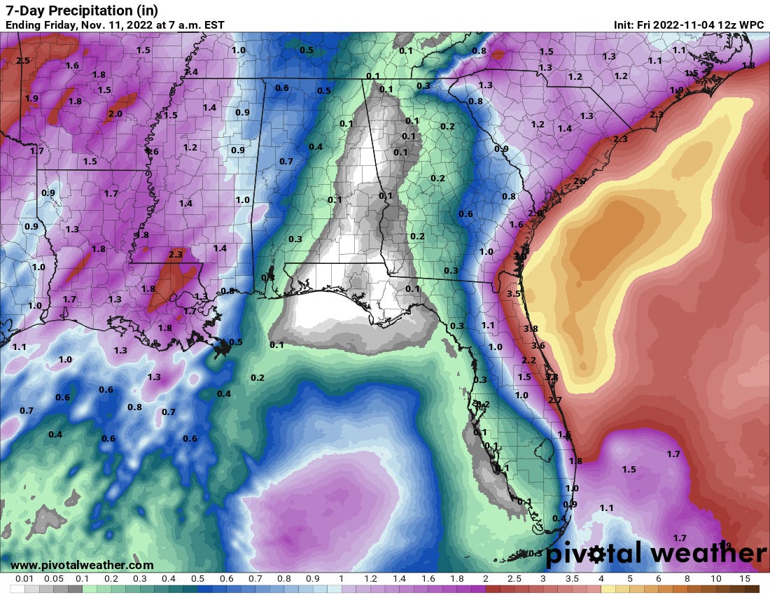
Messy continues to be the operative word. I wouldn’t be concerned about the precise track of the system here, particularly as the stronger winds and heavier rain will be at some remove from the center. However, it looks increasingly likely that Florida (and potentially the coastal Southeast U.S. as well) will see a period of nasty weather between Tuesday and late next week. This certainly bears watching, particularly given that Ian’s river flooding continues and the sensitivity of the Florida peninsula to additional flood risks with even 2-4” inches of widespread rainfall. The current NWS 7-day precip outlook (below) remains conservative in rainfall totals and extent, but could trend farther west over the weekend if model trends continue. Stay tuned.
Elsewhere: Nothing else of note.
Next report: Next bulletin out Monday.