Little Surprise: WeatherTiger's Hurricane Watch for June 28th
A tropical depression is inbound to South Carolina while the Atlantic simmers.
WeatherTiger’s Hurricane Watch daily briefings are released each weekday afternoon during hurricane season. Click below to subscribe to receive these forecasts by e-mail:
Almanac: Today is Monday, June 28th… day 28 of the 2021 hurricane season, 156 days to go. By total storm energy, the season is 2.3% complete as a whole, 7.0% complete for the continental U.S., and 7.0% complete for Florida.
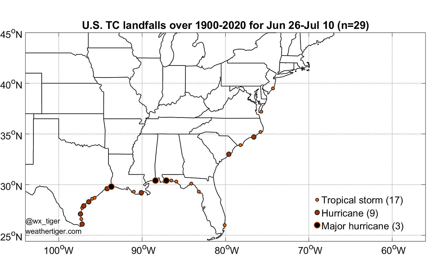
On this date in 1913 and again in 1929, Category 1 hurricanes on the Saffir-Simpson Hurricane Wind Scale made landfall in south-central Texas. As shown above, these hurricanes are a fair representation of late June or early July landfalls— typically not too strong, and biased towards the western Gulf Coast.
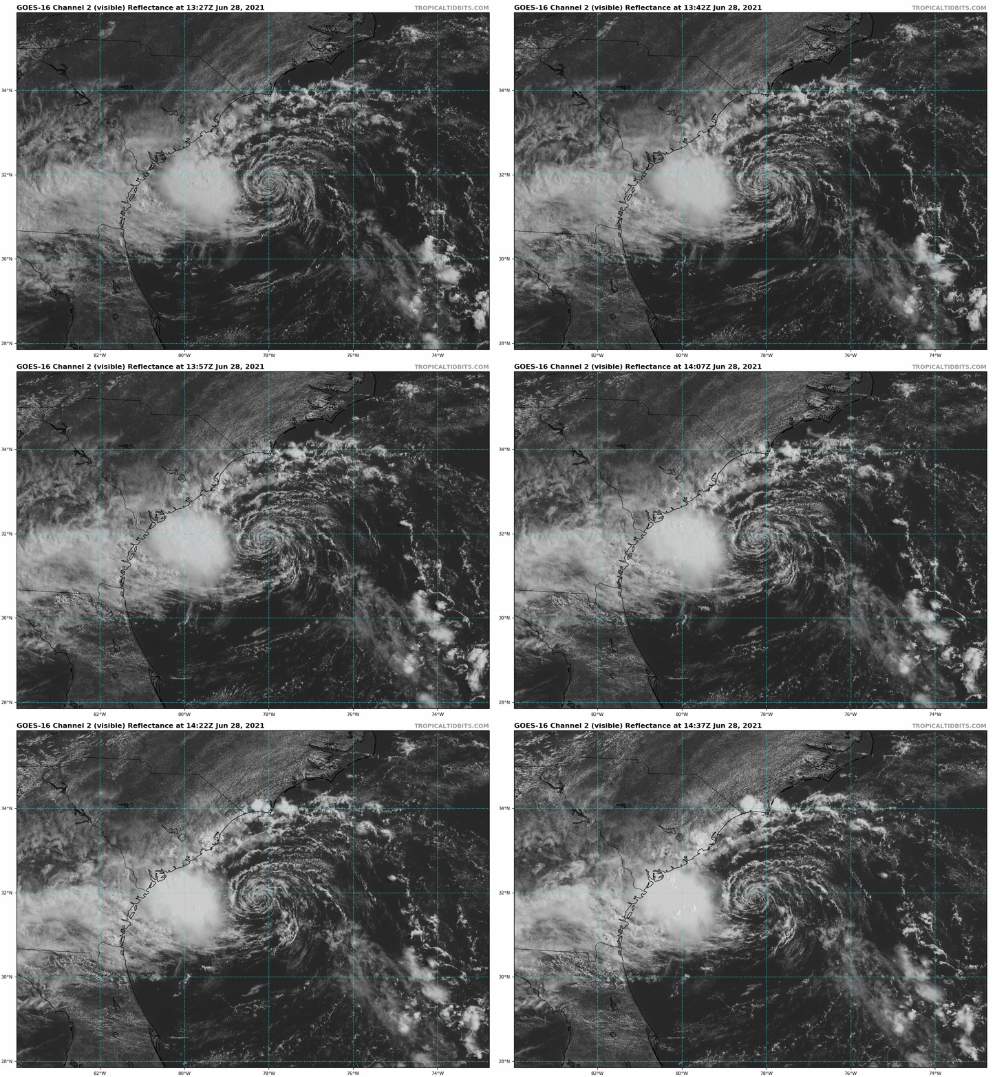
Active Storms: Tropical Depression Four has developed this morning just to the east of the South Carolina coast, with the NHC initiating advisories at 11 a.m. TD #4 had an unusual route to development, rapidly burrowing down to the surface from a mid-level low as it crossed the warm waters of the subtropical western Atlantic.
The depression is being sheared from the east, and while it has a well-defined surface circulation, convection is limited to pretty much just one amorphous blob around 100 miles west of the center. Little structural change is expected today as TD #4 moves west-northwest under continued shear, and the system will move inland near Charleston this evening either as a TD or minimal tropical storm.
Impacts will be very modest. Tropical Storm Warnings are out for the central South Carolina coast to cover near-shore wind gusts to 45 mph, and 1-2” of rain is possible in central Georgia and southern SC through tomorrow associated with the path of that convective blob, which should remain south of the center. If TD 4 ekes out a name today, it would be Danny. We’ll find out if the pipes are calling in the next 12 hours before the center moves inland.
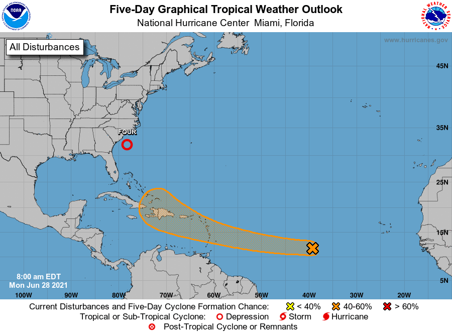
Current disturbances in NHC outlook:
Invest 95L/Central Tropical Atlantic (2-/5-day odds: 20/40%). A tropical wave halfway between Africa and the Lesser Antilles has limited convection this morning, and is struggling as it ingests some drier air to its northwest. Any development will be slow from 95L, and is more likely to occur between 50W and 60W, where early season development is less unprecedented.
One other thing to note is that the NHC outlook appears to elide the development area from 95L and a wave to the east that is expected to catch 95L from behind later this week. Given the better availability of moisture with the wave further east, that actually may be the one to keep an eye on. Overall, the development of either one of these waves is possible, but less likely than not.
Elsewhere: None, if the Atlantic waves are considered jointly.
Next report: The next daily update will be sent by 3 p.m. on Tuesday.


