


Lesser Concerns: The Hurricane Watch for October 16th
A tropical wave in the central Atlantic is something to watch for the Lesser Antilles this week, but no U.S. threats are on the horizon.
Florida tropical threat synopsis: No tropical threats to Florida over the next week.
Almanac: It’s Monday, October 16th… day 136 of the 2023 hurricane season, 47 days to go. By total storm energy, the season is 87.5%, 91.3%, 84.8% complete for the Atlantic, continental U.S., and Florida, respectively.
With the final eighth of hurricane season (in ACE terms) now underway, WeatherTiger’s real-time modeling is retiring for the 2023 season, reaching the coveted right side of the graph. As of the final October 15th run, our model is calling for a total of 148 ACE units, compared with a current 130, and an 85%+ chance of an “above average” season landing between 130-165 ACE. If 94L (see below) doesn’t develop, that 148 ACE number is probably a bit of a reach.
Active Storms: None. Sean has dissipated in the central Tropical Atlantic.
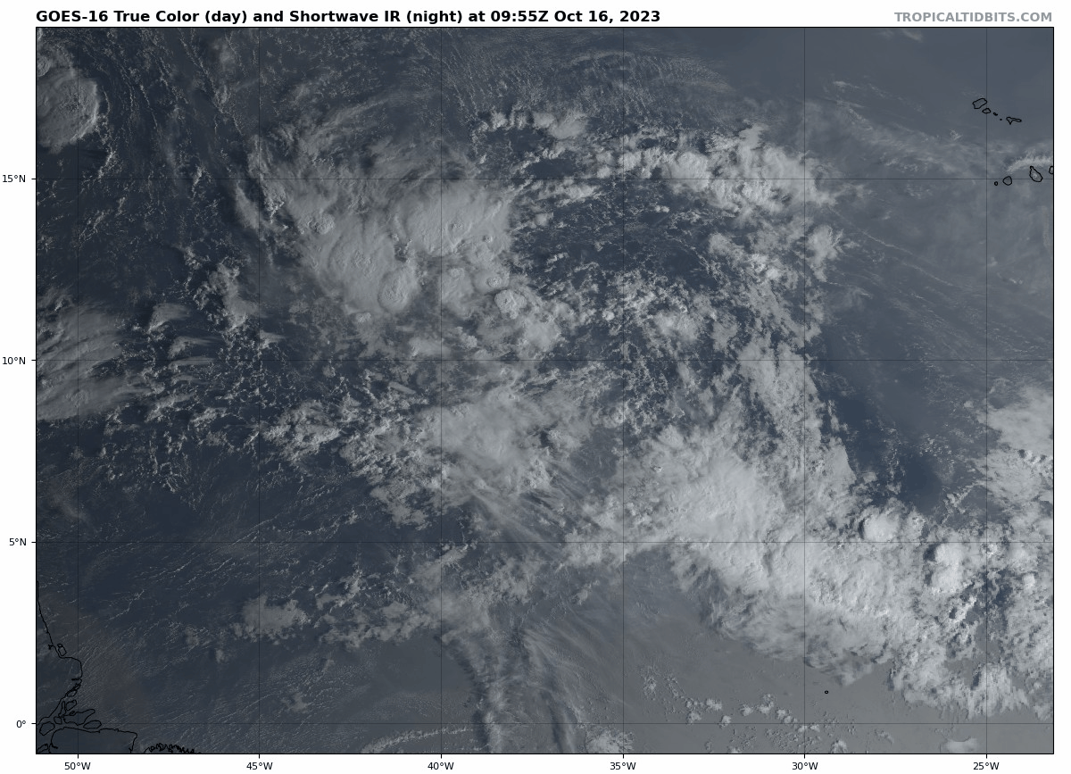
Other disturbances in the NHC outlook, with 2-/7-day NHC development odds: The only game in town in the Atlantic Basin today is Invest 94L, a tropical wave halfway between Africa and the Lesser Antilles which has a 30% chance of development in the next two days and 70% in the next 7 days per NHC. Satellite imagery shows 94L has a broad area of rotation along 10N between 35W and 40W, but lacks a concentrated area of central convection so development is unlikely in the near term. Upper-level winds may support a better chance of organization in 3-6 days, although development is far from certain due to the presence of nearby dry air. There is a reason TC formation is uncommon in the eastern Atlantic in the second half of October.
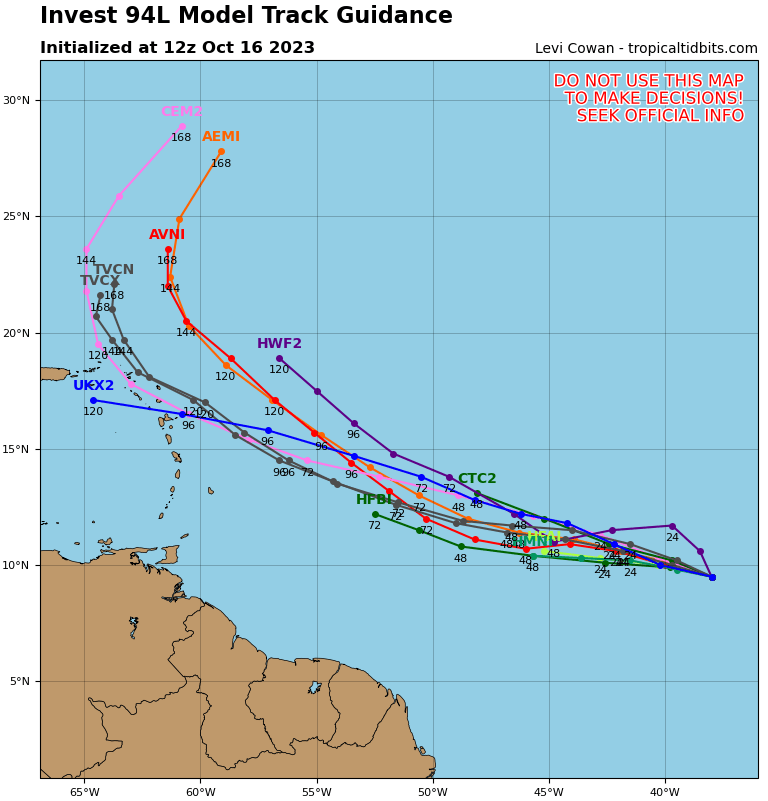
A strong ridge of high pressure to the north of the Main Development Region will keep 94L moving generally west- or west-northwest-ward at a leisurely pace over the next 5-7 days; on this general track, the wave may approach or cross the central or northern Lesser Antilles over the weekend or early next week. A dip in the jet stream moving off the U.S. East Coast would likely scoop up anything that developed from 94L and turn it north in the 7-9 day range, though Puerto Rico and islands to the east should carefully monitor the system as it could make it that far west before such a turn occurred. Overall, models aren’t as enthusiastic about the development or intensification potential of 94L as they were late last week, but there is still a chance of what would be a very unusual late season MDR threat for the Antilles that should be monitored closely in the islands.
Elsewhere: No notable systems in the Atlantic, Caribbean, or Gulf today. There continues to be no indication of any uptick in development chances in the western Caribbean over the next 8-10 days, though a pattern change to ridging north of the region may lead to slightly more conducive conditions in the last week of October.

Next report: Next daily bulletin out tomorrow.