


It's Gonna Rain: WeatherTiger's Hurricane Watch for June 16th
A rainmaking tropical storm is expected to impact the central Gulf Coast this weekend.

A free preview of our daily briefings for paid subscribers is continuing into June as we settle into our new Substack digs. Enjoy, and drop a line to ryan@weathertiger.com with questions.
Almanac: Today is Wednesday, June 16th… day 16 of the 2021 hurricane season, with 168 days to go. By total storm energy, the season is 1.5% complete as a whole, 3.8% complete for the continental U.S., and 5.1% complete for Florida. On this date in 1934, a Category 2 hurricane with 100 mph sustained winds struck central Louisiana after meandering in the southern Gulf for nearly a week. This is the second earliest U.S. hurricane landfall since 1900.
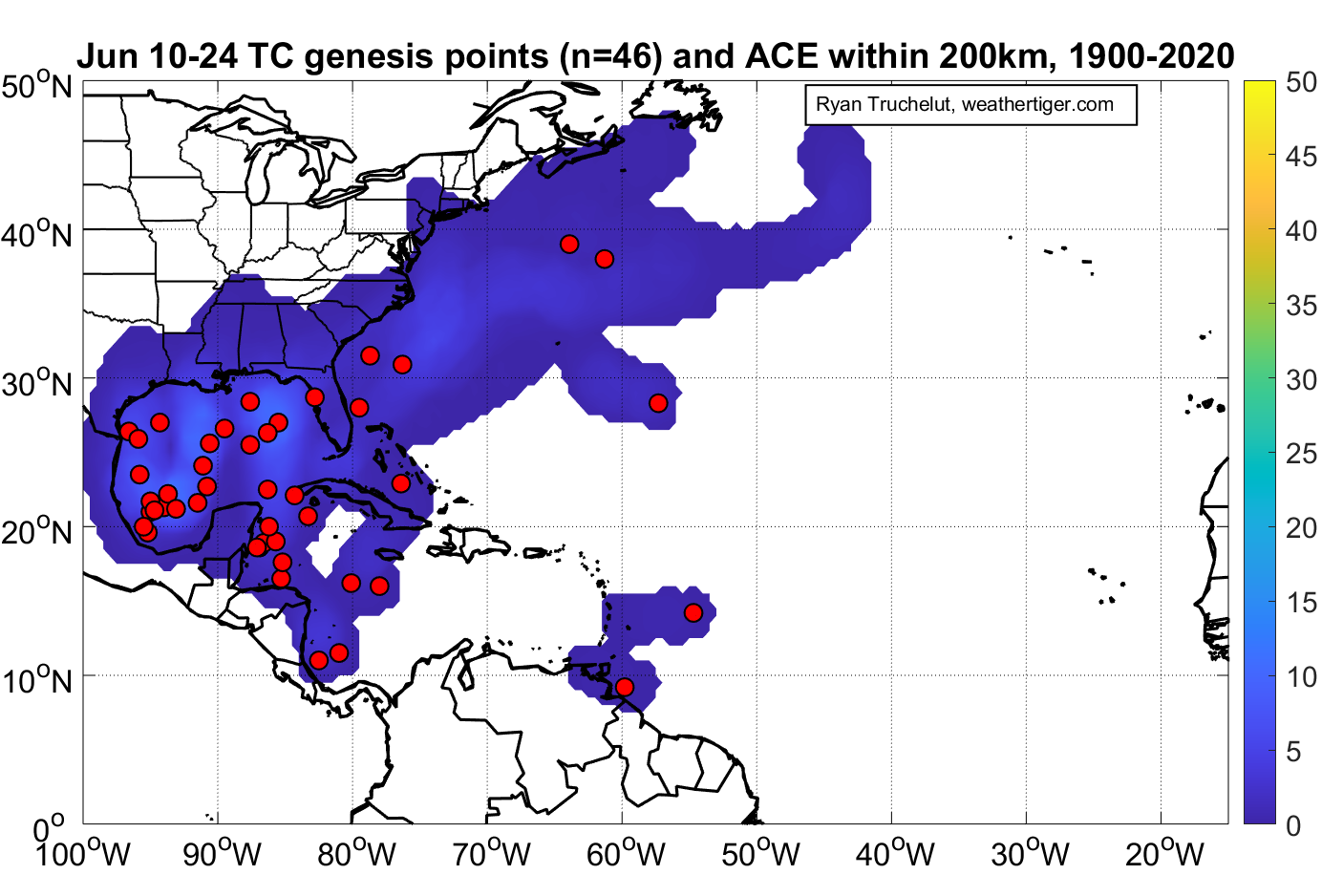
The Gulf remains a climatologically favored location for storm development in mid-June, with a particular concentration of historical formations in the southern Gulf, where today’s interests are focused.
Active Storms: None. Ex-Bill is now a non-tropical low over the Canadian Maritimes.
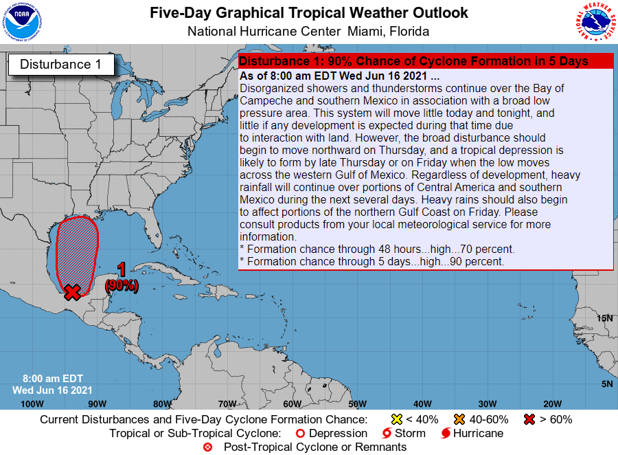
Current disturbances in NHC outlook:
Invest 92L/Southern Gulf (2-/5-day odds: 70/90%). Invest 92L’s slow march towards developing into a broad tropical depression or weak tropical storm has continued over the last 24 hours. As expected, a loose low-level circulation has become better defined since yesterday, and convection is increasing east of the surface center as Caribbean moisture surges north due to interaction of the Central American Gyre with a tropical wave axis.
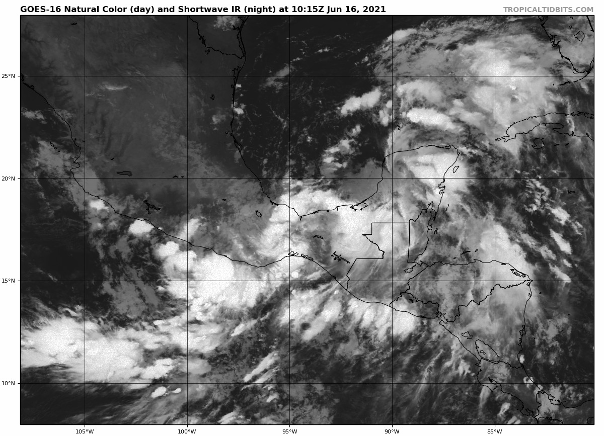
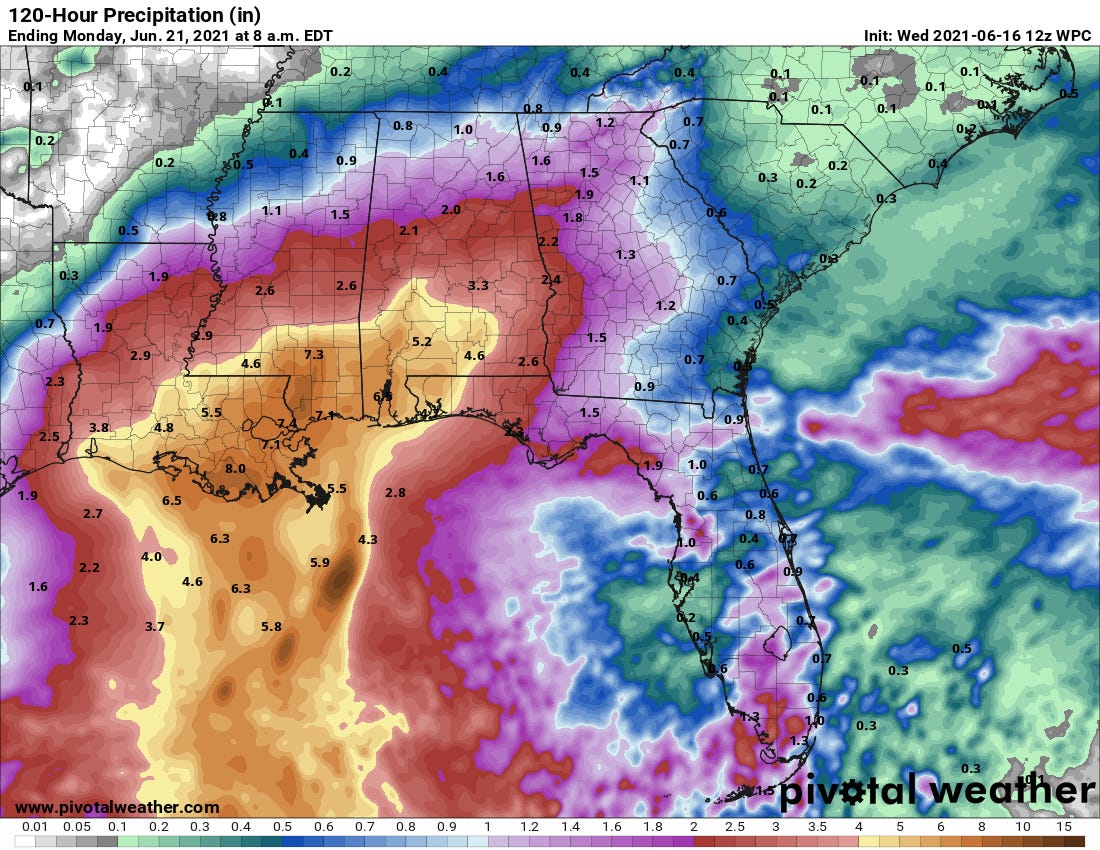
Land interaction will likely keep a depression from developing today, but look for that to occur tomorrow or early Friday as Southwest U.S. ridging weakens and the system begins to lift north. A general northward motion towards Louisiana is expected into the weekend, with “landfall” likely on Saturday and a turn northeast inland over the Deep South on Sunday. Broad systems strengthen slowly, so 92L only reaching low-end tropical storm strength before reaching land is probable. The system will be moving briskly across the Gulf Coast and Deep South, so rain totals are likely to be on the order of 4-8” near the coast and 2-4” inland between central Louisiana and the western Florida Panhandle. Rain totals will likely fall off further east across the Florida Panhandle, but a needed 1-2” is still expected, mostly from Sunday and Monday, in the Big Bend.

Overall, there are no major changes to the forecast for 92L since yesterday, with a weak Gulf Coast tropical storm landfall expected on Saturday. The major concern remains flood risks in central and eastern Louisiana and southern Mississippi, with potential for beneficial rains further east in Alabama and western Florida.

Elsewhere: The eastern Atlantic wave is devoid of convection and has no further shot at developing. A frontal low crossing north of Bermuda Friday and Saturday will likely remain non-tropical. Regardless of structure, this is no threat to land.
Next report: Our weekly long-form column, breaking down the expected impacts of the Gulf storm, will be out tomorrow by 3:00 p.m.
Each weekday, WeatherTiger’s Hurricane Watch publishes a tropical briefing bringing you that day’s hurricane history, a run-down of active storms, and a look at current development threats. Paid subscribers will receive these daily briefings and be able to comment and ask questions, as well as get our Thursday long-form analysis columns, daily forecasts and video discussions during hurricane threats, live landfall coverage, and expanded seasonal outlooks. Free subscribers will receive our weekly forecast column and selected storm coverage.