Intrusive Thoughts: Hurricane Watch for September 3rd
The Atlantic limps into the busiest weeks of hurricane season with a few areas to watch and a huge expanse of dry air.
Florida and continental U.S. tropical threat synopsis: Over the next 7 days, there are no organized tropical threats to the continental U.S., though the Gulf Coast will be wet.
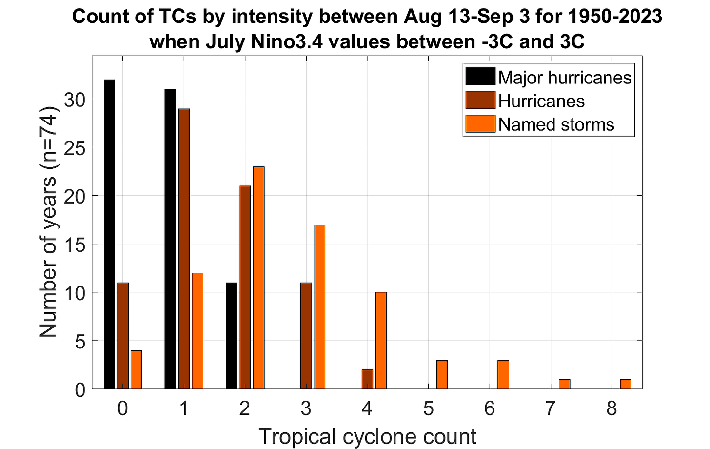
Almanac: It’s Tuesday, September 3rd… day 95 of the 2024 hurricane season, 88 days to go. By total storm energy, the season is 32.2%, 44.9%, and 29.6% complete for the Atlantic, continental U.S., and Florida, respectively. There have been no named storm developments in the Atlantic since August 12, making this the first time since 1997 with nothing forming between 12z on August 13 and 12z on September 3. Normally, 2-3 named storms and 1-2 hurricanes (one of which is usually a major) develop in this timeframe.
Active storms: None.
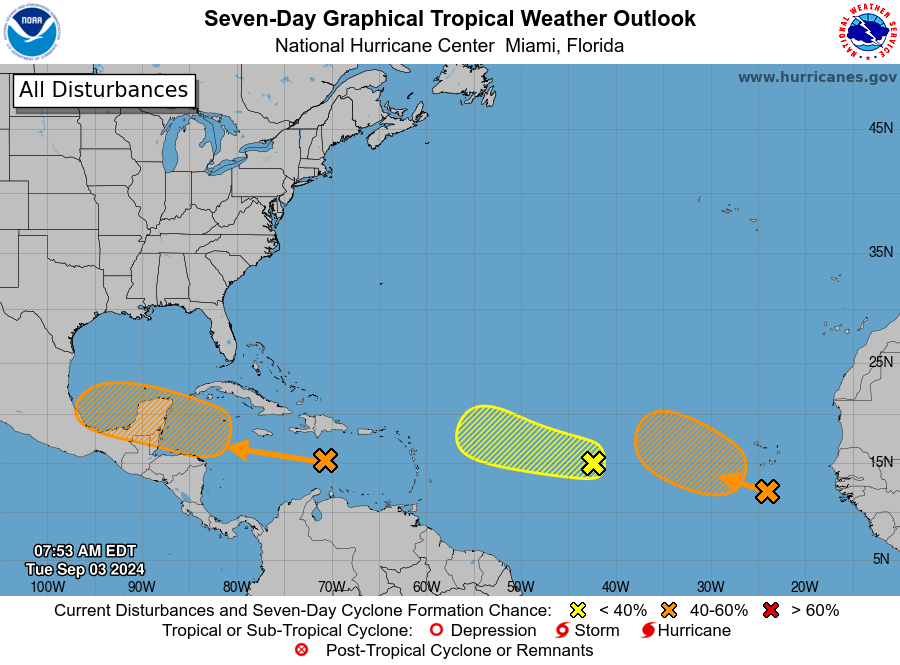
Disturbances in the NHC tropical weather outlook:
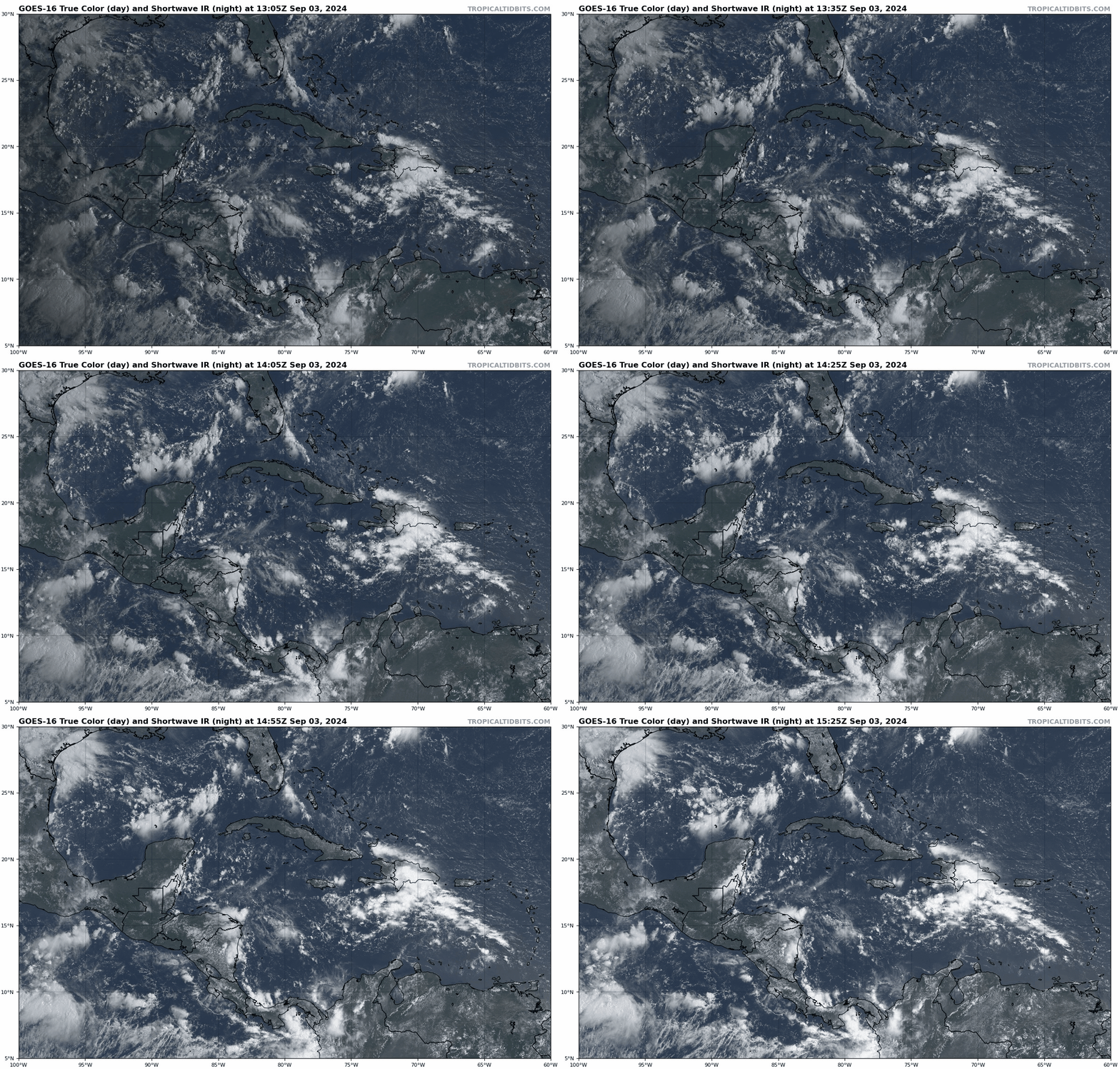
The NHC Tropical Weather Outlook looks loaded today, but it’s quantity over quality. The wave I mentioned on Friday as a possible U.S. threat if it didn’t fail to launch failed to launch over the weekend and is currently a smear of futility in the central Caribbean, though the NHC has it still at a 40% chance of development over the next seven days.
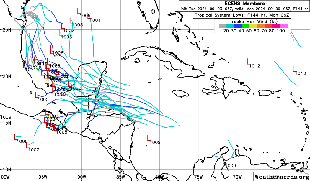
As has been the case with many other disturbances in the last three weeks, dry air prevented enough convection from developing to organize the wave further, and rather than lifting north as an organized system into the Gulf, it will continue westward towards Central America over the next few days. There is a slim chance that it stalls out in the far southern Gulf over the weekend or early next week and eventually develops as steering weakens, and that would be something to monitor on the off chance it happens. But overall, this wave is a chronic underperformer, my expectations are rock bottom given current appearances, and any threat to the U.S. is vanishingly unlikely without strong evidence otherwise.
The NHC is giving a 10% chance of development in the next two days to a tropical wave in the central Atlantic along 15N between 40-45W. This wave is generating some convection today, but dry air has it surrounded. Convection should decrease in the next few days, and no development is likely as it continues west-northwest this week.
Finally, another wave in the eastern Atlantic near 25W is being given a 40% chance of development over the next 7 days. That seems very generous to me, given this one will also be buffeted by dry air from the north over the next week as it slowly moves northwest. It is also no threat to land even if it did develop.
Elsewhere: Nothing else significant to discuss. Disorganized convection persists in the NW Gulf, and an approaching front will spread elevated rain chances back across the Eastern Gulf Coast in the upcoming week, but not as any kind of a tropical system. Still, look for weekly totals of 2-4” along the Gulf Coast from this pattern.
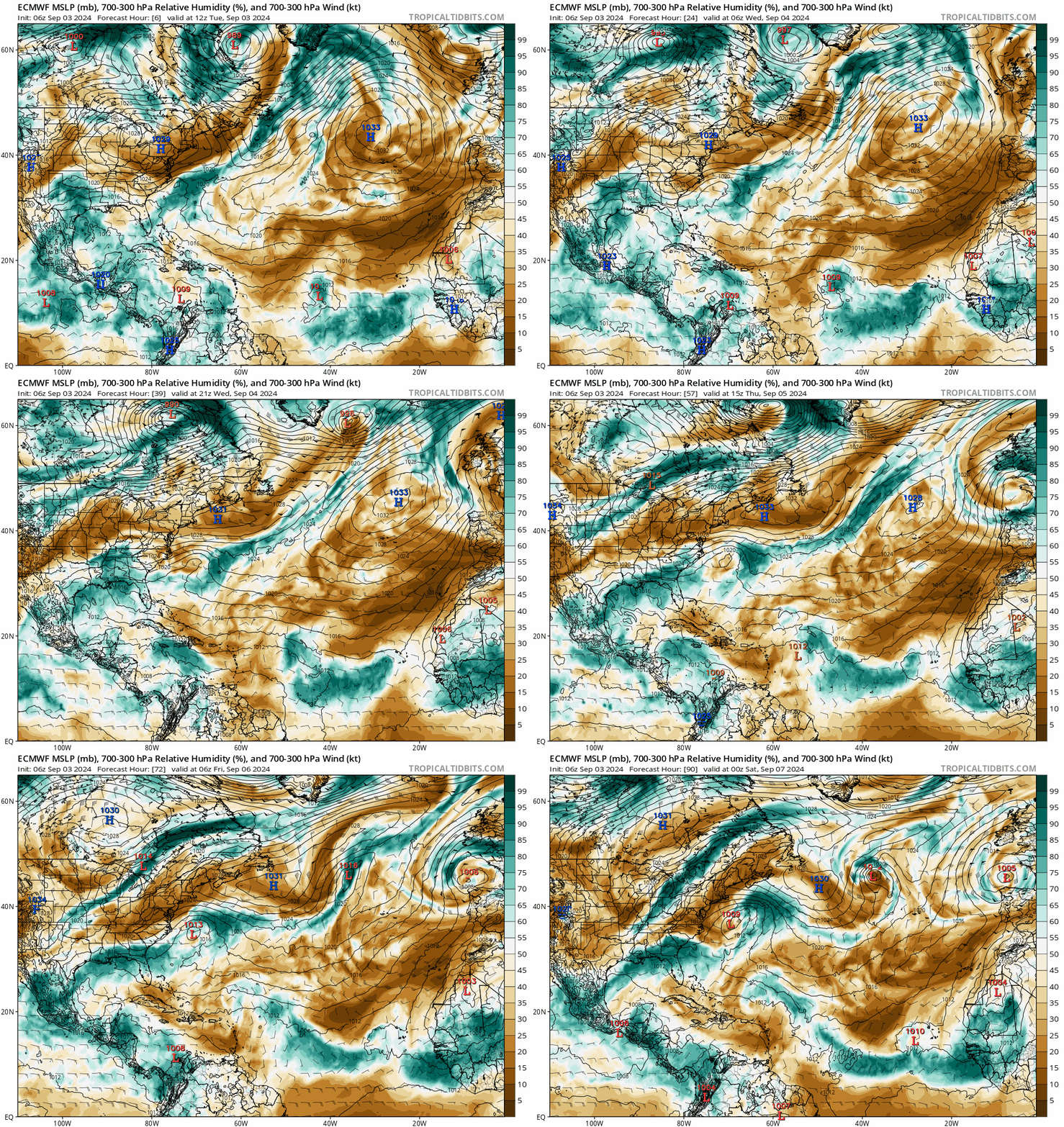
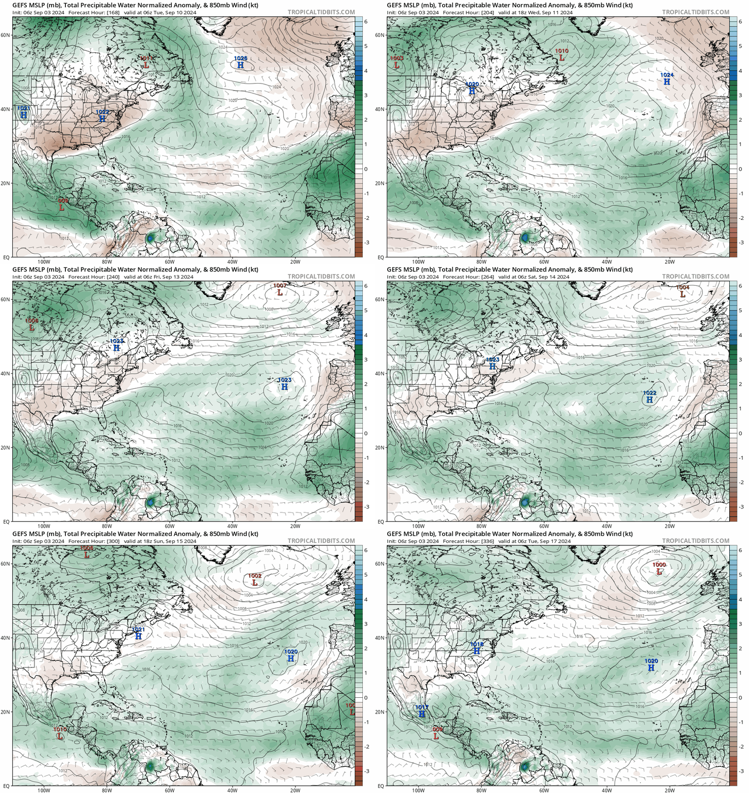
As seen above, the major problem in the Atlantic continues to be the very dry air intrusions (shown in brown above) between 1 and 4 miles up in the atmosphere, with airmasses continually being routed south and southwest from an origin point in the north Atlantic, across the eastern subtropical Atlantic, and then south into the Main Development Region. That cool, dry, stable air is keeping organized and sustained convection from developing with the current crop of waves, and is a lethal blow to the tropical cyclone genesis process. A generally inactive regime in the Tropical Atlantic will probably persist into for another 7-10 days while these dry air intrusions continue. There are some hints that a more normal pattern in terms of better moisture availability will develop by mid-September over the Tropical Atlantic, but it remains to be seen if the Atlantic will actually rouse from its slumber at some point during the climatological peak.
Next update: Next update tomorrow morning.


