In the Beginning: WeatherTiger's Hurricane Watch for May 20th
Taking stock of the Tropics ahead of the official start of the season.
Welcome back to WeatherTiger’s Hurricane Watch! With the 2022 season beginning in less than two weeks, I’m briefly checking in today to debunk recent rumors of Gulf activity. Enjoy, and watch for WeatherTiger’s 2022 Hurricane Season Outlook, out next Wednesday (5/25). We’ve got some exciting new seasonal model bells and whistles to share with you then.
If you like what you read, please support us by signing up for our comprehensive coverage of what looks to be an active 2022 hurricane season. Premium subscribers get Florida-focused daily tropical briefings like the one below each weekday, plus weekly columns (June-October), full forecast and video coverage of every U.S. hurricane threat, and expanded seasonal outlooks, all for as little as $7.99 per month.
Florida tropical threat synopsis: No concerns over the next 7 days. Florida and the rest of the Southeast will be wetter than average this week as disorganized deep moisture streams north out of the Tropics.
Almanac: Today is Friday, May 20th… the 2022 hurricane season officially starts in 13 days and ends in 195 days. By total storm energy, as of today the season is 0.2% complete as a whole, 0.3% complete for the continental U.S., and 0.4% complete for Florida. There are no historical U.S. landfalls on this date.
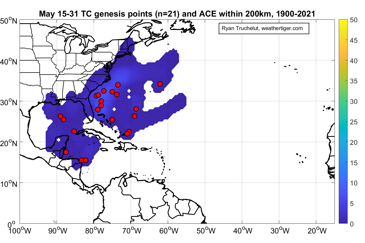
The most common area for development in the second half of May is east of Florida, with a subtropical or tropical storm developing once every 5 to 10 years since 1900. However, pre-season development has been more common in recent decades. U.S. landfalls are rare in May, but the eastern Gulf Coast and Carolinas have seen a handful of May tropical storm hits.
Active Storms: None.
Current disturbances in NHC outlook, with 2-/5-day NHC development odds: None.
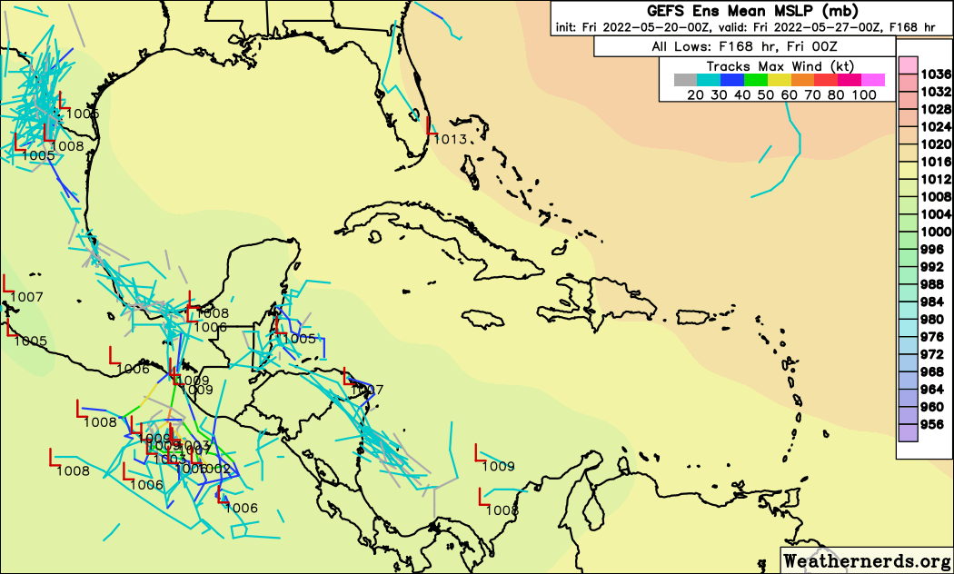
Elsewhere: The Atlantic is blessedly quiet as the start of the season approaches. Earlier this week, there was some intrigue centered on the western Caribbean, with the GFS model repeatedly spinning up a tropical system from a Central American Gyre (CAG) and subsequently moving it north into the Gulf.
However, this tendency to overdevelop CAG circulations is a well-known bias of the GFS, especially early and late in the season. Much like the supposed Avatar sequels, the GFS’ purported development remained a fixed amount of time in the future without ever coming any closer to fruition. The model has since folded on any development east of Central America, just as I believe zero Avatar sequels will ever actually be released (prove me wrong, James Cameron).
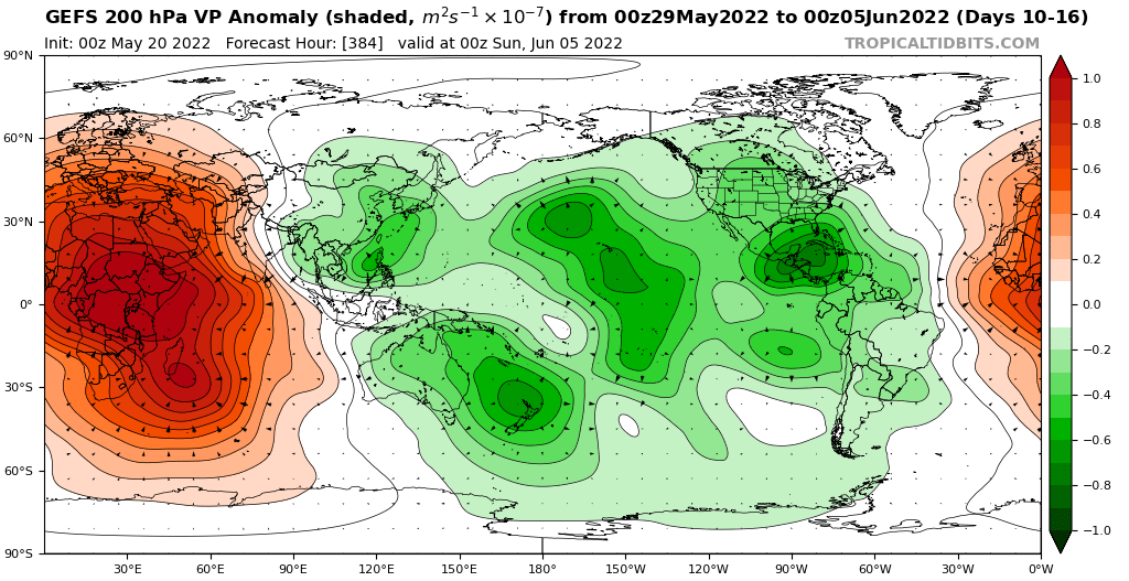
There is some indication another CAG event may spin up in around 10 days as a convection-enhancing upper-atmospheric wave crosses the Caribbean, and early June may thus be a potential timeframe to watch for early season development. But in the short- and medium-terms, there is nothing of concern in the Atlantic Basin.
Next report: WeatherTiger’s outlook for the 2022 hurricane season will be released Wednesday, May 25th. The first weekly column will be issued on June 1st to mark the official start of hurricane season, with daily weekday briefings for subscribers resuming June 2nd. Forecasts will be issued as necessary for the remainder of May.


