Hurricane Rafael Update for November 7th
Rafael is a rare November hurricane in the Gulf, but will not have significant impacts.
Florida and continental U.S. tropical threat synopsis: Peripheral showers from Rafael will wind down over the eastern Gulf Coast over the next day. No other threats or impacts.
Almanac: It’s Thursday, November 7th… day 159 of the 2024 hurricane season, 24 days to go. By total storm energy, the season is 95.7%, 99%, 97.8% complete for the Atlantic, continental U.S., and Florida, respectively.
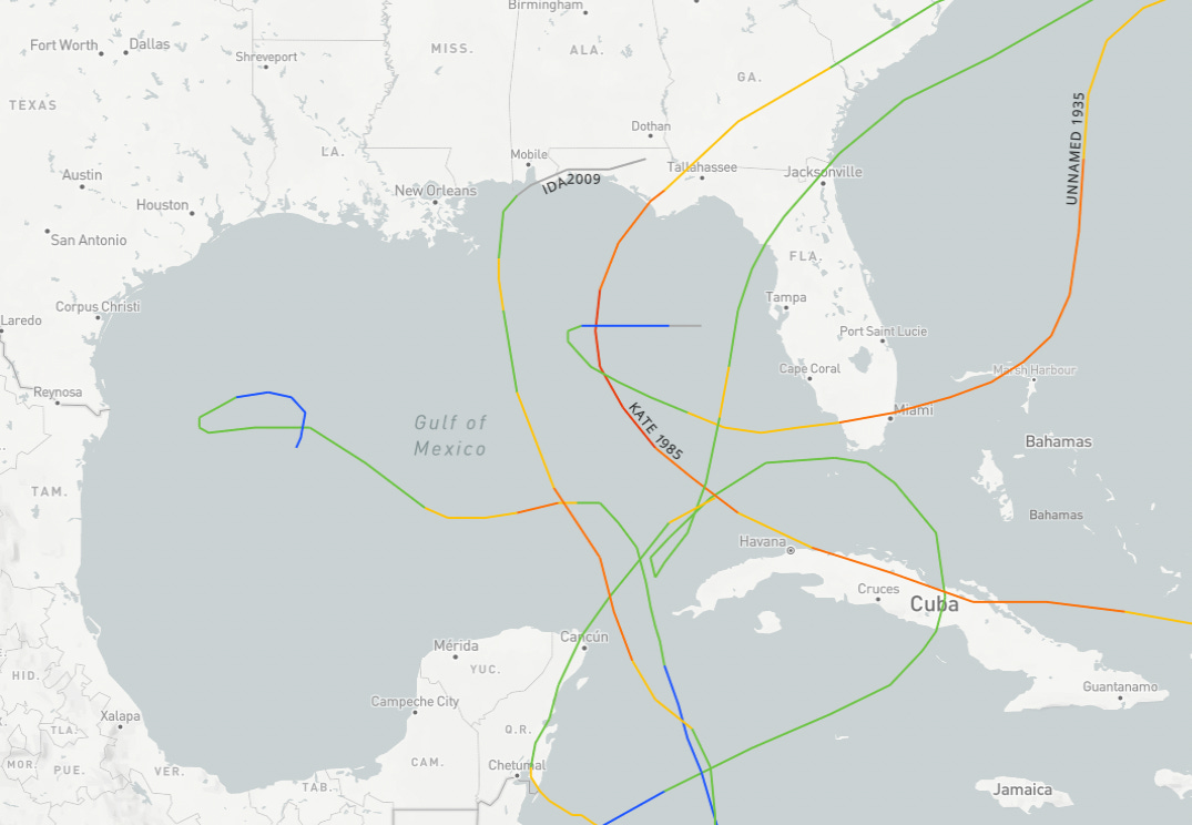
Last night, Rafael became just the seventh Gulf of Mexico November hurricane on record; while certainly not common, most of the other six moved generally north or northeast across the eastern Gulf. Rafael’s westward track (and anticlimactic fate) are only reminiscent of 1980’s Hurricane Jeanne, which spun down in the western Gulf.
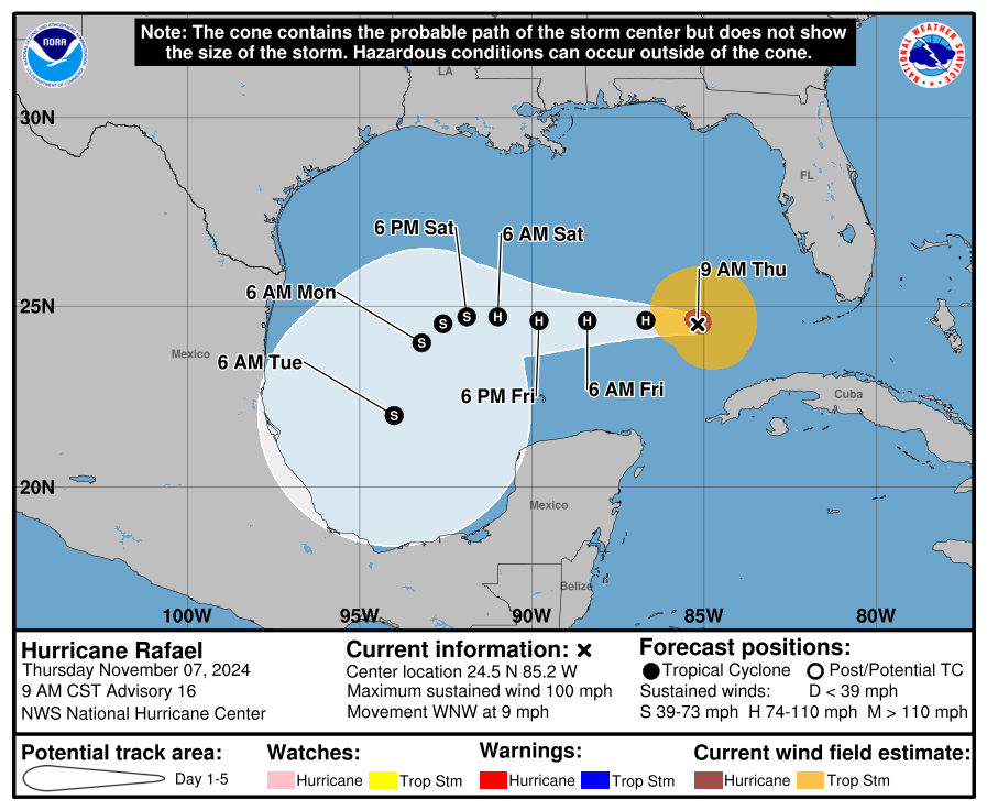
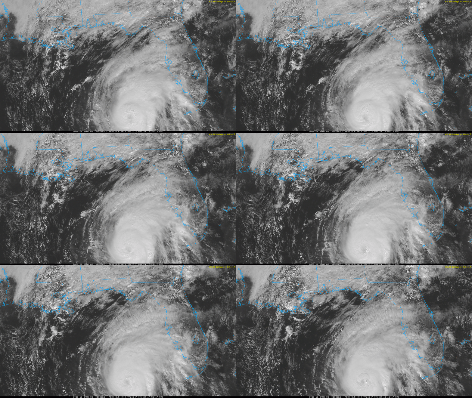
Active storms: Hurricane Rafael is moving a little north of west at about 10 across the southeastern Gulf this afternoon, still at Category 2 intensity with sustained winds of 100 mph. Rafael looks well-organized on satellite this afternoon and will likely hold on to its current strength before starting to weaken tomorrow as it moves over cooler sea surface temperatures and drier air starts to get pulled into the system.
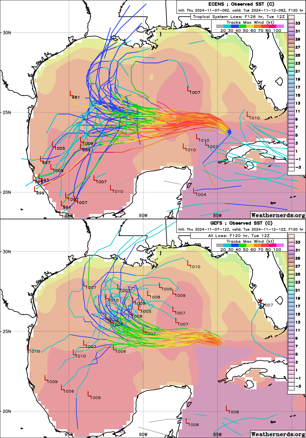
Rafael continues to be a tough track forecast over the weekend, though fortunately neither option puts the U.S. Gulf Coast at much, if any risk. After another couple of days of westward movement to the south of a Deep South ridge, steering currents will weaken and Rafael will slow down as it continues to weaken. If Rafael weakens more, it may follow the shallower steering currents north in the general direction of Louisiana; if it stays a bit stronger, a ridge over Mexico may bend its track southwest towards the Mexican Gulf Coast. In either case, Rafael will likely be reduced to a dry, low-level cloud swirl by early next week, with minimal on land. High wave action and onshore flow may drive some modest coastal flooding concerns in the central and western U.S. Gulf Coast over the weekend, but that’s about it.
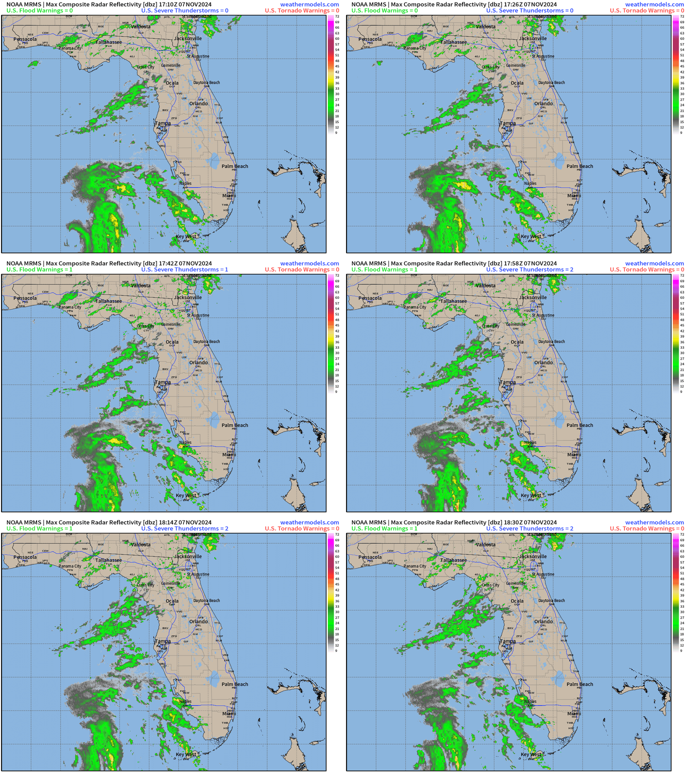
Otherwise, northern and west-central Florida plus the Keys are just seeing some scattered showers this afternoon. Wind gusts in the Keys peaked out in the 40-50 mph range last night on the periphery of Rafael, and these effects will be winding down soon. Bottom line is Rafael has successfully skirted Florida without being a big (or any) deal, which is a remarkable outcome given that almost every other late season hurricane in Rafael’s position has caused notable land impacts. Thank a Southeastern ridge— and the decades of hard-won progress in hurricane modeling and weather observation technology that mean we can accurately forecast storms like Rafael, and thus prevent costly and unnecessary stress, evacuations, closures, and preparations.
Disturbances in the NHC tropical weather outlook: The NHC still has a 20% chance of a brief depression forming in the next two days near Hispaniola. This ex-frontal low is sheared, and doesn’t look to organize further as environmental support for development further deteriorates as it moves west into the weekend.
Elsewhere: Still some ensemble support for a possible final round of Caribbean tropical activity slowly organizing from a tropical wave late next week. If this develops, deep eastern U.S. troughing would route it north and northeast well away from the U.S., so I don’t see it as a potential threat at this point.
And finally, mood music:
Next update: Next bulletin tomorrow. Once Rafael winds down, I’ll likely dial back the frequency of updates to Monday, Wednesday, and Friday of next week. Will take it as it comes and adjust as necessary.


Nice song, thanks for sharing.
Scorpio's Rule! you gonna sell a music service too?