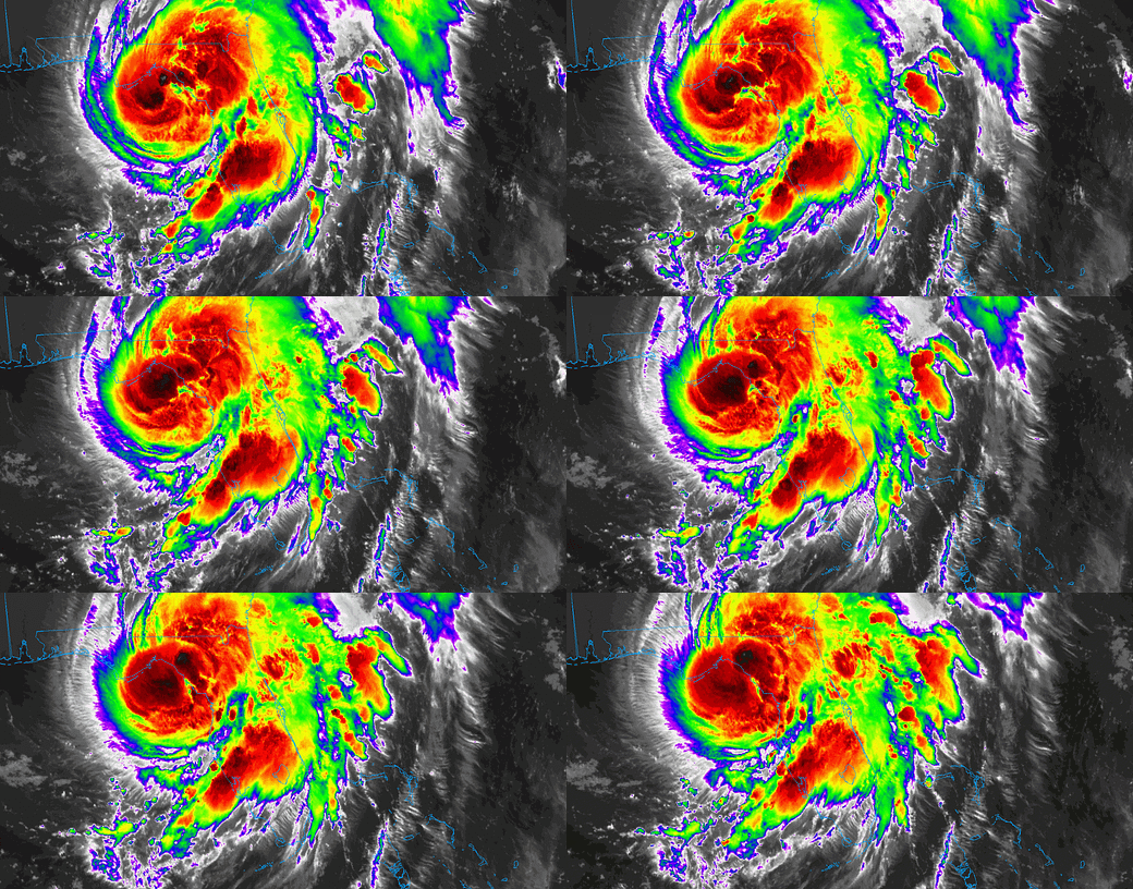
Hurricane Debby Morning Landfall Briefing for August 5th
Debby has made landfall in Florida's Big Bend as a hurricane. Here's the latest.
Sign up for WeatherTiger’s hurricane forecast newsletter by clicking here:
As of 7:00 a.m. this morning, Hurricane Debby has made landfall in eastern Taylor County in Florida’s Big Bend as a Category 1 hurricane with 80 mph sustained winds. Dangerous surge and wind is continuing in eastern Apalachee Bay and the Nature Coast and moving deeper into the Suwannee River Valley, though as expected the Capital Region is missing the worst of Debby. In general, landfall impacts are generally in line with last night’s forecast so far.
Debby’s landfall point in eastern Taylor County is just 5 miles west of the town of Steinhatchee. Remarkably, that's only about 10 miles southeast of where Category 3 Hurricane Idalia made landfall in Keaton Beach less than one year ago. As of the NHC’s 7 a.m. position update, Hurricane Debby is moving north-northeast at about 10 mph. On this track, Debby will move east of Perry in a few hours and cross between Live Oak and Madison early in the afternoon, before angling east-northeast towards the Georgia coastline on Tuesday.
Impacts on the eastern half of Florida’s Big Bend are peaking now. Flash flooding is a primary threat from Debby, and estimates of 4-8” rainfall totals through 6 a.m. are already widespread across west-central Florida, the Nature Coast, and the Big Bend, as shown below:
An additional 4-8” is possible inland over North Florida, but the coastal regions are already winding down their precip as drier air works into the southern side of Debby. Extreme rainfall totals in coastal Georgia and South Carolina are still ahead from tomorrow through Thursday, bringing high risks of flash flooding.
There’s not a lot of observing stations on this part of the coast, so on the ground data from the Big Bend is pretty sparse. Storm surge looks to have peaked in Cedar Key at about 5.5’ over baseline tide levels.
In terms of wind, again, there’s not much in the way of trustworthy reporting stations on the coast in Taylor and Dixie Counties. Cedar Key saw an overnight gust to 67 mph, and there are several unofficial gusts in the 60-65 mph range across inland Taylor and Lafayette Counties as the eyewall moves inland (see NWS peak wind gust map below). These areas will see the worst of what they’re going to get in the next couple hours. Heavy rain and wind gusts will continue farther northeast into NE Florida and SE Georgia into the evening. Gainesville has seen wind gusts into the mid 50s with these bands, so inland impacts are happening, at least east of the center.
West of the center in the Capital Region, wind impacts are generally modest, and will likely stay that way. Leon and Wakulla Counties are the western edge of Debby’s rain shield, and will see more of what you’re getting now over the next 3-4 hours, with rain tapering off in the afternoon in Tallahassee. Coastal wind gusts in western Apalachee Bay have been in the 50s, and so far Tallahassee Airport has seen a top gust of 39 mph. I wouldn’t expect to go much higher than that in Tallahassee, though some gusts into the low 40s are certainly possible in heavier bands. I’m seeing a couple of peak gusts to 41 mph on Leon County mesonet data.
Overall, Debby is another bullet dodged in Tallahassee, and another hard hit for eastern Apalachee Bay. Stay safe this morning, North Florida, and I’ll have continuing updates on WeatherTiger’s Facebook and Twitter through the day as conditions warrant.


![[Image of U.S. rainfall potential] [Image of U.S. rainfall potential]](https://substackcdn.com/image/fetch/w_1456,c_limit,f_auto,q_auto:good,fl_lossy/https%3A%2F%2Fsubstack-post-media.s3.amazonaws.com%2Fpublic%2Fimages%2F1749bc4e-1ee2-4872-9d33-4925ff1147e0_892x716.gif)


information is power, thanks Doc! lb
Great insight as always! Thank you!