Hurricane Beryl Landfall Update and Tropical Overview for July 9th
Beryl has made landfall in Texas this morning. Here's the latest on Beryl and the rest of the Tropical Atlantic.
U.S. tropical threat synopsis: Beryl has made landfall along the central Texas coast as a Category 1 hurricane this morning. Significant rain, surge, and wind impacts are ongoing in eastern Texas. No other U.S. tropical threats for the next 7-10 days.
Almanac: It’s Monday, July 8th… day 38 of the 2024 hurricane season, 145 days to go. By total storm energy, the season is 3.3%, 9.5%, and 8.3% complete for the Atlantic, continental U.S., and Florida, respectively.
Active storms: Hurricane Beryl became the first U.S. hurricane landfall of the 2024 season this morning, striking near Matagorda, Texas with sustained winds of 80 mph. Beryl still has 75 mph sustained winds as of the NHC 8 a.m. intermediate advisory, and is centered about 35 miles southwest of Houston, moving north at 10 miles per hour.
As expected, Beryl began to re-intensify significantly in its last few hours over water, and as typical of hurricanes that strengthen into landfall, is maintaining organization while moving over land. That is bringing some impressive inland wind gusts into the Houston metro area this morning, including a 71 mph gust at Hobby airport and 80 mph at an elevated helipad. Hurricane-force gusts also extended from Matagorda Bay to the Galveston area, including a peak gust of 92 mph east of Matagorda Bay. Dangerous wind gusts of 60-75 mph will continue to rake the Houston metro area through the morning hours as Beryl’s vigorous northeast quadrant moves through the region, as shown on radar above.
The other major impact from Beryl, as expected, is very heavy rainfall. MRMS data shown below already has areas between the southern half of the Houston metro area and the coast as picking up 6-8”+ of rainfall so far, with an even wider area of 3”+ totals. Flood and/or Flash Flood Warnings are in place for all of the Houston metro and much of the surrounding area this morning, as 1-2” per hour rain rates will continue through mid-morning with the inner bands and core of Beryl.
Beryl will accelerate a bit to the north, then northeast in the next day, which means that northeast Texas and western Arkansas will likely see 4-6” rain totals, with more like 1-3” for the southern Ohio Valley as Beryl’s remnants pull through tomorrow and Wednesday. Flash flooding potential will extend well inland into the Midwest with these rains.
Overall, Beryl is packing a wallop in Texas this morning and serious rain impacts will spread inland into the east-central U.S. over the next 48 hours— the final chapters of a two-week journey from West Africa to the Great Lakes, and one of the most remarkable and impactful early season hurricanes of all-time.
Other disturbances in the NHC tropical weather outlook: None.
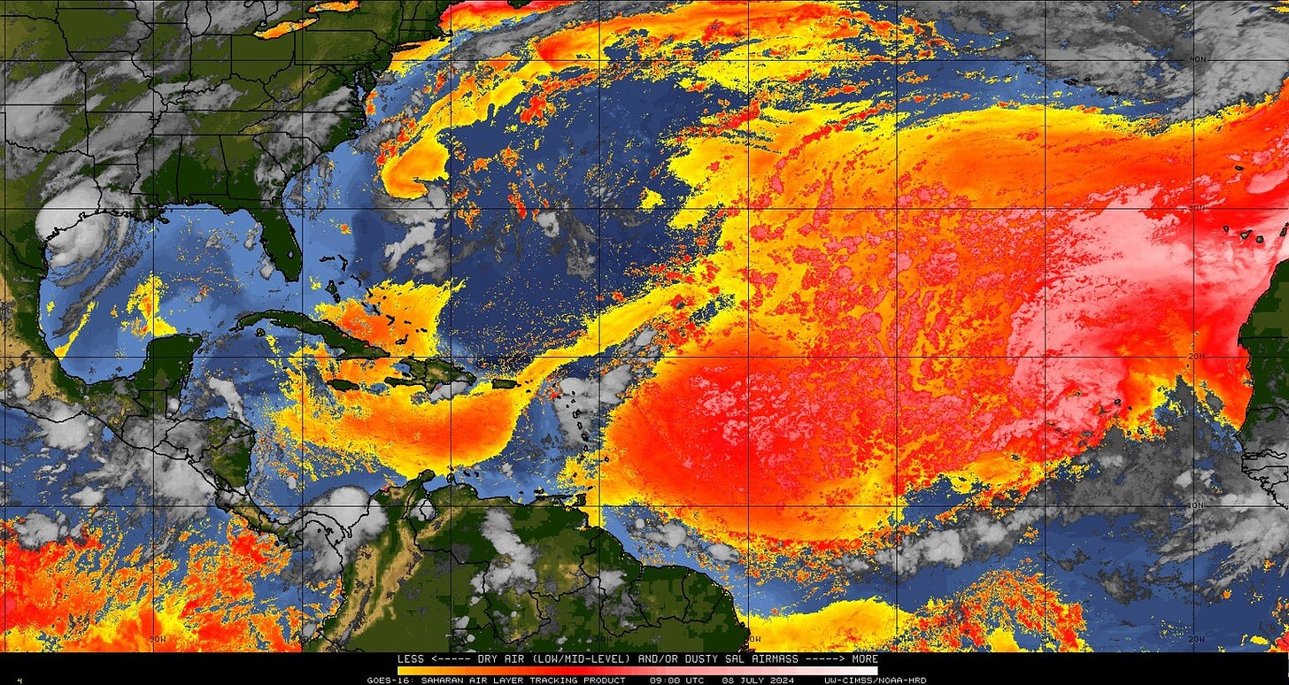
Elsewhere: Nothing of note. Dry and dusty air is over the Tropical Atlantic, which is very typical for mid-July. I don’t expect tropical development for at least 10 days and likely more than that. Tropical activity may pick back up again in the last week to 10 days of July.
Next update: I’m out on vacation this week and we could all use a little break post-Beryl, so updates this week will be Monday-Wednesday-Friday. Wednesday’s column will look at July hurricane climatology.


Thank you for letting us know it’s safe to move around for a couple of weeks 🙌🏽