


Holding Patterns: WeatherTiger's Hurricane Watch for June 8th
It's steady state as we keep an eye on the Gulf and Caribbean into next week.

Welcome to WeatherTiger’s Hurricane Watch! Each weekday we’ll have a tropical briefing bringing you that day’s hurricane history, a run-down of active storms, and a look at current development threats. Paid subscribers will receive these daily briefings and be able to comment and ask questions, as well as get our Thursday long-form analysis columns, daily forecasts and video discussions during hurricane threats, live landfall coverage, and expanded seasonal outlooks. Free subscribers will receive our weekly forecast column.
A free preview of our daily briefing will continue into June as we settle into our new Substack digs. Enjoy, and feel free to drop a line to ryan@weathertiger.com with any questions.

Almanac: Today is Tuesday, June 8th… day 8 of the 2021 hurricane season, 176 days to go. By total storm energy, the season is 1.1% complete as a whole, 1.8% complete for the continental U.S., and 2.2% complete for Florida. There are no U.S. landfalls on this date since 1851, one of only three June dates without a historical hit.
The distribution of U.S. landfalls in June is split between the first and second halves of the month. In the first half of the month, at left, the eastern Gulf is the most common target and landfall intensity tends to be modest. In the second half of the month, the western Gulf sees more landfalls (though the eastern Gulf still has some), and there are more hurricane hits on record. Something to keep in mind for the weeks ahead.
Active Storms: None.
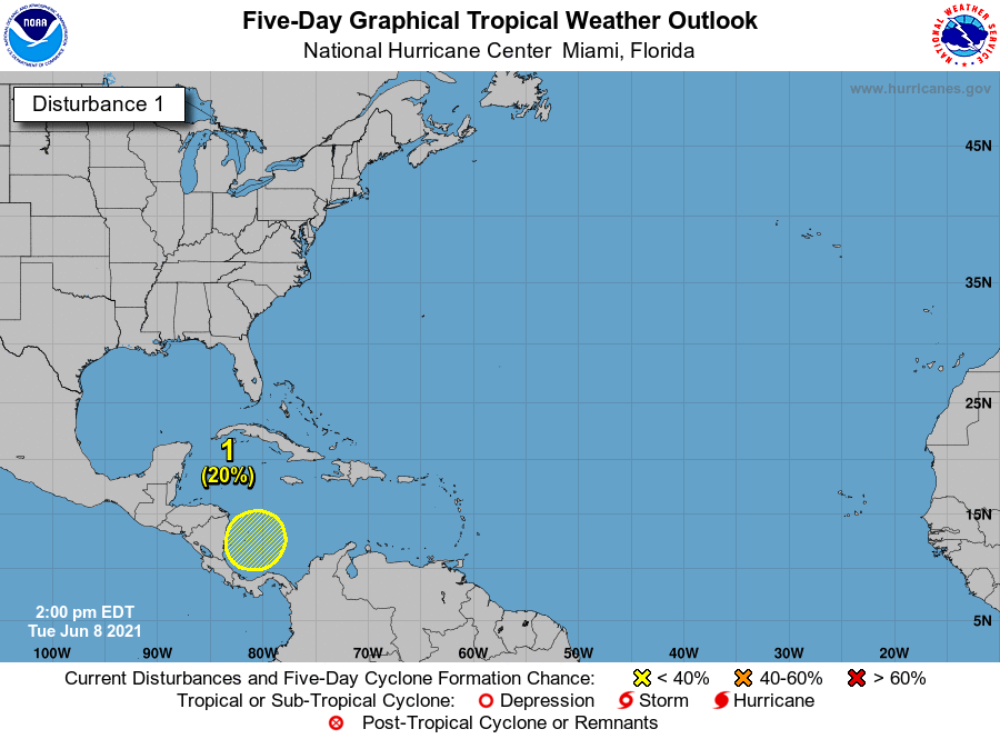
Current disturbances in NHC outlook:
Southwestern Caribbean (2-/5-day odds: 0/20%). Convection is ticking up today in the southern Caribbean as a tropical wave interacts with a general trough of low pressure over Central America and the eastern Pacific. Disorganized storminess is expected to linger in the western Caribbean into the weekend as a Central American gyre takes shape. However, Atlantic tropical development is unlikely in the next 5 days, as chances of tropical cyclone formation initially favored the Pacific side of Central America in 4-7 days.
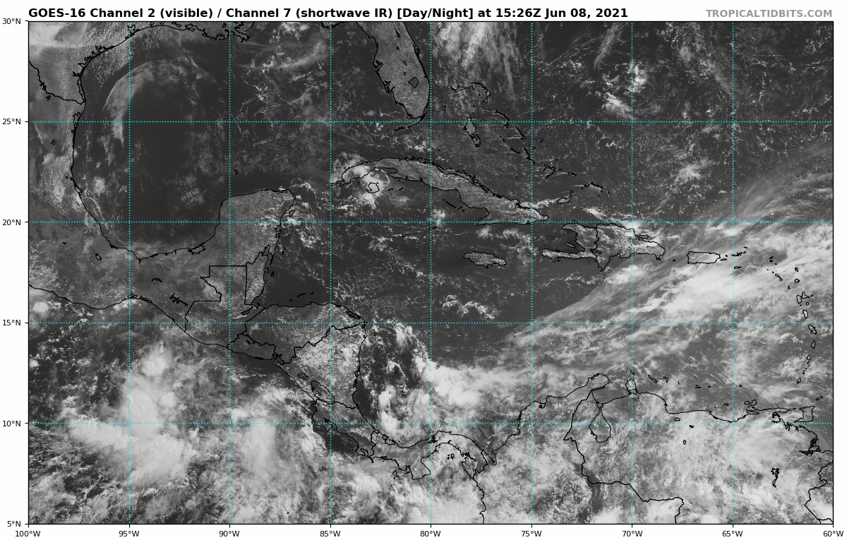
The pattern may improve for possible development in the southern Gulf or northwest Caribbean sometime in week 2 as more conducive upper-level winds shift east of Central America. It is far too early to try to tease out any specific track scenario, and model support remains inconsistent. The longer any possible development is delayed, however, the more risks would tend to shift towards the western Gulf, given both June climatology and the U.S. jet pattern beyond day 10.

Elsewhere: Quiet currently. It may be worth keeping an eye on a stalled front south of the Carolinas and east of Florida early next week, as this set-up sometimes can lead to slow development if the leftover trough lingers over the Gulf Steam long enough. In this case, the time before the next front will be short, so development odds are low.
Next report: Tomorrow’s daily briefing will be issued by 3 p.m., as usual.