Holding Patterns: Hurricane Watch for August 14th
Hurricane Ernesto is departing Puerto Rico for Bermuda and Atlantic Canada, and there are no other current threats.
Florida and continental U.S. tropical threat synopsis: No direct tropical threats to Florida or the continental U.S. in the next 7 days. East Coast beaches will see high surf, rip currents, and possible beach erosion in the Northeast from Ernesto.
Almanac: It’s Wednesday, August 14th… day 75 of the 2024 hurricane season, 108 days to go. By total storm energy, the season is 11.5%, 25.1%, and 17.9% complete for the Atlantic, continental U.S., and Florida, respectively. With Debby’s 5 ACE units and a total of 20-25 ACE probable from Ernesto, the 2024 season remains well ahead of climatological pace, clocking 4-5x the median ACE to date. Note, though, that in ACE terms, hurricane season is only about one-eighth done as of mid-August.
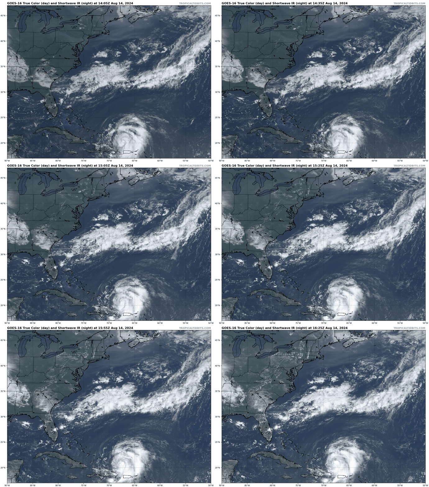
Active storms: Ernesto is now the third hurricane of the 2024 season, located about 200 miles northwest of San Juan as of Wednesday morning, with maximum sustained winds of 75 mph. Ernesto is moving northwest, away from land, at about 15 mph. A turn more northward and then northeastward over the next couple days is expected as a protective East Coast trough sweeps Ernesto out-to-sea; Ernesto is likely to pass near Bermuda in about three days, potentially as the season’s second major hurricane. It should turn post-tropical early next week on approach to Newfoundland, where it may be a wind, rain, and surge event in Atlantic Canada Monday or early Tuesday.
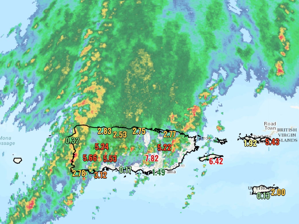
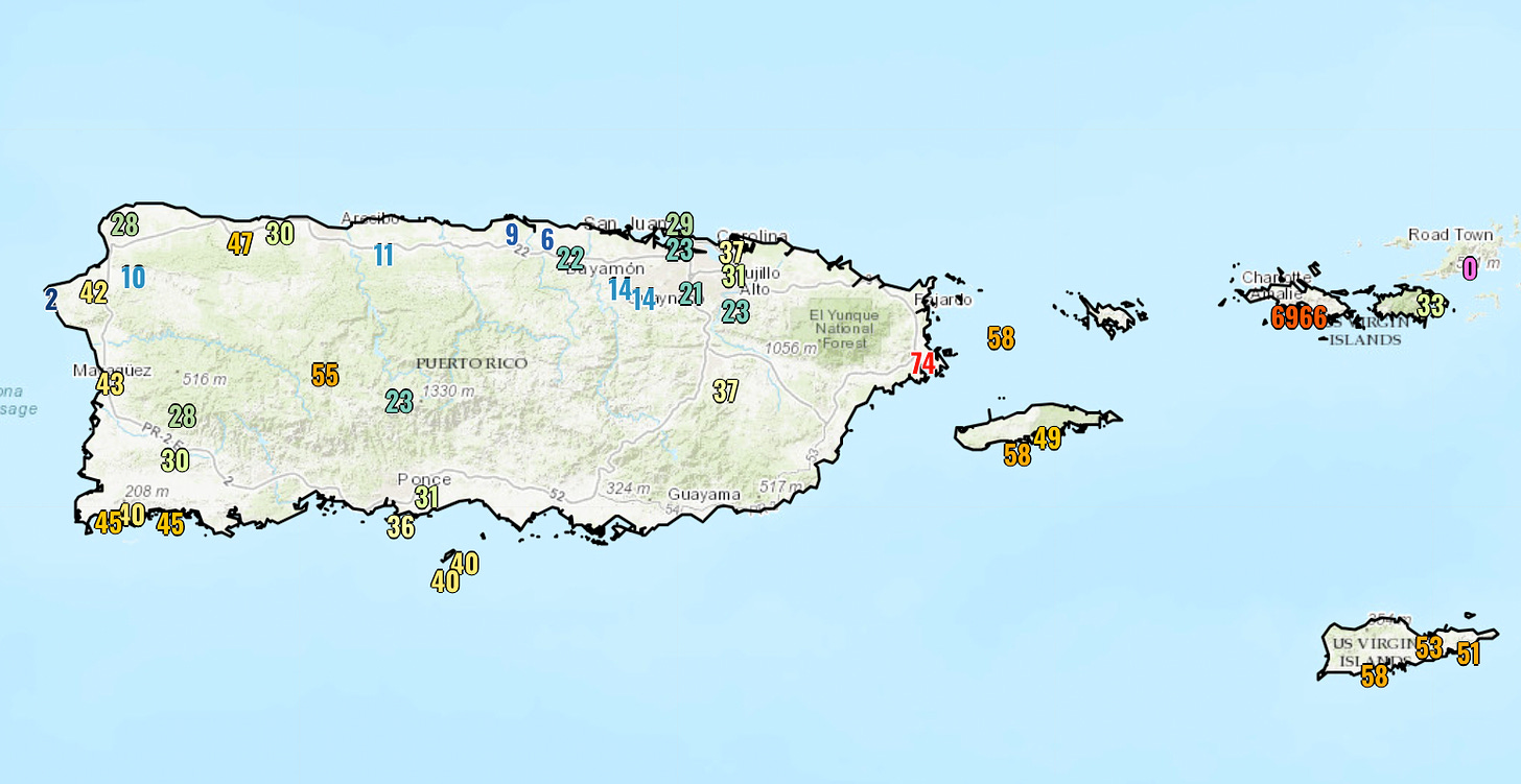
Ernesto’s impacts on Puerto Rico and the Virgin Islands were in line with expectations, and most severe by far in terms of flooding and mudslides. Rain totals so far have been on the order of 5-8” across southern and eastern Puerto Rico, with local amounts of up to 10” in the southeast. Flash Flood Warnings remain in effect over much of the island, and while the steadier rain is starting to wrap up, periodic heavy rainfall with southerly winds will persist through tomorrow and extend the threat. Winds in bands also reached 35-50 mph over most of Puerto Rico, with 55-75 mph gusts along the eastern coast and in the U.S. Virgin Islands.
Disturbances in the NHC tropical weather outlook: None.
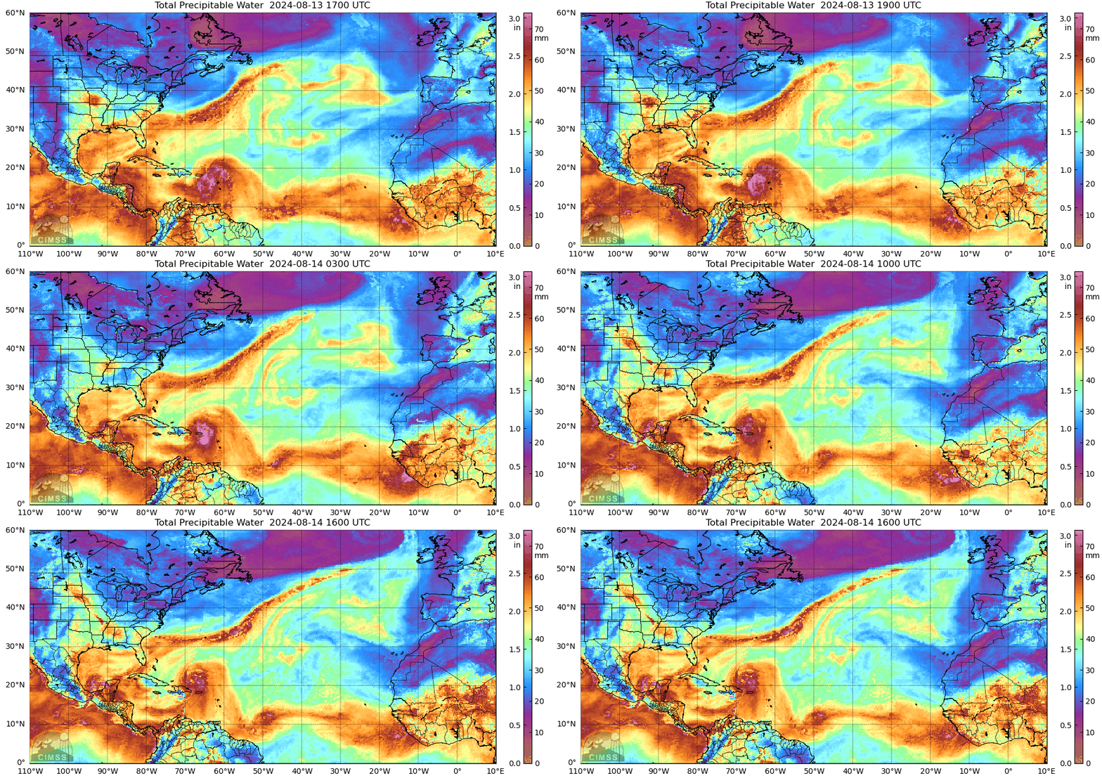
Elsewhere: No real change in the Tropical Atlantic, in which robust tropical waves are rolling off the African coast every few days, but at a fairly high latitude that results in pulling drier, stable mid-latitude airmasses into their circulation envelope pretty quickly after hitting water. All models are in pretty good agreement on this pattern holding steady for another week, while the Intertropical Convergence Zone remains farther north than normal.
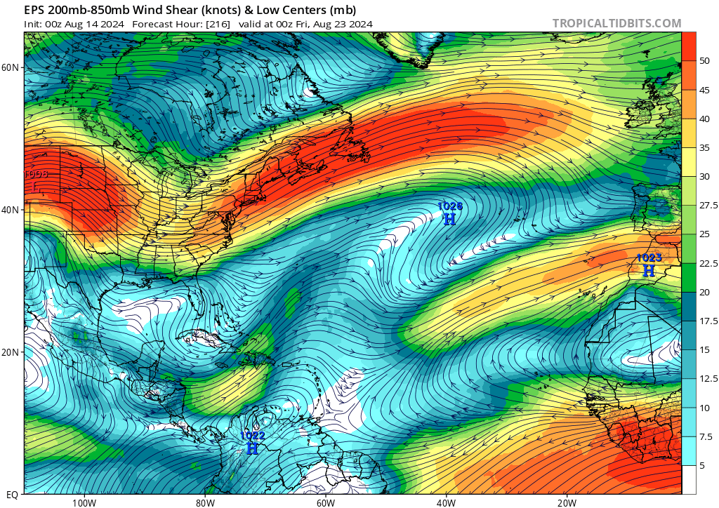
We’re good for the next week, in other words. In the following week, all models suggest a low shear regime over the Main Development Region, and most are now also starting to suggest that tropical waves by 10 day will be hitting the water at a lower latitude. That may set up a very active pattern at long range, but at this point that doesn’t look likely to develop in earnest until the final week of August. In the meantime, we’ll take that win of keeping attention on Ernesto.
Next update: Tomorrow morning. I will have a seasonal outlook update focused on landfall risks and steering heading into the peak season on Friday.


