Henri Ennui: WeatherTiger's Weekly Column for August 19th
Henri may spread significant wind, surge, and rain to the Northeast U.S. this weekend.
WeatherTiger’s weekly Thursday column is provided free to all subscribers. To get our complete storm coverage, upgrade to premium for as little as $8 to get daily forecast briefings, in-depth forecasts and videos during Florida hurricane threats, live landfall coverage, expanded seasonal outlooks, and the ability to comment and ask questions. Click below to sign up below now, or to share the Hurricane Watch with your friends and family.
Florida threat synopsis (column starts below): No immediate threats to Florida over the next 5-7 days. A tropical wave approaches Florida from the east by the middle of next week, but no suggestions of anything other than rain chances at this point.
Conveniently for meteorologists in search of a framing device, the phrase “what’s past is prologue” originates in The Tempest. And indeed, the tempests of hurricane season occurring before the beautyberries turn purple essentially do amount to an extended prologue: since 1900, around 80% of Florida’s historical hurricane activity occurs after August 20th.
That is not to say the slings and arrows of the 2021 hurricane season, including this week’s Tropical Storm Fred, have not been Shakespearean. Fred’s second act over the Gulf of Mexico saw a late intensification to a strong tropical storm with 65 mph sustained winds prior to Monday afternoon landfall south of Port St. Joe in the central portion of the Florida Panhandle.
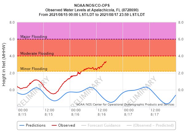
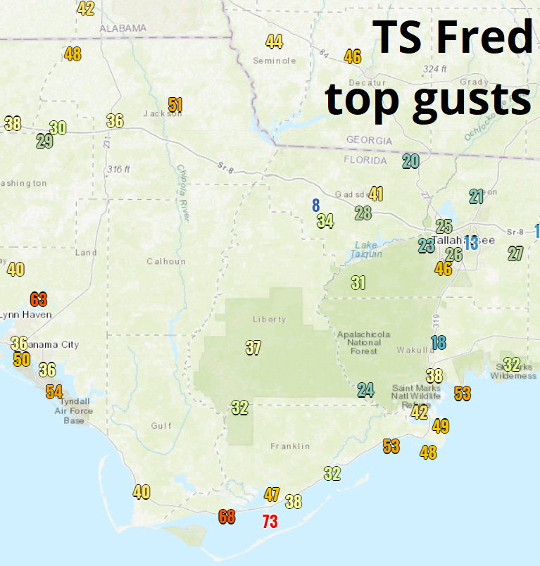
Fred’s packed punch was most keenly felt on the Forgotten Coast between Panama City Beach and Bald Point, where wind gusts peaked out between 60 to 75 mph and storm surge, highest in western Apalachee Bay, exceeded 4.5 feet. Low tide was fortuitously timed near maximum surge, but even so, localized coastal flooding occurred in Bay, Gulf, and Franklin Counties.
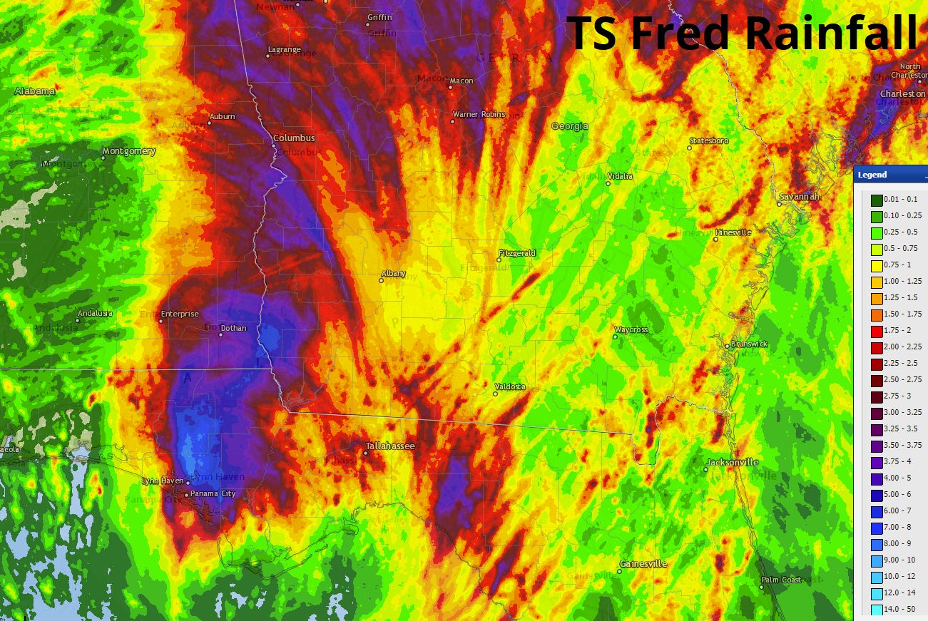
Inland impacts were more measured, though still considerable. Winds gusted to 55 mph in Marianna and 46 mph in Tallahassee and Bainbridge, with rain accumulations of 5-10” along the track of Fred’s center and widespread 2-4” totals further east into the Big Bend. Fred also caused significant flooding in the mountains of western North Carolina as it moved north and merged with a front.
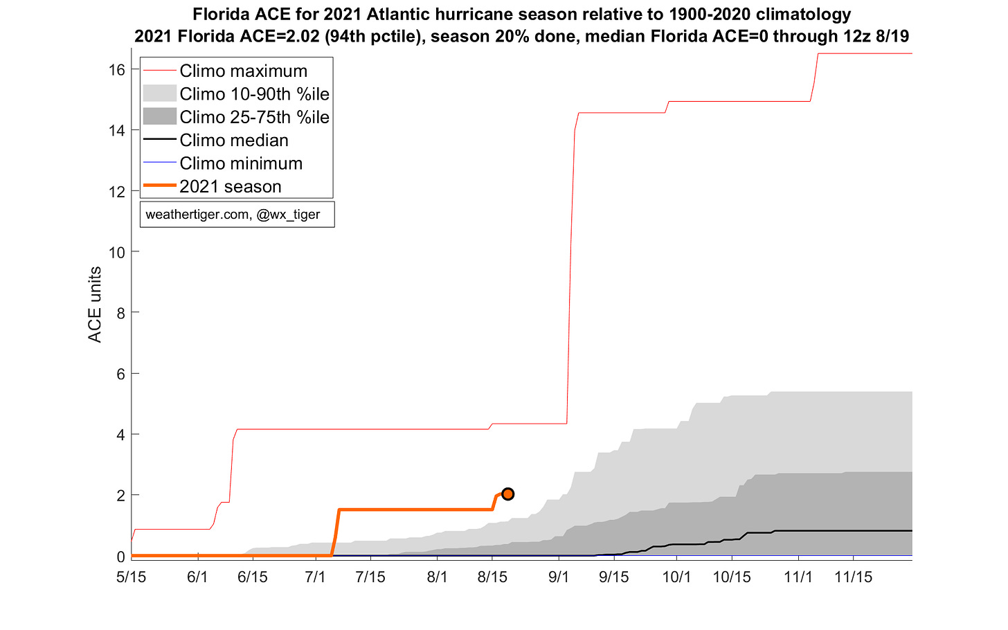
Tallying the intensity and duration of Elsa and Fred’s landfalls, the first 20% of Florida’s hurricane season has been unusually busy—more active than about 19 of every 20 years since 1900. The Atlantic has been more active than about four out of every five years through the first two-thirds of August.
The historical curve gets steep from here. If Florida’s hurricane season were to be divided into quarters of roughly equal landfall activity, the first quarter would run from mid-May to August 27th. The entire second quarter would be crammed into just two weeks from August 28th to September 10th.
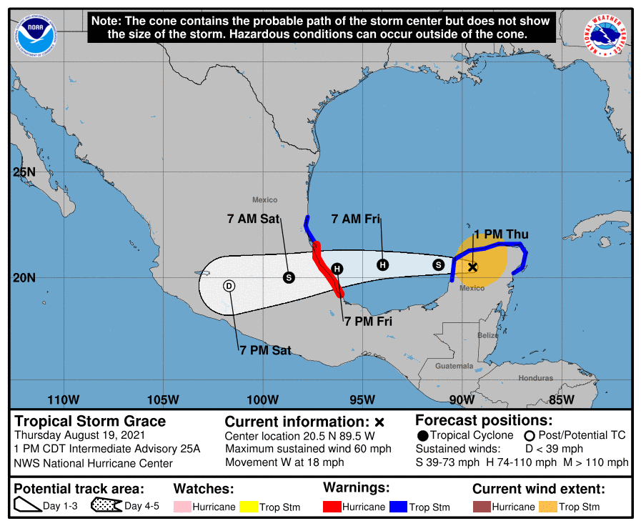
The good news is while the Atlantic is active as this climatological five-pound bag approaches, there are no threats to Florida over the next five to seven days. Hurricane Grace struck the Yucatan peninsula as a Category 1 on Thursday morning, and will continue west for a second landfall on the south-central Mexican Gulf Coast late Friday. No U.S. impacts will occur from Grace other than rip current-enhancing southerly swells along the Gulf Coast through the weekend.
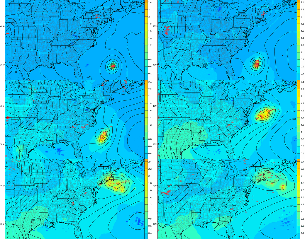
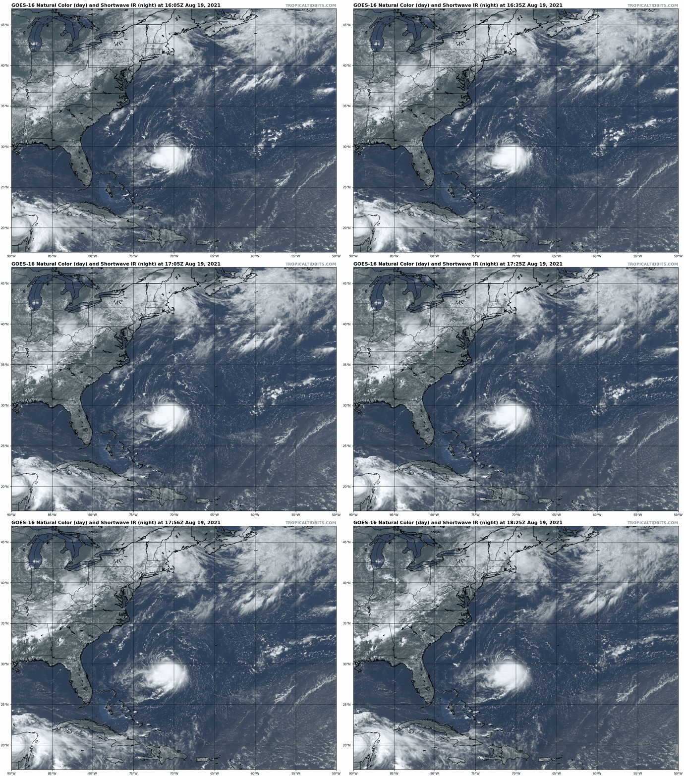
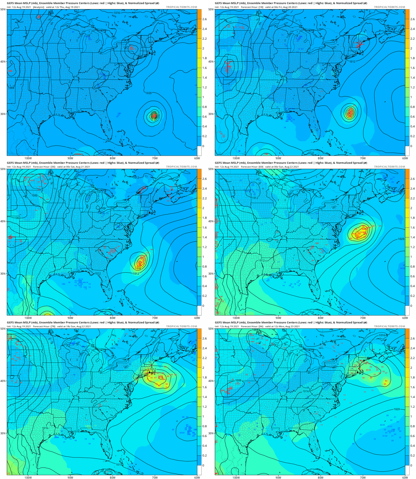
The more concerning U.S. threat comes from Tropical Storm Henri, located halfway between Bermuda and the Bahamas. Fortunately, Henri is no threat to Kokomo (off the Florida Keys), but rather will be shipping up to Boston; look for an eastern U.S. trough to turn the storm north Friday and Saturday as well as providing favorable outflow for likely intensification to hurricane strength, potentially major.
Depending on Henri’s interaction with the trough, late this weekend the hurricane will either pass close enough to New England to bring some significant coastal wind, surge, and rain, or make landfall in the Long Island to Cape Cod range. Landfall would be a rare event, as it has been 30 years since Bob, the last true New England hurricane. However, ocean temperatures near the northeastern U.S. are three to five degrees above normal, which may slow Henri’s expected Sunday weakening enough to allow such a thing to happen. The northern mid-Atlantic and New England need to take this threat seriously.
Elsewhere, there are no immediate threats for development over the next five days behind Grace and Henri. The next feature to monitor is a tropical wave approaching Florida from the east around the middle of next week, but there are no suggestions of anything other than enhanced rain chances at this point. There are indications that enhanced outflow will move back into the Tropical Atlantic in 7-10 days, setting up another uptick in tropical activity around the tail end of August or start of September—just as Florida’s second quarter of hurricane season begins.
Overall, history shows that this is the time of year that hurricane threats can develop quickly, so stay nimble despite the quiet short-term outlook. If the past is prologue, then Tropical Storm Fred plus pandemics, geopolitical chaos, and the botched selection of the next host of Jeopardy! all indicate more trouble ahead. After all, there’s nothing more Shakespearean than The Globe burning down. Keep watching the skies.
Next update: Paid subscribers will receive a daily briefing tomorrow.

