


Full Starburst: WeatherTiger's Hurricane Watch for June 14th
The Atlantic is unusually active for mid-June this fine Monday morning.

Welcome to WeatherTiger’s Hurricane Watch! Each weekday we’ll have a tropical briefing bringing you that day’s hurricane history, a run-down of active storms, and a look at current development threats. Paid subscribers will receive these daily briefings and be able to comment and ask questions, as well as get our Thursday long-form analysis columns, daily forecasts and video discussions during hurricane threats, live landfall coverage, and expanded seasonal outlooks. Free subscribers will receive our weekly forecast column and selected storm coverage.
A free preview of our daily briefing will continue into June as we settle into our new Substack digs. Enjoy, and feel free to drop a line to ryan@weathertiger.com with any questions.
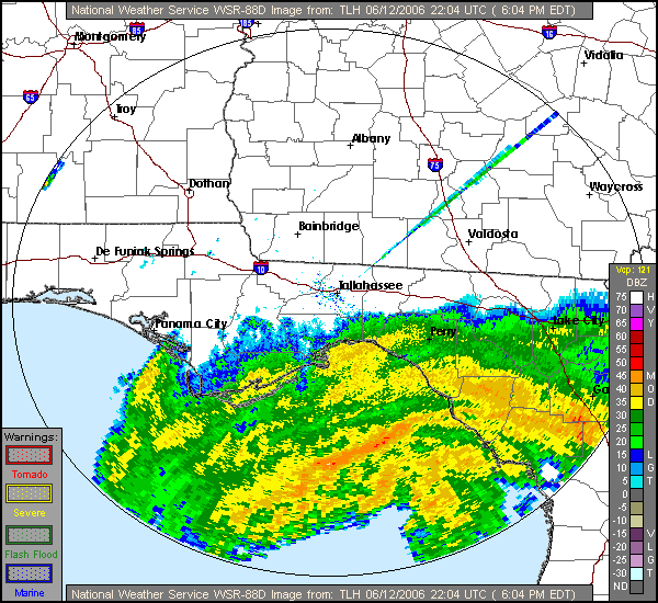
Almanac: Today is Monday, June 14th… day 14 of the 2021 hurricane season, 170 days to go. By total storm energy, the season is 1.4% complete as a whole, 2.9% complete for the continental U.S., and 4.3% complete for Florida. A tropical storm made landfall as a near-hurricane in Louisiana on this date in 1912; more recently, Tropical Storm Alberto brought heavy rain as it came ashore in Florida’s Big Bend on June 13, 2006, along with some moderate storm surge in—where else—Steinhatchee and vicinity.
Active Storms: None. As you can see below, the NHC tropical weather outlook has gone full Starburst (lemon, orange, cherry) this morning, so that may change soon.

Current disturbances in NHC outlook:
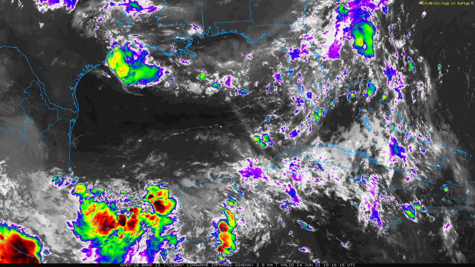
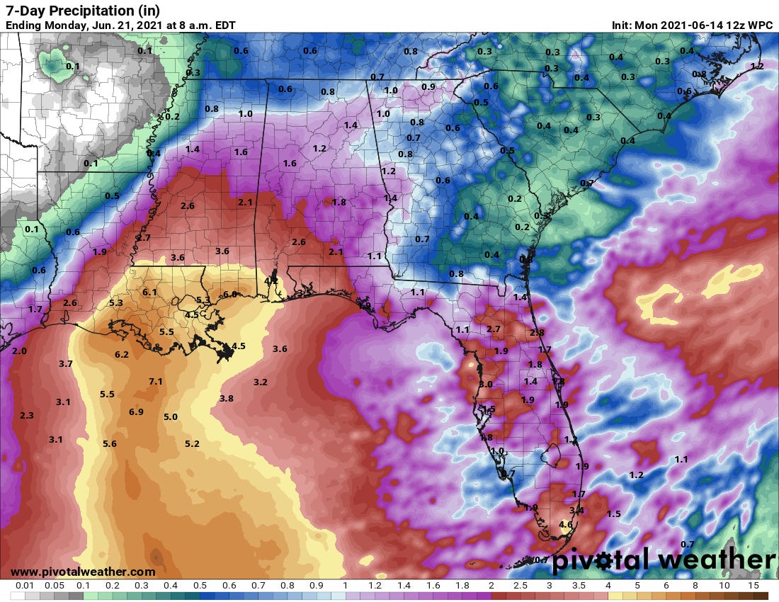
Invest 92L/Gulf (2-/5-day odds: 20/60%). The Gulf system being monitored last week has become a little better organized over the weekend, with a small circulation forming in the far southwestern corner of the Gulf of Mexico. With its companion disturbance in the eastern Pacific not getting better organized, there is more opportunity here for slow organization in the Gulf over the next 3-5 days. Invest 92L should move slowly and erratically through Thursday before the whole mess begins to lift north across the western Gulf into the weekend.

As this occurs, upper-level winds will support the development of a broad and loosely organized low-end tropical storm. However, persistent SW shear of 20+ knots means convection will be mostly displaced east of the center, and upside intensity potential should be limited. As is common in mid-June, look for a good chance of a sloppy, rain-making, low-end tropical storm to impact the central or western Gulf Coast this weekend. As shown below, this scenario would bring heavy rainfall to portions of Louisiana that absolutely do not need it, so flood potential is the key risk here. Stay tuned.

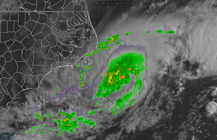
Invest 93L/Outer Banks (2-/5-day odds: 70/70%): An area of low pressure along a stalled front moved over the warm Gulf Stream waters overnight, resulting in a dramatic increase of convection near the center of circulation. While this low is still connected to a front, it also appears that Invest 93L will track northeast along 25-27C SSTs for the next day or two. Given its appearance this morning, it is more likely than not that it will briefly obtain subtropical or tropical characteristics and steal the name Bill in that timeframe.
This system is not a threat and will move northeast into the open Atlantic, away from land.
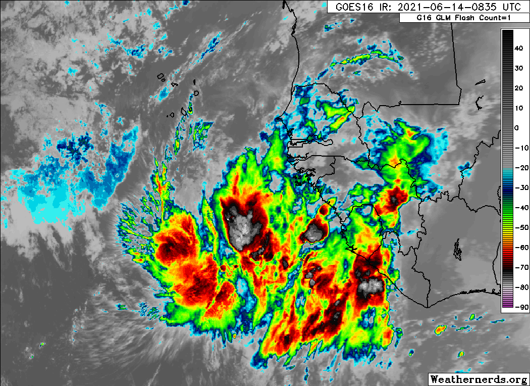
Eastern Atlantic (2-/5-day odds: 10/20%): A tropical wave just emerging from Africa is unusually well-organized for June, despite African easterly waves almost never develop east of the Lesser Antilles until July. The Main Development Region is actually cooler than normal right now, so despite its impressive appearance this morning, convection should wane over the next few days and development is unlikely. It is worth keeping an eye on this wave when it reaches the Caribbean/western Atlantic in 8-10 days.


Elsewhere: That about covers it.
Next report: The next daily briefing will be issued by 3 p.m. Tuesday.