Every New Beginning: The Hurricane Watch for June 1st
Hurricane Season 2023 gets off to a rolling start with a chance of Gulf development.
Happy first day of hurricane season! Free subscribers, please enjoy this sample of WeatherTiger’s daily tropical bulletins, just one of the many benefits of becoming a paid supporter of the Hurricane Watch. Sign up here to receive these forecasts all year.
Florida tropical threat synopsis: An area of low pressure in the NE Gulf is better organized this morning and may become a depression or weak named storm in the next day. This system will slide south away from Florida tomorrow, and increased rain chances through the weekend for Central and South Florida will be the only impact.
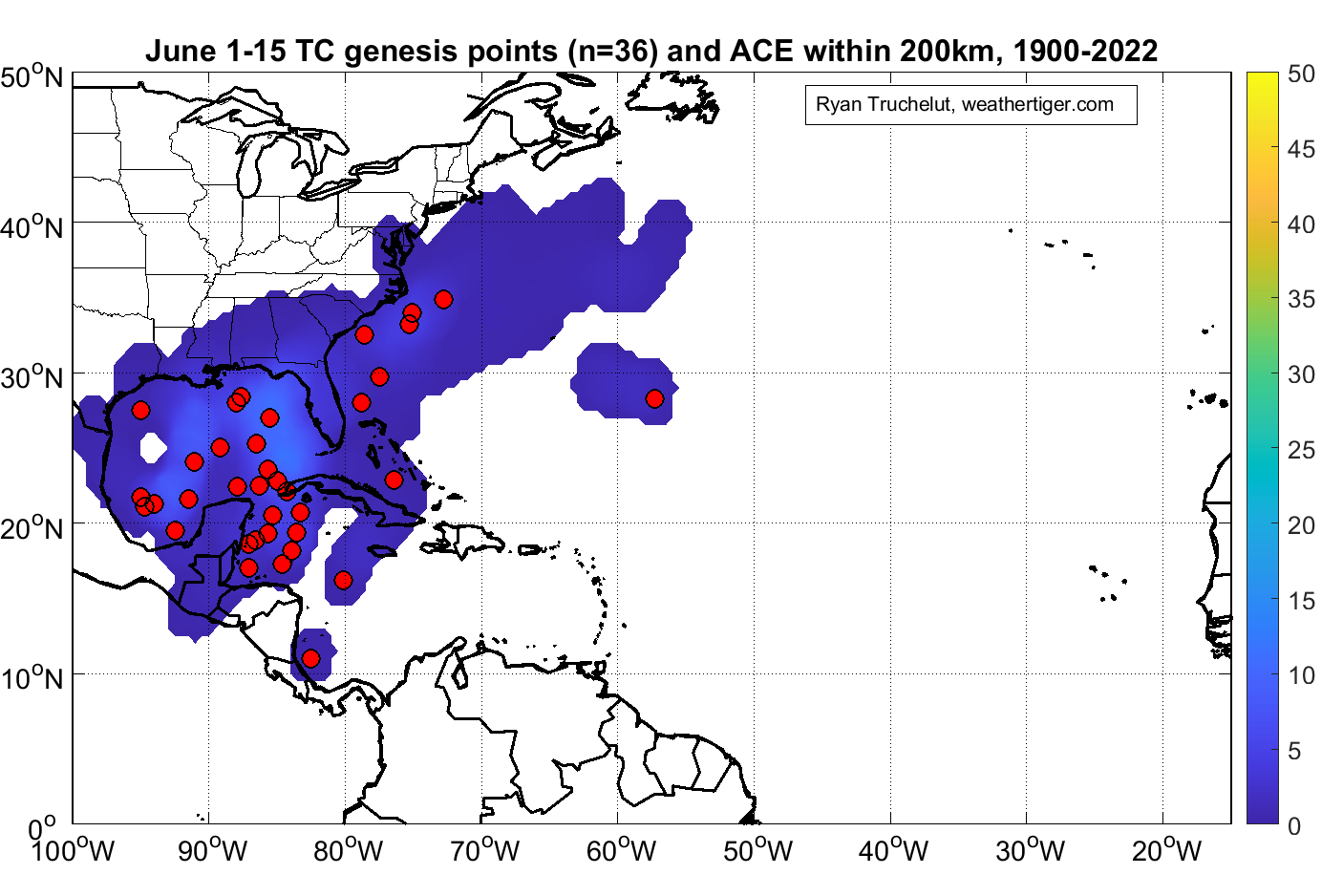
Almanac: It’s Thursday, June 1st… day 1 of the 2023 hurricane season, with a mere 182 more days to go. By total storm energy, the season is 0.6%, 0.8%, and 0.6% complete for the Atlantic, continental U.S., and Florida, respectively. In the first half of June, a named storm develops in about 30% of hurricane seasons, with the Gulf, western Caribbean, and southwestern Atlantic the favored areas for formation.
Active Storms: None.
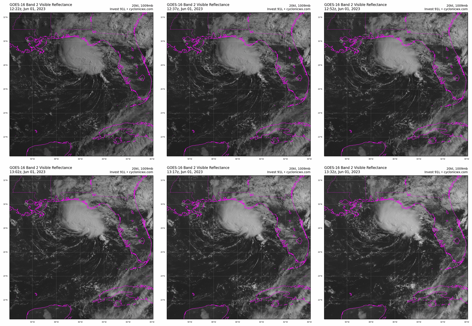
Other Disturbances in NHC outlook, with 2-/7-day NHC development odds: Happy Hurricane Season 2023! One of you must not have set out a gallon of distilled water and a 96-pack of Kirkland Signature AAA batteries for the cyclone imp on Hurricane Season Eve, because Invest 91L has gotten better organized in the NE Gulf.
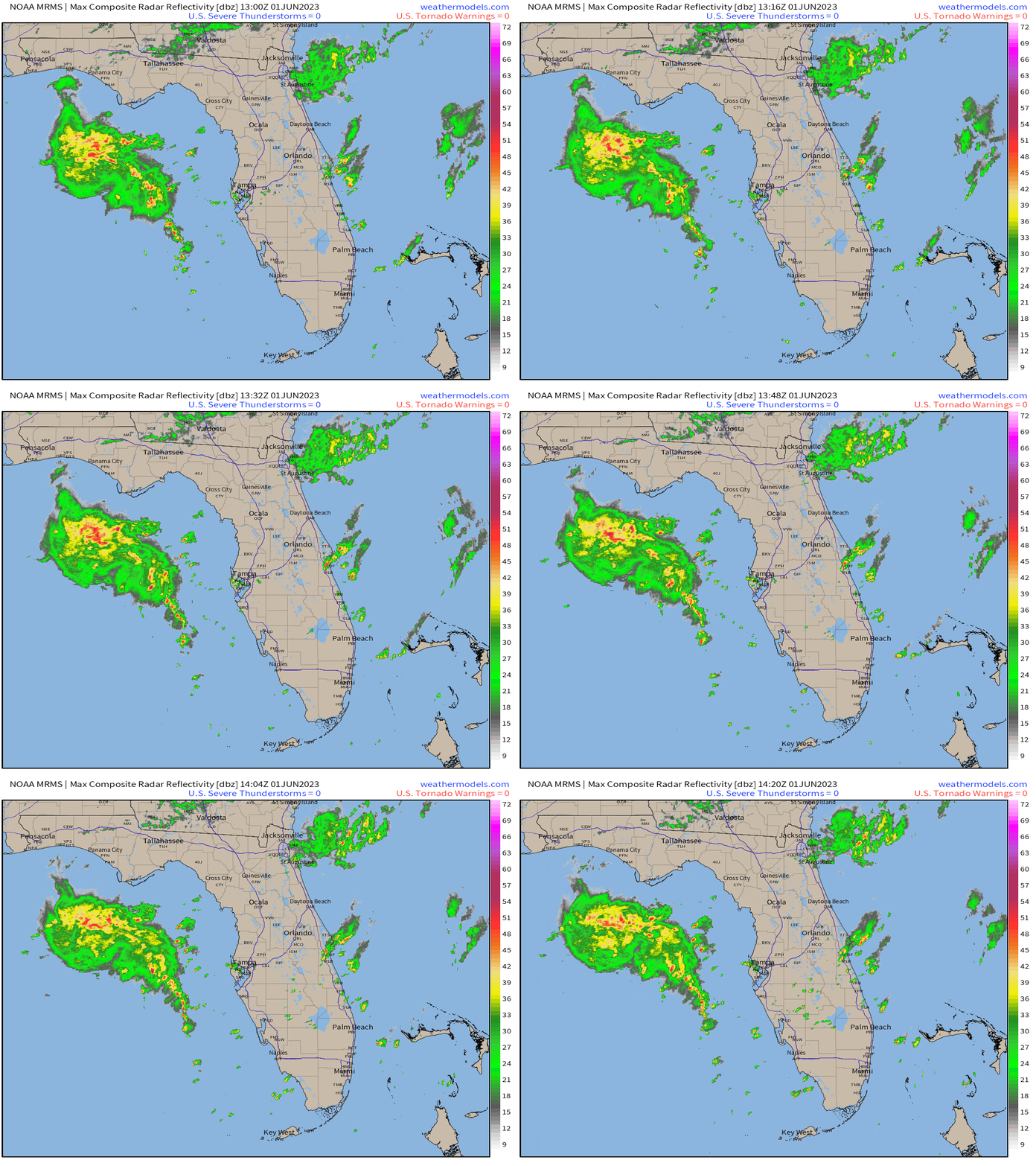
Despite 20 to 30 knots of wind shear and a dry airmass to its south and west, 91L is generating some impressive convection north and east of an apparent circulation center this morning approximately 150 miles south of Destin. Buoy observations show falling pressures in the Gulf and wind gusts east of the center of around 35 mph. A Hurricane Hunter airplane will be investigating the system this afternoon to determine if a tropical or subtropical cyclone has developed; based on satellite and radar imagery, it won’t take much additional organization to earn a number or name (Arlene). The NHC has a 50% chance of development over the next 2 days.
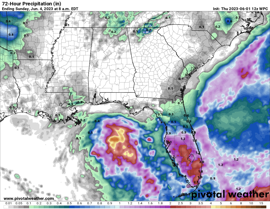
As of late morning, most of the rainfall associated with 91L is over the Gulf, with just a few scattered showers elsewhere across Florida. Enhanced rainfall over the state for the next three days, associated with deep tropical moisture to the east of 91L, will be the primary impact of this system whether or not it develops. Daily storm chances will be elevated south of I-4, where 1-3” of rainfall is likely through the weekend, with only hit-or-miss showers and breezy conditions along the coast in North Florida.
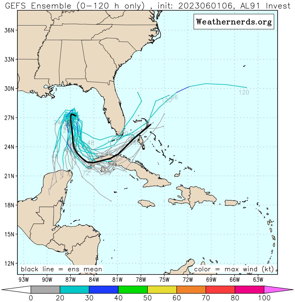
Despite the proximity of 91L, the system is not a wind or even a landfall threat for Florida. A powerful ridge of high pressure developing over the Great Lakes will push 91L south starting tomorrow, with whatever is left of the low turning east this weekend across the NW Caribbean or Florida Straits. Dry air is likely to overspread the circulation late tomorrow and Saturday and weaken 91L, so the development window is probably the next 36 hours or so.
Overall, 91L may get the 2023 Hurricane Season off to an early start, but it is not a major threat to Florida— just a rainmaker for the southern half of the peninsula.
Elsewhere: Nothing else of note in the Atlantic, Caribbean, or Gulf.
Next report: Next daily bulletin for supporters out tomorrow afternoon; the first weekly column of the year will be released on Monday.


