Doing the Twists: The Hurricane Watch for June 27th
A tropical wave in the Tropical Atlantic is showing signs of getting better organized, and may well be a tropical storm when it reaches the Lesser Antilles on Monday.
Florida tropical threat synopsis: There remain no threats to Florida over the next 7 days, with all tropical activity remaining far south of the continental U.S. during that time.
Almanac: It’s Thursday, June 27th… day 27 of the 2024 hurricane season, 156 days to go. By total storm energy, the season is 2.3%, 6.3%, and 6.3% complete for the Atlantic, continental U.S., and Florida, respectively.
Today is the 67th anniversary of the only June major hurricane strike in the continental U.S. on record, 1957’s Category 3 Hurricane Audrey. Making landfall on the Texas-Louisiana border, Audrey rapidly intensified overnight in the hours before reaching shore, and thus caught the Gulf Coast by surprise with its ferocity. Audrey is a destructive and deadly storm, likely responsible for 500 or more storm surge deaths.
Active storms: None.
Disturbances in the NHC tropical weather outlook:
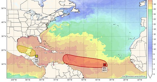
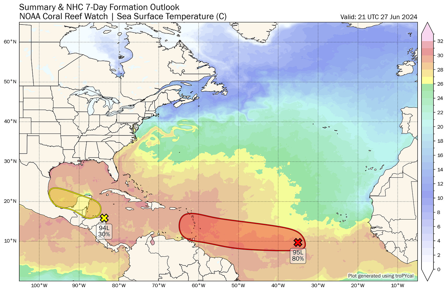
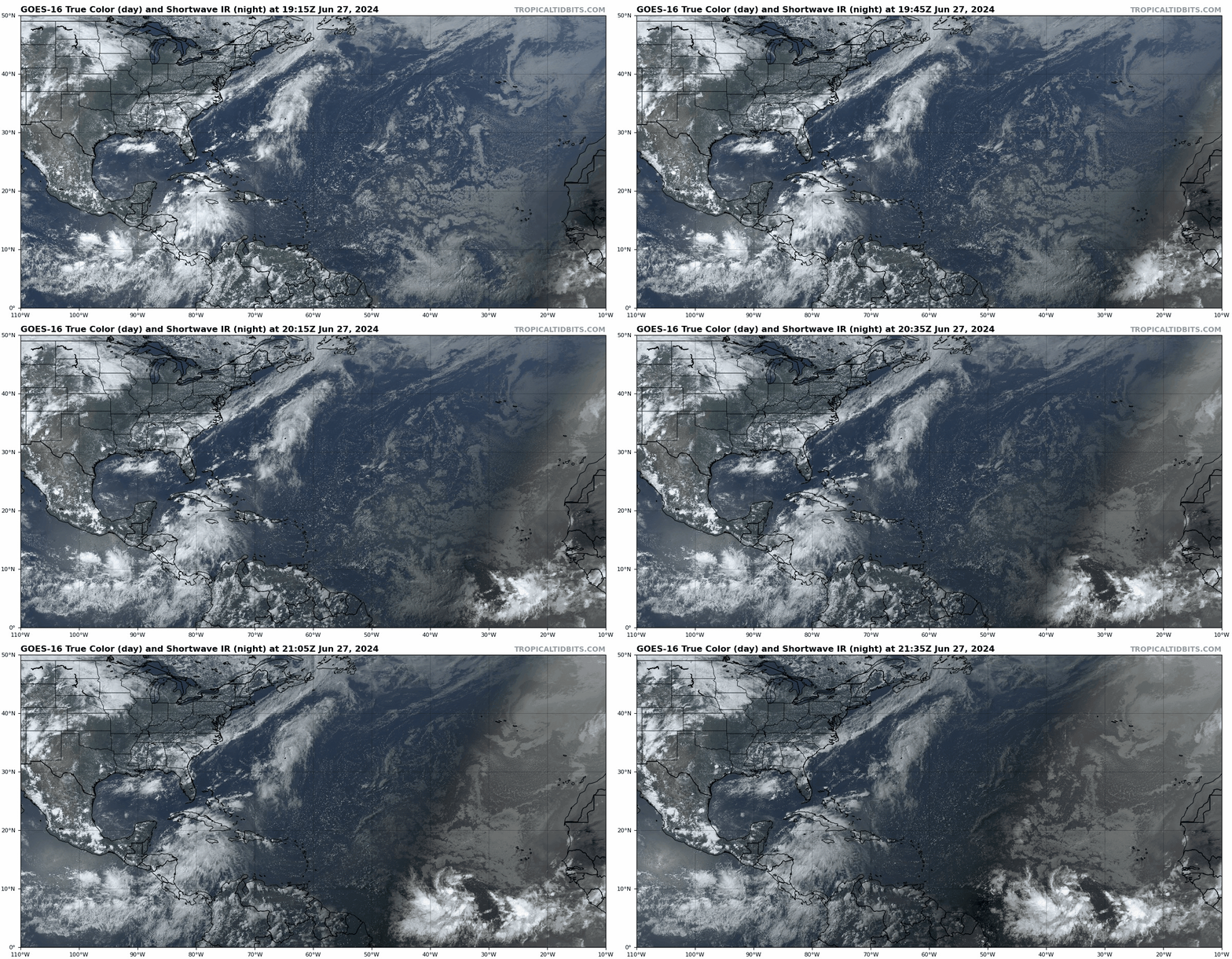
Invest 94L in the western Caribbean is flaring up this afternoon as it approaches Central America and moves into a region of diverging winds in the upper atmosphere, which promote deep convection. Some mid-level twists are evident on satellite within this roiling cloud mass, but no lower-level organization is evident. Land interaction with Central America will likely prevent development tomorrow, but there remains a narrow window for a tropical depression to possibly form in the far southwestern Gulf late Saturday or early Sunday before 94L hustles into the Mexican Gulf Coast. Still no U.S. impacts expected. NHC has this at a 10% chance of development within two days, and 30% overall.
Invest 95L in the Central Tropical Atlantic remains the star of the show today, with multiple disparate twists embedded Chubby Checker-style within a broad circulation mostly south of 10N between 35W and 40W. Invest 95L appears to be firing some new convection in the center of its envelope of rotation this, signaling that its multiple vorticity maxima are beginning to merge. This indicates that the development of a tropical depression is probable within the next 24-48 hours, as most models now suggest. The NHC concurs, giving 2- and 7-day development odds of 60% and 80%, respectively.
The prognosis for this one hasn’t changed all that much in the last day. A tropical storm is likely to develop over the weekend east of the Lesser Antilles as 95L moves west into a pocket of very favorable outflow and anomalously warm water temperatures in the mid-80s, with a peak at low-end hurricane intensity not out of the question as it approaches the islands on Monday. Models have backed off since yesterday on some of the wackier solutions in which a stronger storm turns north earlier, and there is now decent consensus on a track through the Windward Islands and into the eastern Caribbean. With brisk trade winds, 95L will probably zip west or west-northwestward through the Caribbean midweek; models suggest that the system will not dissipate, but nor is it likely to strengthen further. The Gulf Coast ridging I discussed yesterday is holding firm on today’s guidance (see below), so Caribbean steering winds remain mostly east-to-west, and 95L will most likely approach the Yucatan peninsula or Central America in 7-9 days. Bottom line, 95L is certainly a threat to the southern Lesser Antilles, but there is no credible risk to Puerto Rico or the continental U.S. at this time.
Elsewhere: A tropical wave south of the Cape Verde islands has rolled off the African coast with respectable convection and circulation in tow, and like 95L is embedded in an unusually favorable environment for late June. I’m a little surprised the NHC hasn’t tagged this one with a requisite 0/20% yet, but that’s probably coming soon. The fate of this wave is tied to what happens with 95L; if 95L gets stronger, this wave is close enough that 95L’s outflow will cause shear over it and reduce its development odds. If 95L is weaker, it has a better shot of becoming a depression as it continues west, as shown by a minority ensemble members. Long time to monitor this wave, but interests in the Lesser Antilles should be aware that 95L might not be the last tropical system to watch in the upcoming week.
Next update: Daily update tomorrow afternoon.


