


Cyclon-ish: WeatherTiger's Weekly Column for September 8th
Tropical Storm Mindy will cross North Florida with ample rain over the next 12-24 hours.

WeatherTiger’s weekly column is provided free to all subscribers. To get our complete storm coverage, upgrade to premium for as little as $8 to get daily forecast briefings, in-depth forecasts and videos during U.S. hurricane threats, live landfall coverage, expanded seasonal outlooks, and the ability to comment and ask questions. Click below to sign up below now, or to share the Hurricane Watch with your friends and family.
Florida threat synopsis (column starts below): Tropical Storm Mindy will cross North Florida overnight into early tomorrow will be a rainmaker to the tune of 1-3” north of Orlando, whether or not it briefly becomes a depression or weak tropical storm. There are no other short or long range tropical threats to Florida otherwise at this time.

In the second week of September, climatology says about 2% of the total storm energy for the entire Atlantic hurricane season is expected to occur each day. Historically, Florida’s landfall risks also reach their seasonal apogee this week. In fact, some of the worst major hurricane strikes in the state’s history— Hurricanes Donna (1960), Dora (1964), Betsy (1965), and Irma (2017)—all made landfall on the same date, September 10.
Fortunately, this September 10 will cut against the grain of both the 2021 hurricane season, and 2021 generally. While there is no threat of significant hurricane activity for the U.S. coastline over the next week or more, short-fused Tropical Storm Mindy is bringing enhanced rainfall and localized flood potential to North Florida through Friday.
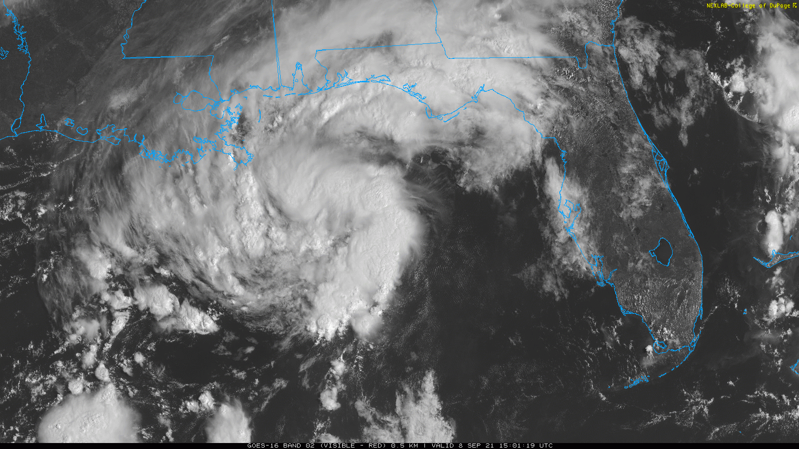
Mindy has developed quickly on approach to the Panhandle from a cluster of showers and thunderstorms associated with an area of surface low pressure. As of the National Hurricane Center’s initial 5 p.m. Wednesday advisory, Mindy has sustained winds of 40 mph, mainly in bands east of the center. The storm is being hustled quickly east-northeast at around 20 mph by a deep upper-level trough extending south from the Great Lakes.
Ample tropical moisture is streaming into the Southeastern U.S. ahead of Mindy, and intermittent moderate to heavy rainfall began Wednesday morning over much of the Florida Panhandle. With limited time over the Gulf, don’t expect much additional strengthening before Mindy crosses the North Florida coast in the vicinity of Cape San Blas overnight into early Thursday.

Tropical Storm Warnings are in effect from Mexico Beach to Steinhatchee, where low-end tropical storm force gusts along the immediate coast are possible, but Mindy is not an inland wind threat.
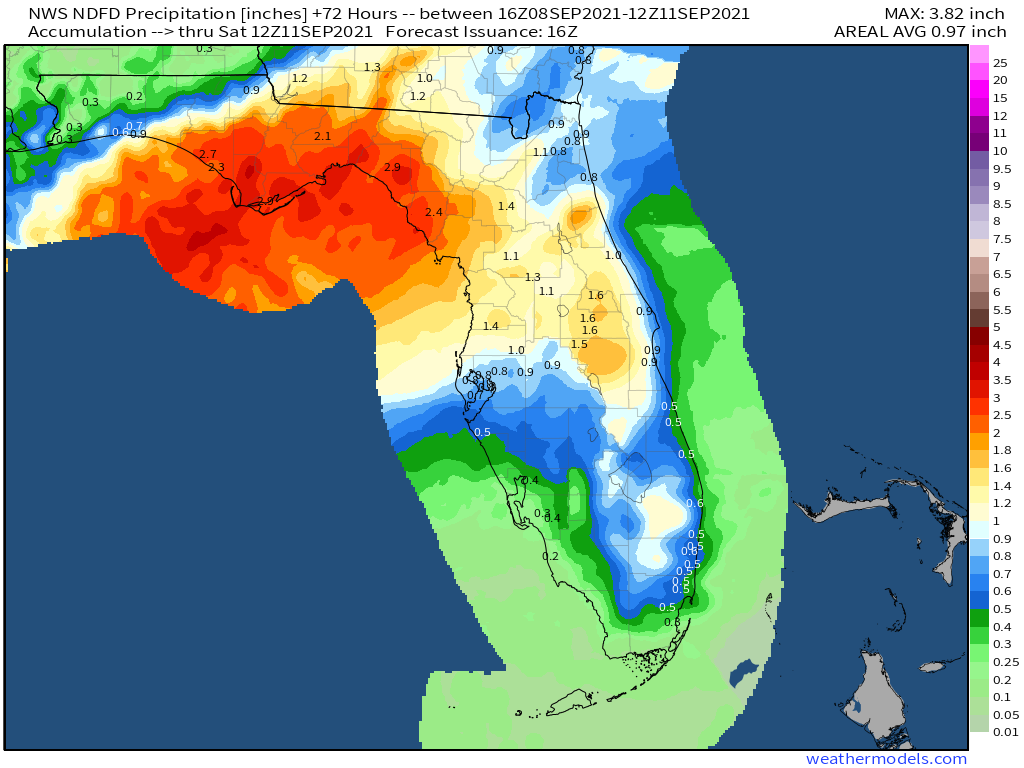
The key forecast impact of Mindy remains the same as when it was a disturbance: heavy rainfall. Look for widespread storm totals of 1-3” across the Panhandle and north central Florida, with isolated totals to 5” causing localized flood issues. A Flash Flood Watch is in effect for Florida’s coastal counties between roughly Fort Walton Beach and Cedar Key, where soils are saturated after recent rain from Fred and Ida.

The heaviest rainfall from this system will clear the western Panhandle east to Tallahassee by sunrise on Thursday, and push through the remainder of the eastern Big Bend and north central Florida by early Thursday afternoon as the center of Mindy moves east-northeast into the Atlantic. Some modest re-strengthening is possible as it moves away from land into the weekend.
During the day on Thursday, North Florida can expect just passing wraparound shower chances and vaguely breezy conditions before a drier airmass moves in for Friday. Heavier rain chances will persist in central Florida into the weekend to the south of a front. In summary, Tropical Storm Mindy is something to be aware of for flood-prone areas, but a mere tropical irritant for most in North Florida.
Elsewhere in the Atlantic, there are no other threats to the U.S. on the immediate horizon. Long-lived, large, lumbering Larry provided the punmasters writing the NHC forecast headlines with ample alliterative opportunities this week as it turned north into the open central Atlantic. After five days as a major hurricane, Larry is now a Category 2 and will pass well east of Bermuda on Thursday before clipping Atlantic Canada as it transitions into a non-tropical storm system Friday into Saturday.
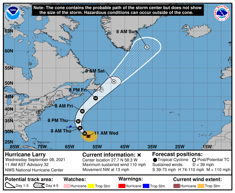
Overall, Larry is my favorite kind of hurricane: predictable and nice to look at, while harming few to none. Stay safe if you partake of Larry’s gnar wave action along the U.S. East Coast this weekend—don’t do anything Matthew McConaughey wouldn’t do. Words to live by.
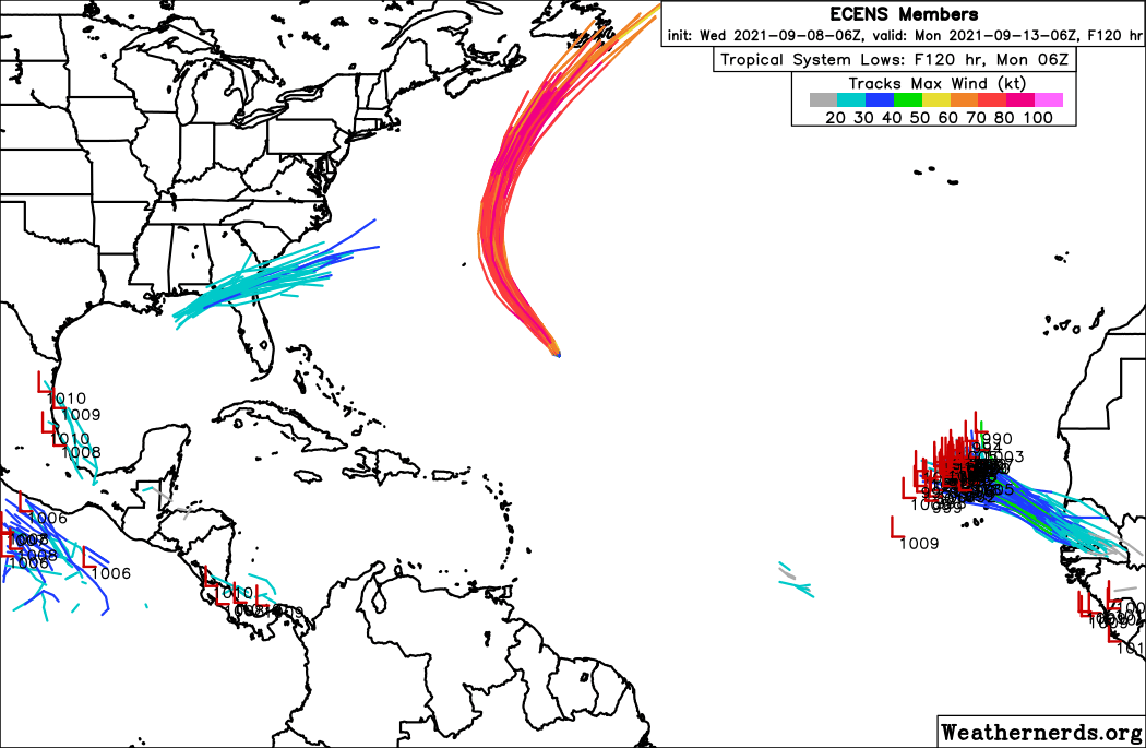
Otherwise, the Atlantic is quiet. There is some chance of development with a tropical wave emerging from the West African coast in three days, but this disturbance is likely to turn north into the open eastern Atlantic by early next week so U.S. concerns are negligible. It’s worth keeping an eye on the far western Gulf of Mexico over the weekend for a slight chance of a quick spin-up, but the most likely outcome there is a disorganized moisture surge into Texas in five to seven days.
The peak of the peak of hurricane season is often as tricky to negotiate as the summit of the Matterhorn, or, in terms a youth might find relevant, a mountain of milk crates. Fortunately for our tenuous collective sanity, 2021 has eschewed the violent path of Roland Emmerich and brought only some tropical downpours this week. Enjoy it while it lasts, as a developing La Nina and a robust pool of warm water in the western Atlantic augur a fall relapse. Back next week with an outlook for the final third of the Atlantic hurricane season; in the meantime, keep watching the skies.
Next update: Paid subscribers will receive a daily briefing tomorrow.