


Crack a Window: WeatherTiger's Hurricane Watch for September 15th
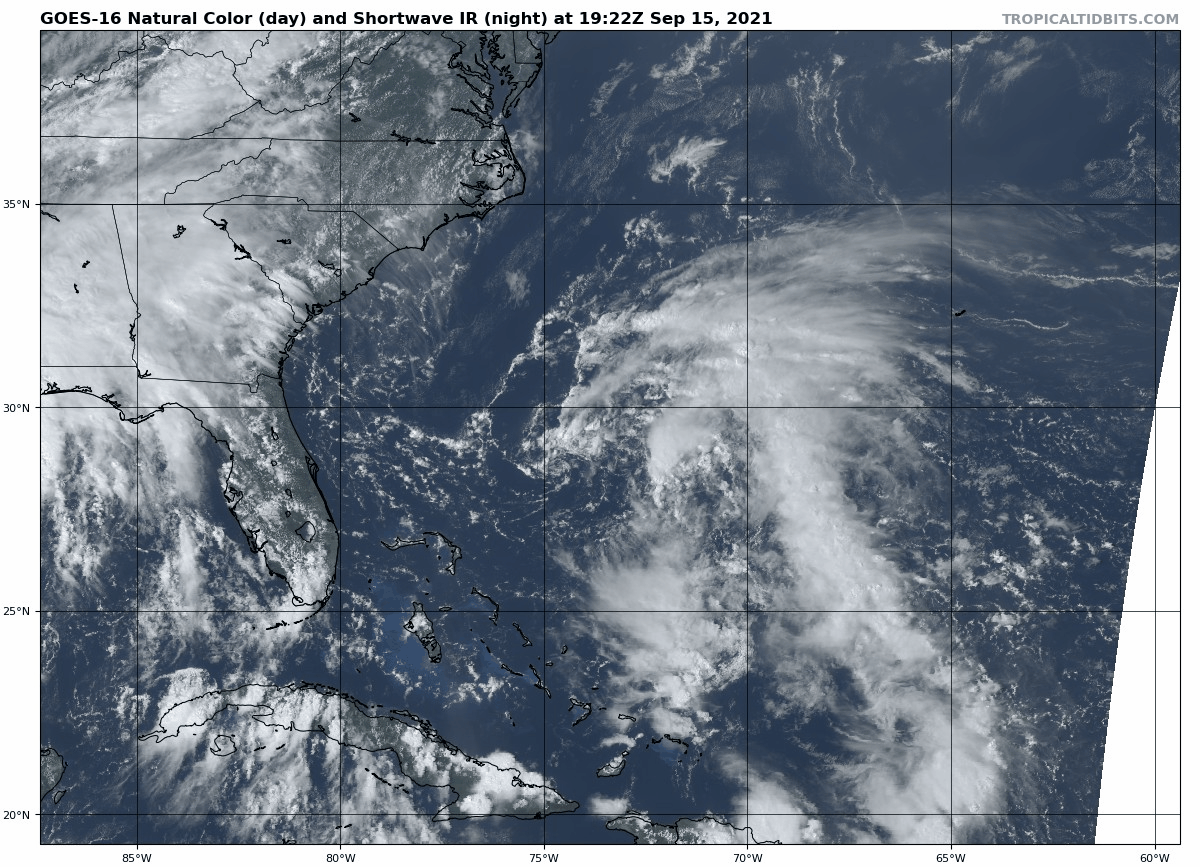
Nicholas is still making it rain along the Gulf Coast, while a wave in the eastern Atlantic continues to bear watching.

WeatherTiger’s Hurricane Watch has been selected to share the front page of Substack.com with Salman Rushdie this week, and we’re welcoming our new subscribers by making all daily blog posts free through the 17th.
We hope you enjoy our coverage of a busy week in the Atlantic. If you find it valuable, please consider upgrading to a paid subscription to continue receiving our daily reports, comment and ask questions, and get lots of subscriber extras. As always, thanks for reading the Watch.
Two-sentence Florida tropical threat synopsis: The only tropical weather influence on Florida over the next 10 days are enhanced rain chances in the Panhandle between through Friday due to residual rain from Nicholas. A tropical wave in the far eastern Atlantic has a little more potential to eventually be of concern to the U.S. East Coast, but remains over 10 days away.
Almanac: It’s Wednesday, September 15th… day 106 of the 2021 hurricane season, 77 days to go. By storm energy, the season is 55.1% complete as a whole, 64.7% complete for the continental U.S., and 54.9% complete for Florida.
As the second half of September begins, Atlantic hurricane season starts to slightly decelerate. In particular, there is a reduction in storm formation frequence in the eastern Tropical Atlantic between the first (left) and second (right) halves of the month.
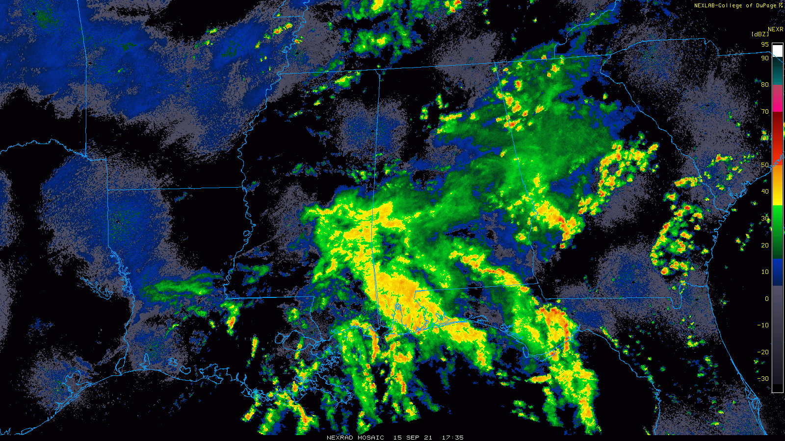
Active Storms: Tropical Depression Nicholas is still milling about the central Gulf Coast, no longer kicking up significant winds but still touching off heavy bands of showers and storms from eastern Louisiana into the western Florida Panhandle. Another 3-6” of rainfall is expected in these areas through the day on Saturday, which will continue to cause local flash flood risks into the weekend.
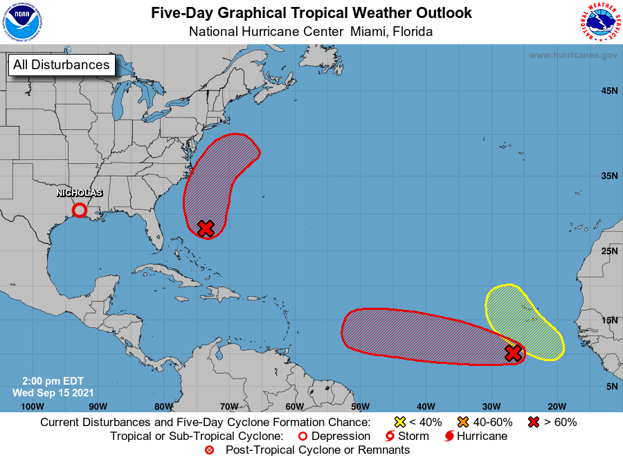
Current disturbances in NHC outlook, with 2-/5-day NHC development odds:
Invest 95L in the Eastern Atlantic (80/90%): A tropical wave in the eastern Atlantic today continues to have a well-defined mid-level circulation but only intermittent deep convection. This wave is a decent convective burst away from becomes a depression Invest 95L has a very good chance of slow development over the next 3 to 4 days as it moves steadily westward across the Main Development Region.

However, development may be slowed over the next couple of days by entanglement with a wave to 95L’s west, as seen above. The GFS shows more interaction with this other wave, leading to a substantial difference between the GFS and Euro Ensembles by early next week, with the Euro missing the islands to the north and GFS and UKMET showing more of a potential threat to the northern Lesser Antilles. It should be noted that trends are heading in the GFS Ensembles’ direction in the last 24 hours.
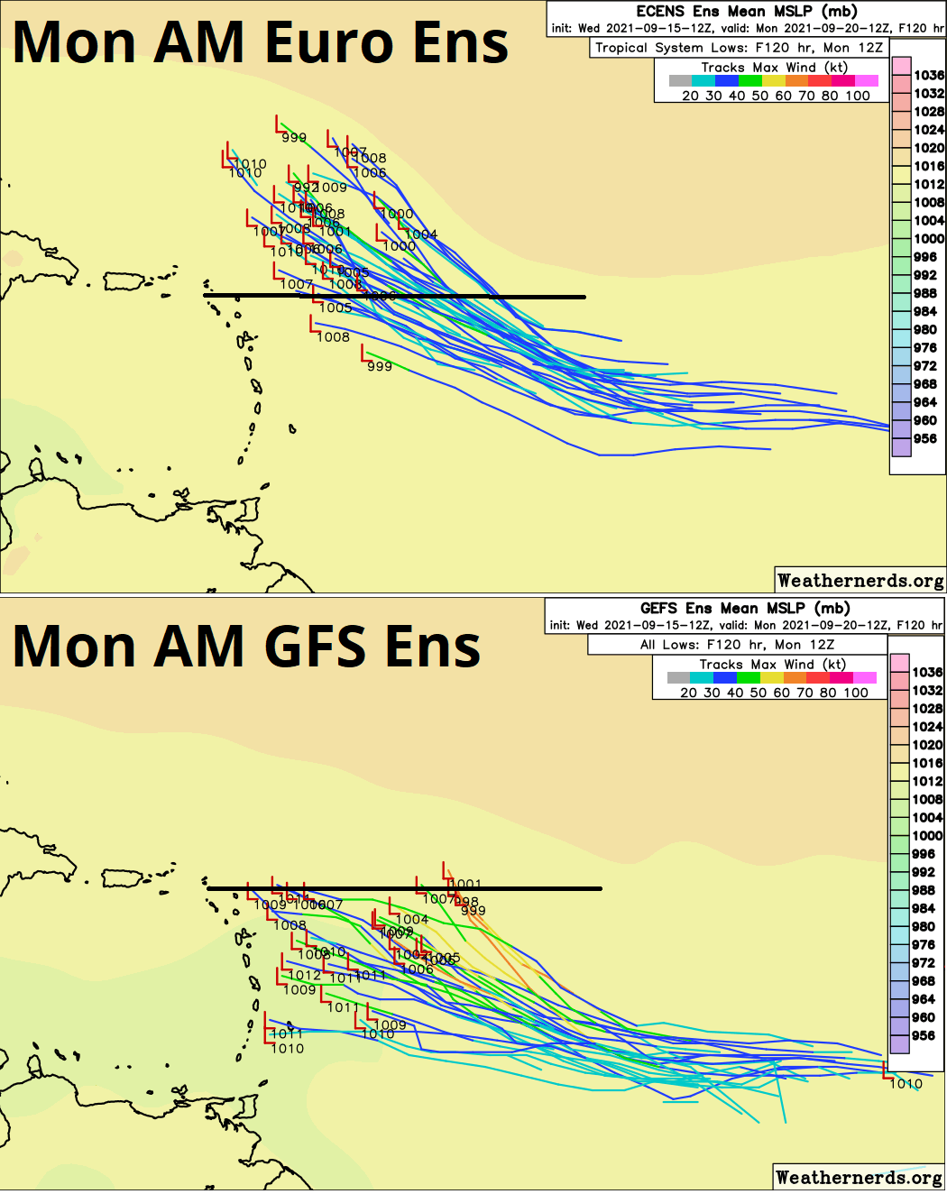
While 95L is still expected to encounter more shear near or north of the islands in 5-7 days, this southern shift is leading to a little more model support today for a potential track further west under the steering influence of East Coast ridging. There remains a great deal of model spread, with dissipation (or never forming), a turn north into open waters, and a more westward track all still in the mix. Overall, the window for U.S. threat possibility in around 10-12 days is perhaps a little wide than yesterday, but still quite narrow. We’ll keep watching.

Invest 96L in the Southwestern Atlantic (70/70%): A disturbance about 400 miles east of Cape Canaveral is generating a good deal of convection and a broad area of surface low pressure has formed. Invest 96L is likely to become a tropical storm by Friday as it passes east of the Outer Banks, potentially bringing some enhanced rain chances to the eastern Carolinas as it does. However, 96L is highly likely to remain offshore with most rain and wind east of the center. This system will turn northeast to the east of the mid-Atlantic over the weekend and should head into open waters.
Far eastern Atlantic (0/20%): Another tropical wave coming off the African Coast has a slight chance of development into the weekend. This disturbance is expected to turn north and is not a concern for the continental U.S.


Elsewhere: No other active disturbances or significant future threats.
Next report: An updated seasonal outlook for the final third of the hurricane season is out tomorrow. Until then, keep watching the skies.