Bubbling Under: Hurricane Watch for July 29th
The Southeast should keep an eye on a tropical wave that may approach the U.S. early next week.
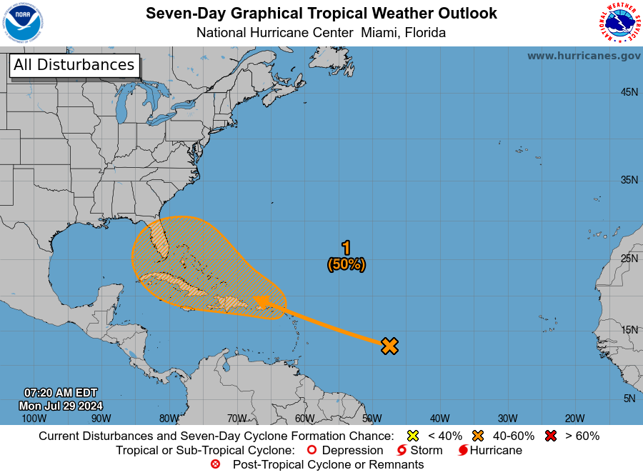
Florida and continental U.S. tropical threat synopsis: A tropical wave may develop as it moves near or east of Florida in 4-7 days. This feature is worth watching from the eastern Gulf to the Carolinas, though it is unlikely to be a major threat to Florida.
Almanac: It’s Monday, July 29th… day 59 of the 2024 hurricane season, 124 days to go. By total storm energy, the season is 6.5%, 15.7%, and 9.9% complete for the Atlantic, continental U.S., and Florida, respectively.
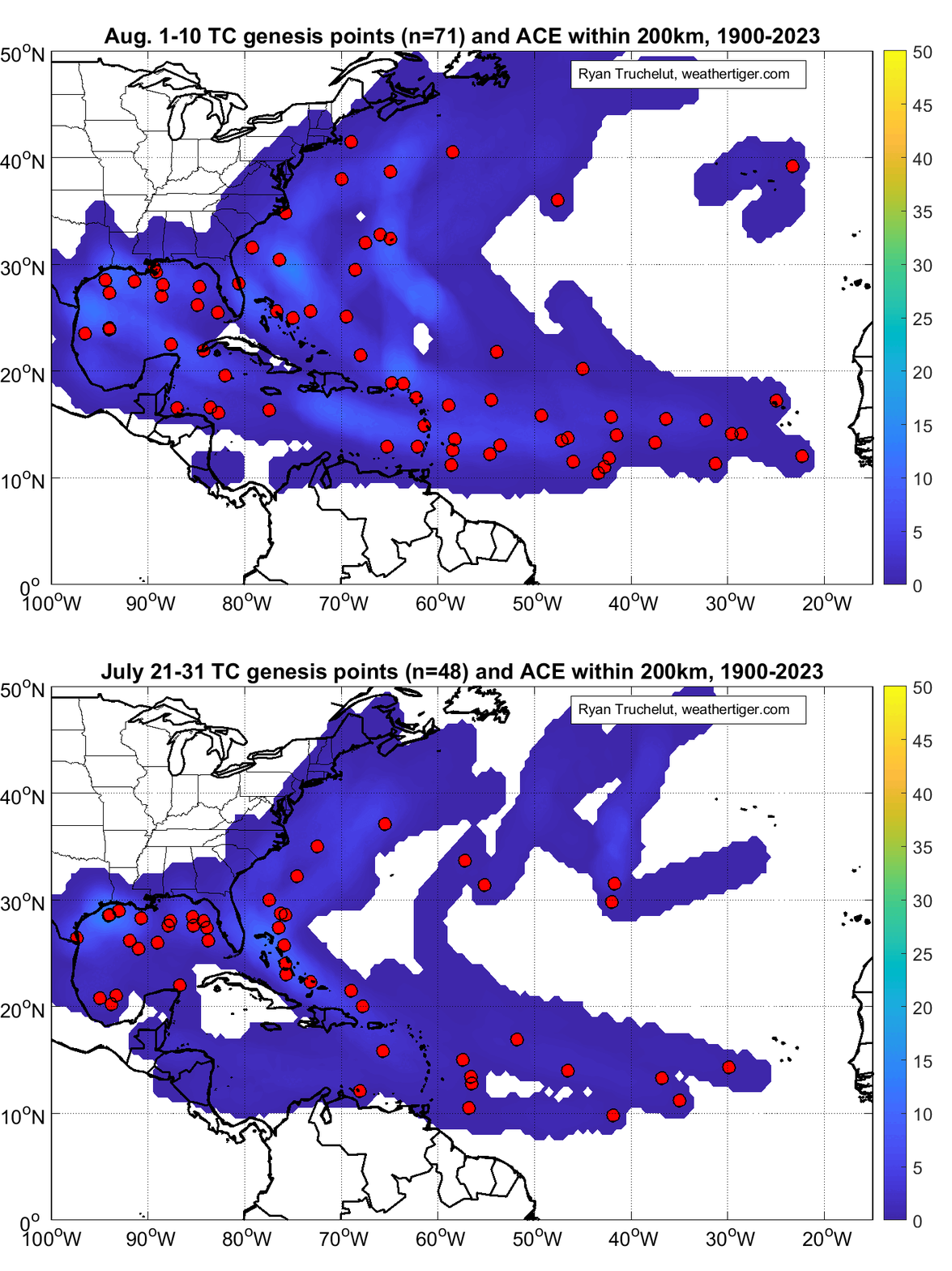
As July comes to a close, tropical development becomes more common, both overall and specifically east of the Lesser Antilles. About half of hurricane seasons see at least one storm develop in the first 10 days of August.
Active storms: None.
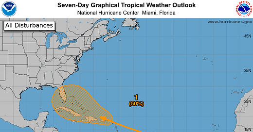
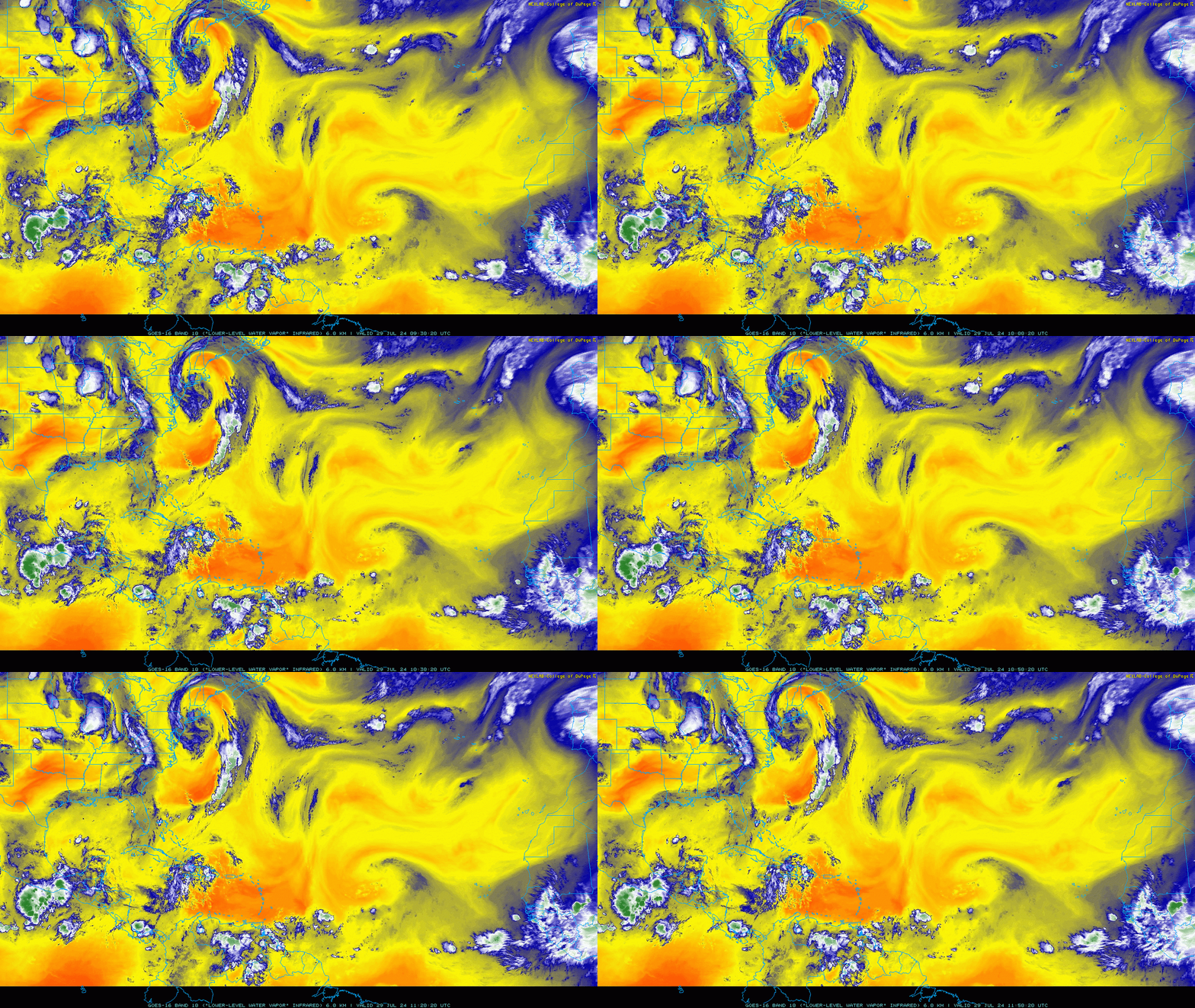
Disturbances in the NHC tropical weather outlook: The NHC has bumped development odds for a tropical wave in the central Tropical Atlantic this morning up to a 50% chance over the next seven days. Currently, this tropical wave is located between 45-50W; it shows up quite well on water vapor imagery (below) as the large swirl between the Lesser Antilles and west Africa.
Water vapor imagery also shows that the wave is not generating any deep convection as it moves westward through a bone-dry airmass, denoted by yellows and oranges on the image above. These low humidities in the middle layers of the atmosphere extend west to approximately Puerto Rico, so the wave is likely to struggle to generate much convection for another two or three days. This means no development in the short term, so the wave is not a threat to the Lesser Antilles.

However, large tropical waves tend to persist, even when not developing. Towards the end of this week, the wave will start to pull in better moisture as it moves west-northwest towards the Bahamas, and should start to generate convection. The upper-level environment looks favorable for development there in 5-7 days as well, with a nearby upper-level high providing solid outflow. These factors mean a depression is more likely than not to form in the general vicinity of the Bahamas by the end this weekend.
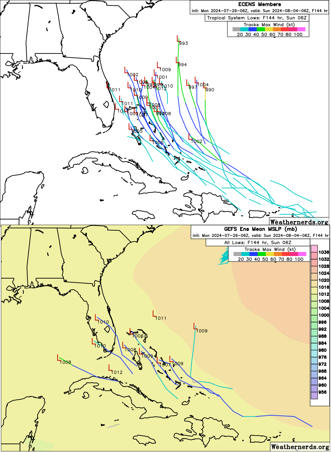
The longer term fate of this system is tied to how quickly that convection can start to bubble up and tighten the broad turning of the wave’s low-level winds. The European model, which was first to pick up on the development prospects of this wave, shows storms firing up along the wave axis on Wednesday as it moves through the Leeward Islands; two-thirds of overnight Euro Ensemble members thus show a depression developing by Saturday. If development occurs over the weekend, an organized system would be likely to turn north by early next week in response to a trough over the eastern U.S., and would likely stay east of Florida. The Carolinas should be watching this feature as well, though most ensemble members that develop the wave keep it east of the Outer Banks.
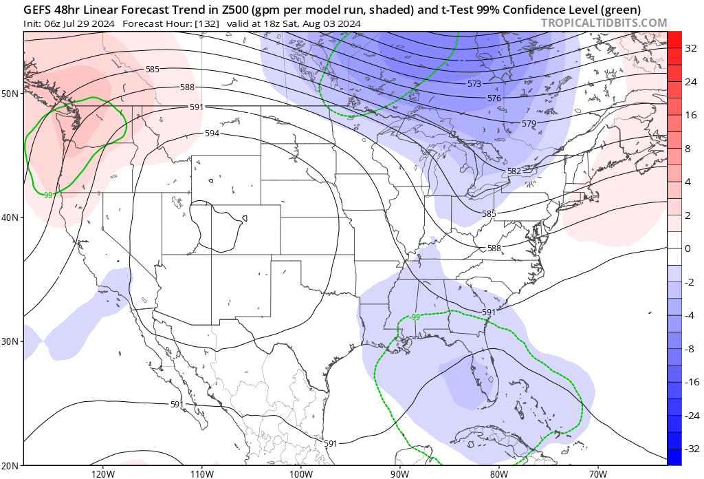
On the other hand, the GFS keeps the wave dry until Thursday, and if the wave doesn’t organize or takes longer to develop, it could continue west-northwestward across Florida (as a wave or weak system) into the eastern Gulf, as some GFS and Canadian model runs have shown. The eastern U.S. trough is trending stronger in the guidance with time and more members of the GFS Ensembles are latching onto the Euro’s eastward track, so the Gulf scenario is less likely, though worth keeping in mind. Overall, while the trajectory of the wave on the NHC outlook is unnerving, I’m not seeing this system as a serious threat to Florida at this time, as a stronger system would be favored to remain out-to-sea. I’ll be monitoring it closely this week.
Elsewhere: No other disturbances worth discussing.
Next update: Next update tomorrow morning.



One of these days, could we newbie/dummies get a brief lesson on what it means when you mention Leeward Islands, Lesser vs Greater Antilles, etc?