


And Away We Go: WeatherTiger's Hurricane Watch for June 1st
Thankfully, the Atlantic is quiet as Hurricane Season 2021 officially gets underway.

Welcome to WeatherTiger’s Hurricane Watch! From today through October 31st, each weekday I’ll be issuing a tropical briefing bringing you that day’s hurricane history, a quick run-down of active storms, and a look at current development threats. Paid subscribers will receive these daily briefings and be able to comment and ask questions, as well as get all of our weekly long-form analysis columns, daily in-depth forecasts and video discussions during Florida hurricane threats, live landfall coverage, and expanded seasonal outlooks. Free subscribers subscribers will receive a weekly forecast column. Sign up below to get WeatherTiger’s Hurricane Watch newsletters all season long.
A free preview of our daily briefing will continue through June as we settle into our new Substack digs. Enjoy, and feel free to drop a line to ryan@weathertiger.com with any questions.
Almanac: Today is Tuesday, June 1st… the 2021 hurricane season officially starts now and ends in 183 days. Oddly enough, no U.S. tropical storms or hurricanes have ever struck on June 1st. By total storm energy, the season is 0.6% complete as a whole, 0.9% complete for the continental U.S., and 0.7% complete for Florida. In progress bar form:


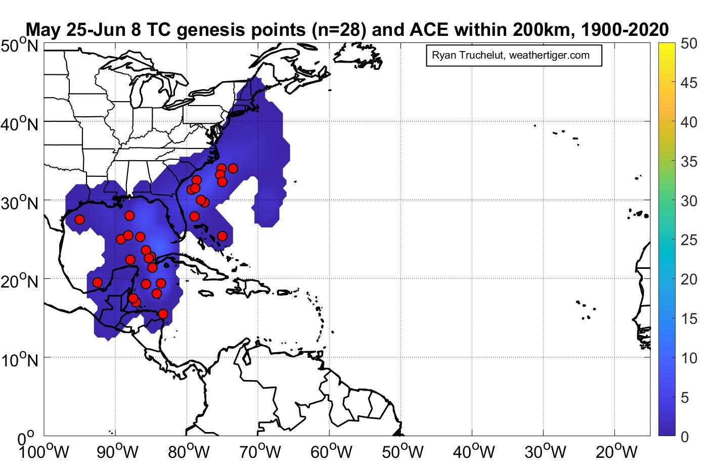
Historically, as shown above, tropical or subtropical storm development generally takes place in the eastern Gulf, western Caribbean, or subtropical western Atlantic in the last week of May and first week of June. About 25% of seasons have a named storm form in this timeframe.
Active Storms: None.
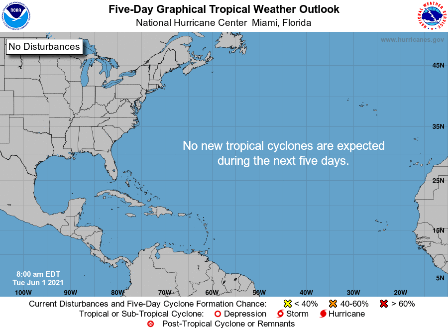
Current disturbances in NHC outlook: None. A nice, blank NHC outlook map to start the season. May it remain that way.
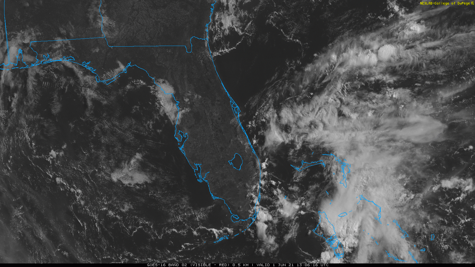
Elsewhere: The Atlantic is quiet, and tropical storm formation is unlikely for the next 7 days with upper-level winds remaining unfavorable for development. The only area to note is over South Florida and the Bahamas, where an upper-level low is triggering showers and storms. There is no surface circulation associated with this non-tropical upper low, and its only impact will be to usher some needed rain chances back into Florida over the course of the next 3-5 days as the climatological wet season begins.
Next report: Our weekly long-form analysis column will be released tomorrow afternoon, and will take a look at whether a dry May in Florida means anything for hurricane risks in the year ahead. WeatherTiger’s 2021 updated hurricane season outlook will be issued on Friday.