


A New Wave: WeatherTiger's Hurricane Watch for June 22nd
In an odd development for June, attention turns to the eastern Atlantic.

WeatherTiger’s free June preview of our Hurricane Watch blog is wrapping up today. If you have enjoyed our briefings and would like to continue receiving them each weekday, along with other subscriber exclusives like our July seasonal outlook, please consider signing up to support our work by clicking below. Subscriptions start at just $8/month.
Free subscribers will continue to receive our weekly long-form column on Thursday afternoons, as well as coverage of Florida landfall threats. We will likely be running another free preview period of our daily service closer to the peak of hurricane season. Thanks for reading and as always, feel free to get in touch at ryan@weathertiger.com with any questions.

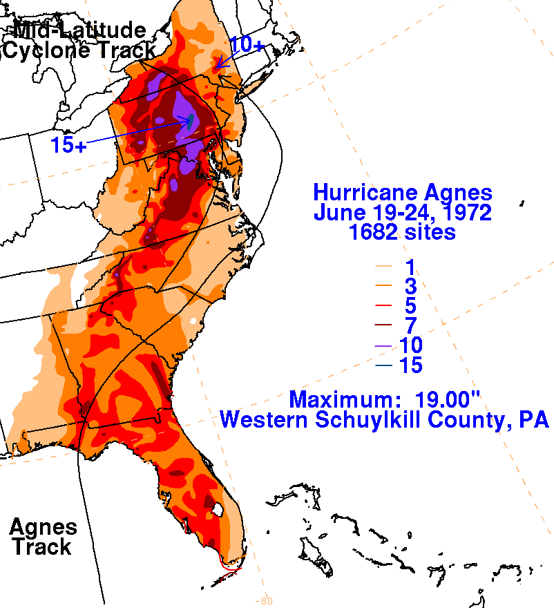
Almanac: Today is Tuesday, June 22nd… day 22 of the 2021 hurricane season, 162 days to go. By total storm energy, the season is 1.8% complete as a whole, 5.1% complete for the continental U.S., and 6.3% complete for Florida. On this date in 1972, Tropical Storm Agnes made landfall near New York City with 65 mph winds. Agnes went on to become one of the most devastating flood events in the history of Pennsylvania and southern New York.
Agnes is the sole late June storm since 1900 to strike north of North Carolina (above). The western Gulf is the historical focus of tropical risks over the next couple weeks.
Active Storms: None. Claudette lost tropical characteristics overnight and is now a non-tropical low racing into eastern Canada.

Current disturbances in NHC outlook:
Central Tropical Atlantic (2-/5-day odds: 20/20%). A tropical wave is slowly approaching the Lesser Antilles, generating some linear convection as it does. There continues to be no sign of low-level organization with this wave, and development is unlikely over the next 36-48 hours before strong shear closes any window for medium-term development.
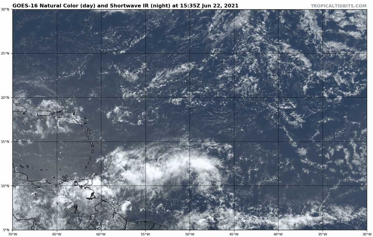
This wave may have another chance of development in 6-8 days once it moves into the western Caribbean, but this potential is no better defined today than yesterday.

Elsewhere: Models continue to intermittently suggest that a tropical wave emerging from the west African coast around Thursday has some shot of slow development in 3-7 days due to very favorable upper-level winds. However, only three depressions have ever developed east of 45W in June, and there’s nothing to watch yet here. I’ll stay climatologically skeptical until there’s more evidence to the contrary, despite a handful of GFS and European model ensemble members routing this wave west across the Atlantic MDR as if it were mid-August.

Next report: The next daily briefing for paid subscribers will be issued by 3 p.m. tomorrow. Free (and paid) subscribers will receive the weekly long-form column by 3 p.m. Thursday.